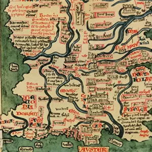
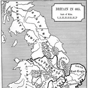
Photographic Print : Map of the Wars of the Roses, 15th century (1893)
")
![]()
Photo Prints from Heritage Images
Map of the Wars of the Roses, 15th century (1893)
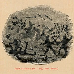
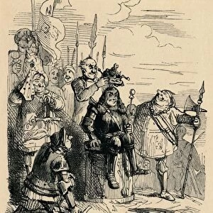
Map of the Wars of the Roses, 15th century (1893). The Wars of the Roses was a civil war fought over the throne of England between adherents of the House of Lancaster and the House of York. The intermittent conflict lasted from 1455 until the decisive defeat of Richard III by Henry Tudor at Bosworth Field in 1485. An illustration from A Short History of the English People, by John Richard Green, illustrated edition, Volume II, Macmillan and Co, London, New York, 1893
Media ID 14925530
© The Print Collector / Heritage-Images
1455 1485 Cartography Civil War House Of Lancaster House Of York John Richard John Richard Green Map Making Power Struggle Wales War Of The Roses Wars Of The Roses
11"x8.5" Photo Print
Photo prints are produced on Kodak professional photo paper resulting in timeless and breath-taking prints which are also ideal for framing. The colors produced are rich and vivid, with accurate blacks and pristine whites, resulting in prints that are truly timeless and magnificent. Whether you're looking to display your prints in your home, office, or gallery, our range of photographic prints are sure to impress. Dimensions refers to the size of the paper in inches.
Our Photo Prints are in a large range of sizes and are printed on Archival Quality Paper for excellent colour reproduction and longevity. They are ideal for framing (our Framed Prints use these) at a reasonable cost. Alternatives include cheaper Poster Prints and higher quality Fine Art Paper, the choice of which is largely dependant on your budget.
Estimated Image Size (if not cropped) is 18.2cm x 27.9cm (7.2" x 11")
Estimated Product Size is 21.6cm x 27.9cm (8.5" x 11")
These are individually made so all sizes are approximate
Artwork printed orientated as per the preview above, with portrait (vertical) orientation to match the source image.
MADE IN THE USA
Safe Shipping with 30 Day Money Back Guarantee
FREE PERSONALISATION*
We are proud to offer a range of customisation features including Personalised Captions, Color Filters and Picture Zoom Tools
SECURE PAYMENTS
We happily accept a wide range of payment options so you can pay for the things you need in the way that is most convenient for you
* Options may vary by product and licensing agreement. Zoomed Pictures can be adjusted in the Cart.