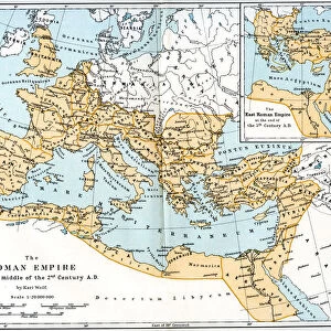
Framed Print : Map of the Wars of the Roses, 15th century (1893)
")
")
![]()
Framed Photos from Heritage Images
Map of the Wars of the Roses, 15th century (1893)
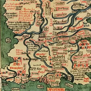
Map of the Wars of the Roses, 15th century (1893). The Wars of the Roses was a civil war fought over the throne of England between adherents of the House of Lancaster and the House of York. The intermittent conflict lasted from 1455 until the decisive defeat of Richard III by Henry Tudor at Bosworth Field in 1485. An illustration from A Short History of the English People, by John Richard Green, illustrated edition, Volume II, Macmillan and Co, London, New York, 1893
Media ID 14925530
© The Print Collector / Heritage-Images
1455 1485 Cartography Civil War House Of Lancaster House Of York John Richard John Richard Green Map Making Power Struggle Wales War Of The Roses Wars Of The Roses
18"x14" Modern Frame
16x12 Print in an MDF Wooden Frame with 180 gsm Satin Finish Paper. Glazed using shatter proof thin plexiglass. Frame thickness is 1 inch and depth 0.75 inch. Fluted cardboard backing held with clips. Supplied ready to hang with sawtooth hanger and rubber bumpers. Spot clean with a damp cloth. Packaged foam wrapped in a card.
Contemporary Framed and Mounted Prints - Professionally Made and Ready to Hang
Estimated Image Size (if not cropped) is 35.6cm x 40.6cm (14" x 16")
Estimated Product Size is 35.6cm x 45.7cm (14" x 18")
These are individually made so all sizes are approximate
Artwork printed orientated as per the preview above, with portrait (vertical) orientation to match the source image.
MADE IN THE USA
Safe Shipping with 30 Day Money Back Guarantee
FREE PERSONALISATION*
We are proud to offer a range of customisation features including Personalised Captions, Color Filters and Picture Zoom Tools
SECURE PAYMENTS
We happily accept a wide range of payment options so you can pay for the things you need in the way that is most convenient for you
* Options may vary by product and licensing agreement. Zoomed Pictures can be adjusted in the Cart.