
John Speed (1542-1629), English cartographer and historian, 1816

John Speed (1542-1629), English cartographer and historian, 1816


Photo Prints
Poster Prints
Cards
Jigsaw Puzzles
Fine Art Prints
Canvas Prints
Home Decor
Mounted Prints
Metal Prints


We accept all major credit cards

Wall Art and Photo Gifts from Heritage Images

John Speed (1542-1629), English cartographer and historian, 1816

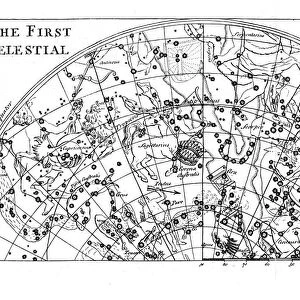
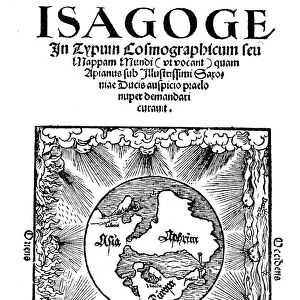
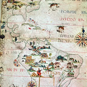
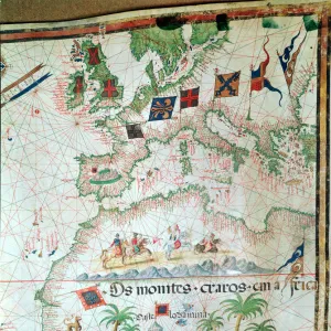
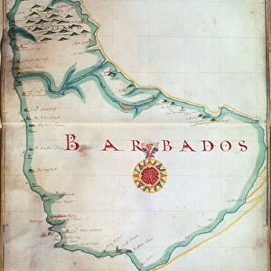
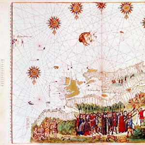
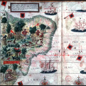
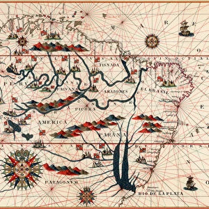
John Speed (1542-1629), English cartographer and historian, 1816. Speed is probably the most famous of British mapmakers. In 1612 he published The Theatre of the Empire of Great Britain, an atlas containing 67 maps of English and Welsh counties, and in 1627 he became the first English cartographer to produce a world atlas

Media ID 14843238

© Ann Ronan Picture Library / Heritage-Images

Cartographer Cartography Historian Map Making Ruff Speed Stewart Stuart


MADE IN THE UK
Safe Shipping with 30 Day Money Back Guarantee

FREE PERSONALISATION*
We are proud to offer a range of customisation features including Personalised Captions, Color Filters and Picture Zoom Tools

FREE COLORIZATION SERVICE
You can choose advanced AI Colorization for this picture at no extra charge!

SECURE PAYMENTS
We happily accept a wide range of payment options so you can pay for the things you need in the way that is most convenient for you

* Options may vary by product and licensing agreement. Zoomed Pictures can be adjusted in the Basket.


redeem
Beautiful Photo Prints and Gifts
image
Professionally Printed
inventory
Photo Prints are in stock
thumb_up
Professional quality finish
diamond
Made with high-grade materials
inventory_2
Carefully packed to aid safe arrival


Related Images


First part of the star chart of the Southern Celestial Hemisphere showing constellations, 1747
Title page of Isagoge in Typum Cosmographicum seu Mappam Mundi by Peter Apian, 1523
St Cecilia or Cecile, legendary Roman martyr, 19th century
Japanese naval squadron steaming to bombard Port Arthur, Russo-Japanese War 1904-1905
French Map of Central and South America, French, 1550
Map by Bastian Lopez showing Europe, the British Isles and part of Africa, Portuguese, 1558. Artist: Bastiaim Lopez
Map of Barbados, 1683
Map of the east coast of North America, early 16th century
Map of Brazil by Portuguese navigators Pedro Reinel and Lopo Homen, c1525. Artist: Pedro Reinel
Part of South America, 1582
Second part of the star chart of the Southern Celestial Hemisphere showing constellations, 1747
Canal near the promontory fort at Ruadha A Dunain

+

Shipping

+

Choices

+

Guaranteed