mail_outline sales@mediastorehouse.com
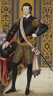
Sir Robert Dudley, Duke of Northumberland, c1600. Creator: Nicholas HilliardSir Robert Dudley, Duke of Northumberland, c1600
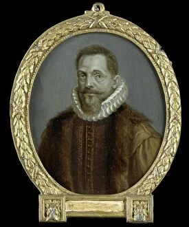
Portrait of Petrus Bertius, Professor at Leiden, 1700-1732. Creator: Arnoud van HalenPortrait of Petrus Bertius, Professor at Leiden, 1700-1732
Johan François Adriaan Cateau van Rosevelt... 1885. Creator: LoveraJohan Francois Adriaan Cateau van Rosevelt, Chief of the Construction Department and Agent General of Immigration in Suriname, 1885
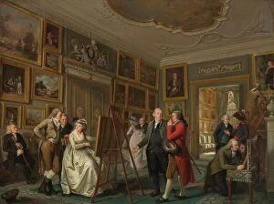
The Art Gallery of Jan Gildemeester Jansz, 1794-1795. Creator: Adriaan De LelieThe Art Gallery of Jan Gildemeester Jansz, 1794-1795. In 1792, Gildemeester, a merchant, turned two large rooms at his house on Amsterdam's Herengracht into an art gallery
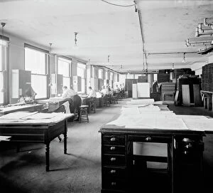
Geological Survey art room, between 1910 and 1920. Creator: Harris & EwingGeological Survey art room, [Washington, DC], between 1910 and 1920. [Map-making]
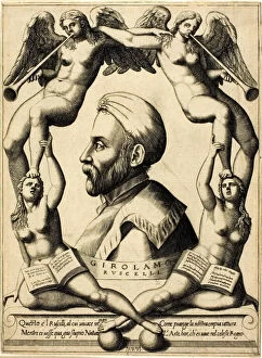
Portrait of Girolamo Ruscelli, 1566. Creator: Nicolo NelliPortrait of Girolamo Ruscelli, 1566
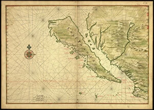
Map of California shown as an island, c 1650. Creator: Johannes VingboonsMap of California shown as an island, c 1650. This map from around 1650 shows California as an island. A half-century would pass before Spanish explorers determined with certainty that California was
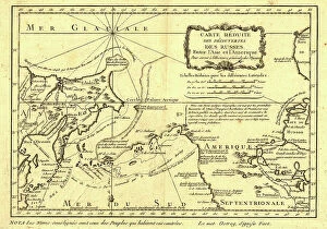
Carte re´duite des de´couvertes des Russes, entre l'Asie et l'Amerique, (1747?). This French map of Alaska, Siberia, and the North Pacific, published in 1747
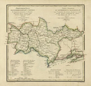
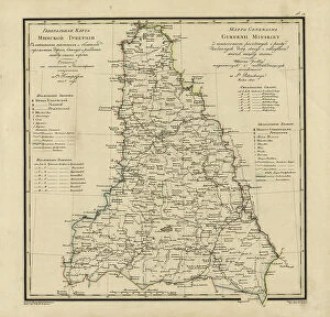
General Map of Ekaterinoslav Province: Showing Postal and Major Roads, Stations and the... 1821General Map of Ekaterinoslav Province: Showing Postal and Major Roads, Stations and the Distance in Versts between Them, 1821
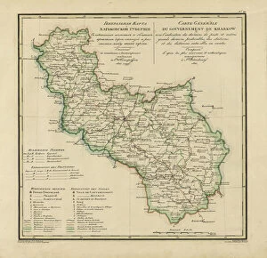
General Map of Kharkiv Province: Showing Postal and Major Roads, Stations and the... 1821General Map of Kharkiv Province: Showing Postal and Major Roads, Stations and the Distance in Versts between Them, 1821. This 1821 map of Kharkiv Provinceis from a larger work
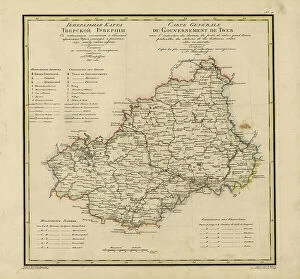
General Map of Tver Province: Showing Postal and Major Roads, Stations and the... 1821General Map of Tver Province: Showing Postal and Major Roads, Stations and the Distance in Versts between Them, 1821. This 1821 map of Tver Provinceis from a larger work
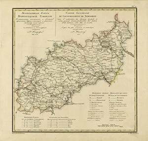
General Map of Novgorod Province: Showing Postal and Major Roads, Stations and the... 1821General Map of Novgorod Province: Showing Postal and Major Roads, Stations and the Distance in Versts between Them, 1821. This 1821 map of Novgorod Provinceis from a larger work
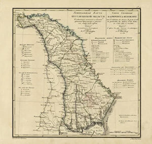
General Map of Bessarabia: Showing Postal and Major Roads, Stations and the... 1821General Map of Bessarabia: Showing Postal and Major Roads, Stations and the Distance in Versts between Them, 1821. This 1821 map of Bessarabia is from a larger work
General Map of Minsk Province: Showing Postal and Major Roads, Stations and the... 1821General Map of Minsk Province: Showing Postal and Major Roads, Stations and the Distance in Versts between Them, 1821. This 1821 map of Minsk Province is from a larger work
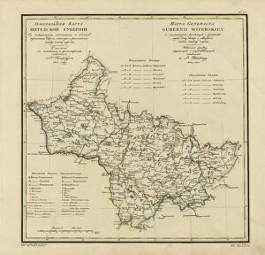
General Map of Vitebsk Province: Showing Postal and Major Roads, Stations and the... 1820General Map of Vitebsk Province: Showing Postal and Major Roads, Stations and the Distance in Versts between Them, 1820. This 1820 map of Vitebsk Provinceis from a larger work
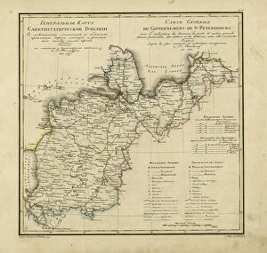
General Map of Saint Petersburg Province: Showing Postal and Major Roads, Stations and the... 1820General Map of Saint Petersburg Province: Showing Postal and Major Roads, Stations and the Distance in Versts between Them, 1820
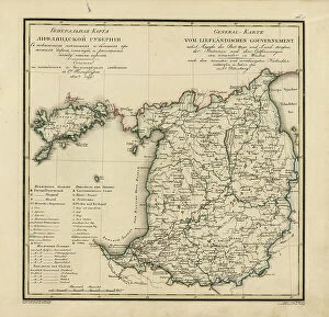
General Map of Livland Province: Showing Postal and Major Roads, Stations and the... 1820General Map of Livland Province: Showing Postal and Major Roads, Stations and the Distance in Versts between Them, 1820. This 1820 map of Livland Provinceis from a larger work
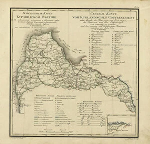
General Map of Courland Province: Showing Postal and Major Roads, Stations and the... 1820General Map of Courland Province: Showing Postal and Major Roads, Stations and the Distance in Versts between Them, 1820. This 1820 map of Courland Province is from a larger work
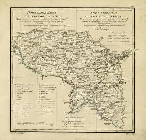
General Map of Vilnius Province: Showing Postal and Major Roads, Stations and the... 1820General Map of Vilnius Province: Showing Postal and Major Roads, Stations and the Distance in Versts between Them, 1820. This 1820 map of Vilnius Provinceis from a larger work
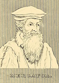
Mercator, (1512-1594), 1830. Creator: UnknownMercator, (1512-1594), 1830. Gerardus Mercator (1512-1594) Belgian geographer, cosmographer and cartographer known for his 1569 world map of sailing courses with rhumb lines
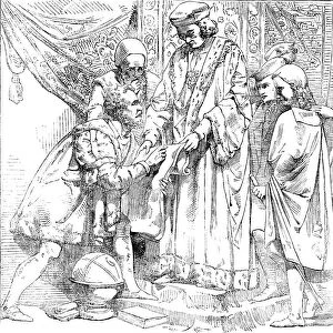
The New Houses of Parliament - Sebastian Cabot before Henry VII, 1854. Creator: UnknownThe New Houses of Parliament - Sebastian Cabot before Henry VII, 1854. Sculpture by William Theed in the Palace of Westminster
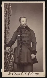
Portrait of Arthur Carl Victor Schott (1814-1875), Before 1875. Creator: UnknownPortrait of Arthur Carl Victor Schott (1814-1875), Before 1875
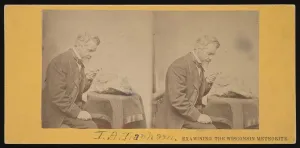
Portrait of Increase Allen Lapham (1811-1875) - Examining the Wisconsin Meteorite, Circa 1868
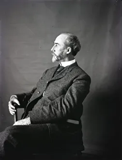
Portrait of William Henry Holmes, 1890s. Creator: United States National MuseumPortrait of William Henry Holmes, 1890s
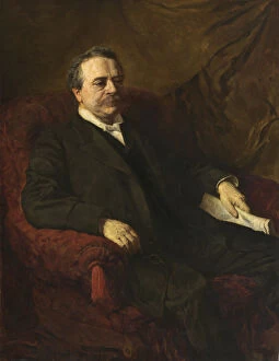
Julius Bien, 1886. Creator: George Da Maduro PeixottoJulius Bien, 1886
Dr. William H. Holmes, 1931. Creator: Edmund Hodgson SmartDr. William H. Holmes, 1931
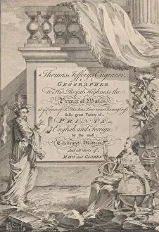
Trade Card for Thomas Jefferys, Engraver, Geographer, and Printseller, 18th century
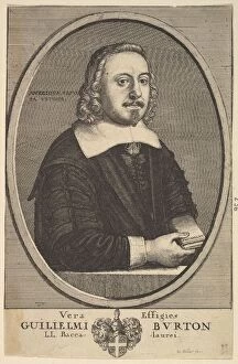
Vera Effigies Guilielmi Burton / L. L. Baccalaurei, 1657-58. Creator: Wenceslaus HollarVera Effigies Guilielmi Burton / L.L. Baccalaurei, 1657-58
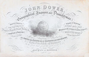
Trade card for John Dower, geographical engraver and draughtsman, 19th century
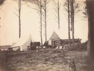
Copying Maps, Photographic Headquarters, Petersburg, Virginia, March 1865
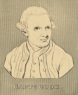
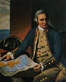
Captain Cook, (1728-1779), 1830. Creator: UnknownCaptain Cook, (1728-1779), 1830. James Cook (1728-1779) British explorer, navigator, cartographer, and captain in the Royal Navy. From " Biographical Illustrations", by Alfred Howard
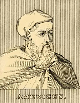
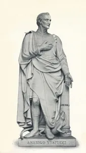
Americus, (1454-1512), 1830. Creator: UnknownAmericus, (1454-1512), 1830. Amerigo Vespucci (1454-1512) Italian explorer, financier, navigator, and cartographer. In 1507
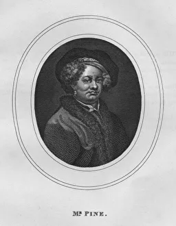
Mr. Pine, 1808, (1827). Creator: Thomas CookMr. Pine, 1808, (1827). Portrait of English designer, engraver, and cartographer John Pine (1690-1756), depicted in the manner of Rembrandt, with a turban and fur collar
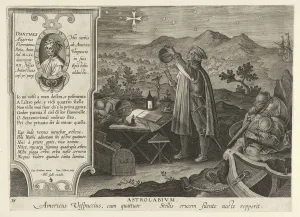
Amerigo Vespucci Discovering the Southern Cross with an Astrolabe, pub. 1600. CreatorAmerigo Vespucci Discovering the Southern Cross with an Astrolabe, from Nova Reperta, pub. 1600 (engraving)
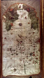
Map of Spain, 1500, work by the Spanish cartographer and pilot Juan de la Cosa
Felix de Azara (1742-1821), Spanish naval officer
James Cook 1728-1779. - Stich nach dem Gemalde von Dance, 1934James Cook 1728-1779, 1934. Captain James Cook FRS (1728-1779), British explorer, navigator, cartographer and captain in the Royal Navy. From Die Groszen der Weltgelchichte
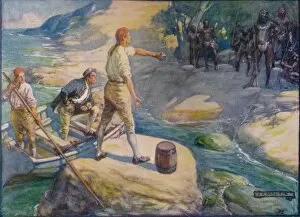
Natives Gathered Round Them, c1908, (c1920). Artist: Joseph Ratcliffe SkeltonNatives Gathered Round Them, c1908, (c1920). Captain Matthew Flinders (1774-1814), English navigator and cartographer, who was the first to circumnavigate Australia and identify it as a continent
Amerigo Vespucci, (1454-1512), 1912. Artist: Gaetano GrazziniAmerigo Vespucci (1454-1512), Italian explorer, financier, navigator and cartographer, 1912. Vespucci first demonstrated that Brazil
Petrus Plancius, Dutch astronomer, cartographer and clergyman, c1870. Artist: JH RennefeldPetrus Plancius, Dutch astronomer, cartographer and clergyman, c1870. Plancius (1552-1622) was one of the founders of the Dutch East India Company, for whom he produced over a hundred maps
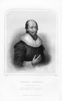
Robert Gordon of Straloch, Scottish cartographer, (1870). Artist:s FreemanRobert Gordon of Straloch, Scottish cartographer, (1870). Gordon (1580-1661) is best known for his contributions to William Blaeus Great Atlas of Scotland
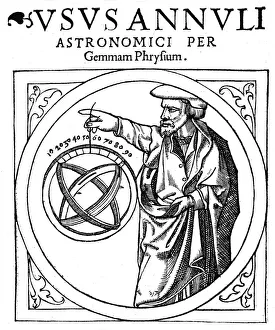
Reiner Gemma Frisius, Dutch astronomer, geographer, cartographer and mathematician, 1539. Gemma Frisius (1508-1555) holding an adjustable ring dial for determining the altitude of the Sun for
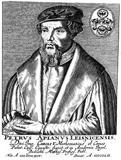
Peter Apian (1495-1552), German geographer, mathematician and astronomer. Apian established his reputation by issuing a world map in 1520, and the publication, in 1524
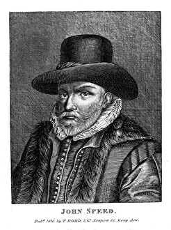
John Speed (1542-1629), English cartographer and historian, 1816. Speed is probably the most famous of British mapmakers. In 1612 he published The Theatre of the Empire of Great Britain