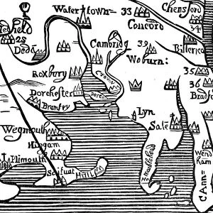
Map of the east coast of North America, early 16th century

![]()
Wall Art and Photo Gifts from Heritage Images
Map of the east coast of North America, early 16th century
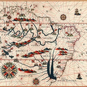
Map of the east coast of North America, early 16th century. Map of pre-1547 based on Jacques Cartiers discoveries of 1534-1541, showing the coastline from Labrador to Cape Florida and featuring the mouth of the St Lawrence river
Media ID 14845568
© Ann Ronan Picture Library / Heritage-Images
Cartography Chart Coastline Discovery Exploration Jacques Map Making Navigation North America
MADE IN THE UK
Safe Shipping with 30 Day Money Back Guarantee
FREE PERSONALISATION*
We are proud to offer a range of customisation features including Personalised Captions, Color Filters and Picture Zoom Tools
SECURE PAYMENTS
We happily accept a wide range of payment options so you can pay for the things you need in the way that is most convenient for you
* Options may vary by product and licensing agreement. Zoomed Pictures can be adjusted in the Basket.