mail_outline sales@mediastorehouse.com
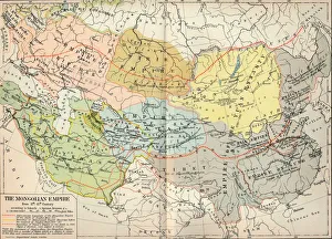
The Mongolian Empire from 12th-15th Century, c1903, (1904). From The Worlds History, Volume II, by Dr. H. F. Helmolt [William Heinemann, London, 1904]
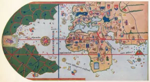
The First map to Show America, (1500) 1912The First map to Show America, 1500 (1912). After the map of Juan de la Cosa (c1450-1510), 1500. The map or chart is a mappa mundi painted on parchment
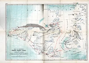
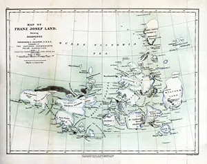
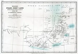
Western Franz Josef Land, 1899. Map showing discoveries and sledge journeys from 1894 to 1897. From an account of the Jackson-Harmsworth Expedition to Franz-Josef Land in the Arctic
Map of North America with locations of Native American tribes, 1841. Artist: Myers and CoMap of North America with locations of Native American tribes, 1841. A print from North American Indians, Wiley and Putnam, 1841
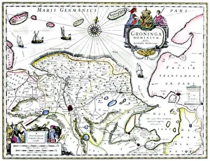
Map of Groningen, Netherlands, 17th century. A map of the Dutch province of Groningen, published by Willem Blaeu after the original design by Barthold Wicheringe
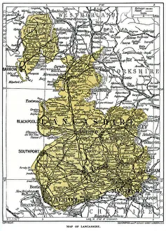
Map of Lancashire, 1924-1926. A print from Hutchinsons Britain Beautiful, edited by Walter Hutchinson, volume III, 1924-1926
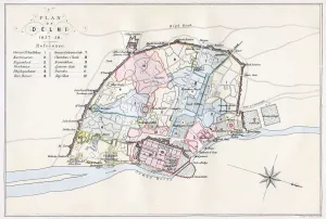
Plan of Delhi, India, 1857-1858, (1893). Artist: Guyoy & WoodPlan of Delhi, India, 1857-1858, (1893). Delhi was besieged and captured by the British in 1857 during the Indaian Mutiny
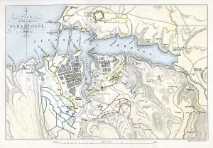
Map showing the Siege of Sevastopol, Crimean War, 1854-1855, (1893). Artist: Robert WalkerMap showing the Siege of Sevastopol, Crimean War, 1854-1855, (1893). The Siege of Sevastopol, lasted from September 1854 until September 1855
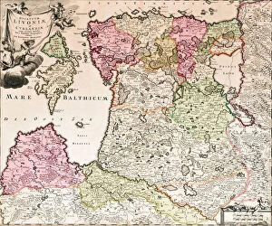
The Baltic Sea (From: Baltikum Ducatuum Livoniae et Curlandiae cum vicinis Insulis Nova Exhibitio Geographica), ca 1720. From a private collection
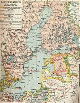
Baltic Countries, c1907, (1907). A map of the Baltic Countries. From The Worlds History, Volume VI. Edited by Dr. H. F. Helmolt [William Heinemann, London, 1907]
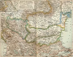
Rumania, Bulgaria, Serva and Montenegro, c1906, (1907). From The Worlds History, Volume V, by Dr. H. F. Helmolt. [William Heinemann, London, 1907]
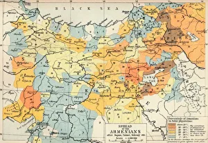
Spread of the Armenias after Supan, Cuinet, Selenoy etc, c1560, (1907). From The Worlds History, Volume V, by Dr. H. F. Helmolt. [William Heinemann, London, 1907]
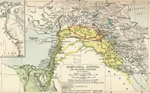
Babylonia, Assyria and Adjoining Countries, c1902, (1903). From The Worlds History, Volume III, by Dr. H. F. Helmolt [William Heinemann, London, 1903]
Ancient Greece, c1901, (1902). From The Worlds History, Volume IV, by Dr. H. F. Helmolt [William Heinemann, London, 1902]
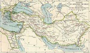
Kingdom of Alexander the Great, c1901, (1902). From The Worlds History, Volume IV, by Dr. H. F. Helmolt [William Heinemann, London, 1902]
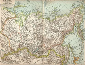
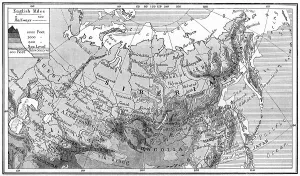
Siberia, c1903, (1904). From The Worlds History, Volume II, by Dr. H. F. Helmolt [William Heinemann, London, 1904]
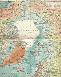
North Polar Regions, c1903, (1904). From The Worlds History, Volume II, by Dr. H. F. Helmolt [William Heinemann, London, 1904]
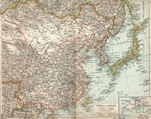
China and Japan, c1903, (1904). From The Worlds History, Volume II, by Dr. H. F. Helmolt [William Heinemann, London, 1904]
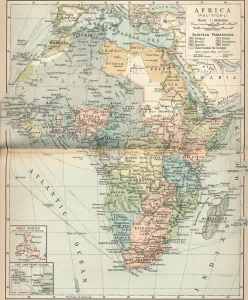
Africa (Political), c1902, (1903). From The Worlds History, Volume III, by Dr. H. F. Helmolt [William Heinemann, London, 1903]
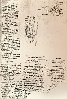
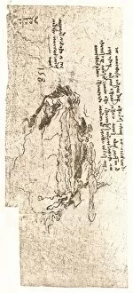
Sketch of a peak in Armenia, and a sketch map of Armenia, c1472-c1519 (1883). Artist: Leonardo da VinciSketch of a peak in Armenia, and a sketch map of Armenia, c1472-c1519 (1883). From The Literary Works of Leonardo Da Vinci, Vol. II by Jean Paul Richter, PH. DR
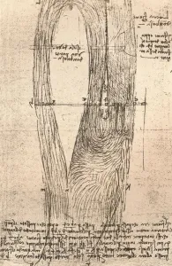
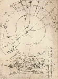
Sketch map of the Loire at Amboise, France, c1472-c1519 (1883). Artist: Leonardo da VinciSketch map of the Loire at Amboise, France, c1472-c1519 (1883). From The Literary Works of Leonardo Da Vinci, Vol. II by Jean Paul Richter, PH. DR
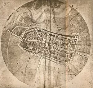
A map representing the town of Imola, Italy, c1472-c1519 (1883). Artist: Leonardo da VinciA map representing the town of Imola, Italy, c1472-c1519 (1883). From The Literary Works of Leonardo Da Vinci, Vol. II by Jean Paul Richter, PH. DR
A map representing the Mediterranean Sea, c1472-c1519 (1883). Artist: Leonardo da VinciA map representing the Mediterranean Sea, c1472-c1519 (1883). From the Codex Atlanticus. From The Literary Works of Leonardo Da Vinci, Vol. II by Jean Paul Richter, PH. DR
Sketch map of Milan, c1472-c1519 (1883). Artist: Leonardo da VinciSketch map of Milan, c1472-c1519 (1883). From the Codex Atlanticus. From The Literary Works of Leonardo Da Vinci, Vol. II by Jean Paul Richter, PH. DR
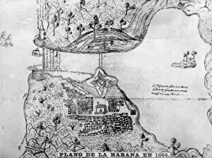
Map of Havana, (1608), 1920sMap of Havana in 1604. We assume this map was made by Christopher Rodal. Havana had in 1608 a population of five hundred. Cigar card from the History of Cuba, Geografico Universal
Map of Benzoni, (1541), 1920sMap of Benzoni. The traveller Girolano Benzoni, author of this map, was Italian and remained in Havana ten months in 1541
Territorial Divison, (1847), 1920s. Artist: Jose Maria de La TorreTerritorial division. This map was made in1837 by Sir Jose Maria de La Torre, who published another edition in 1847 with the title of History Map old
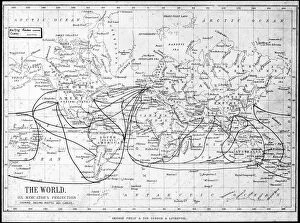
Map of the world showing sailing routes and telegraph cables, c1893. Artist: George Philip & Son LtdMap of the world showing sailing routes and telegraph cables, c1893. From Outlines of British Colonisation, by William Henry Parr Greswell
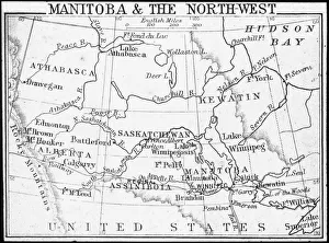
Map of Manitoba and the Northwest, Canada, c1893. Artist: George Philip & Son LtdMap of Manitoba and the Northwest, Canada, c1893. From Outlines of British Colonisation, by William Henry Parr Greswell
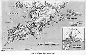
Scene of operations south of Port Adams, Manchuria, Russo-Japanese War, 1905. The Russo-Japanese War arose due to the two countries conflicting territorial ambitions in East Asia
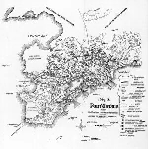
Port Arthur, Manchuria, showing Japanese and Russian fortifications, Russo-Japanese War, 1905. The city of Port Arthur, leased from the Chinese by Russia
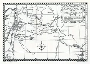
Railway and motor routes and pipelines, Syrian desert, 1937. Artist: Emery Walker LtdRailway and motor routes and pipelines, Syrian desert, 1937. A print from The Syrian Desert: Caravans, Travel and Exploration, by Christina Phelps Grant, A & C Blacks Ltd, London, 1937
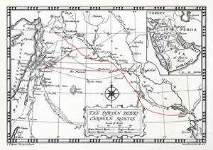
Caravan, courier and pilgrim routes in the Syrian desert, 1937. Artist: Emery Walker LtdCaravan, courier and pilgrim routes in the Syrian desert, 1937. A print from The Syrian Desert: Caravans, Travel and Exploration, by Christina Phelps Grant, A & C Blacks Ltd, London, 1937
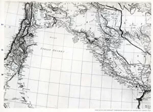
Rennells map of the Syrian desert, dated 1809, published 1831 (1937). A print from The Syrian Desert: Caravans, Travel and Exploration, by Christina Phelps Grant, A & C Blacks Ltd, London, 1937
Franz Josef Land, 1899. Map showing discoveries from 1894 to 1897. From an account of the Jackson-Harmsworth Expedition to Franz-Josef Land in the Arctic
Western Franz Josef Land, 1896 (1899). Map showing exploration up to end of Spring 1896 by the Jackson-Harmsworth Expedition to Franz-Josef Land in the Arctic
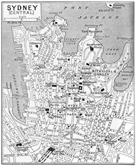
Map of central Sydney, New South Wales, Australia, c1924. A print from Countries of the World, edited by JA Hammerton, volume six, The Fleetway House, London, c1924
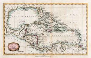
Map of the West Indies, 18th century(?). Artist: BarlowMap of the West Indies, 18th century(?)
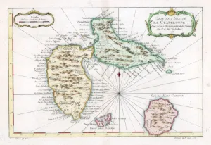
Map of the Caribbean island of Guadeloupe, c1764
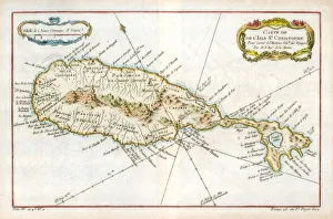
Map of the Caribbean island of St Christopher, c1764
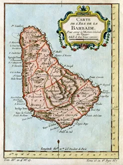
Map of Barbados, c1764
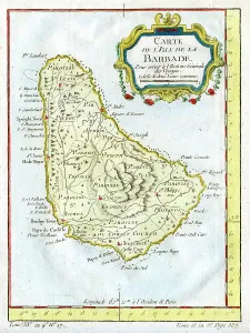
Map of Barbados, c1758
Map of Siberia, c1923. A print from Countries of the World, Volume VI, edited by JA Hammerton, The Fleetway House, London, c1923
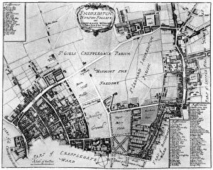
Map of Shoreditch, Norton Folgate and Cripplegate, (1907). A print from The History of the Squares of London Topographical and Historical by E Beresford Chancellor, Kegan Paul, Trench
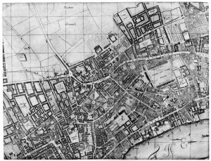
Plan of the parish of St Giles, London, 1907. A print from The History of the Squares of London Topographical and Historical by E Beresford Chancellor, Kegan Paul, Trench, Trubner and Co Ltd, London
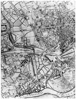
Plan of the parish of St Georges, Hanover Square, London, 1907Plan of the parish of St George s, Hanover Square, London, 1907. A print from The History of the Squares of London Topographical and Historical by E Beresford Chancellor, Kegan Paul, Trench
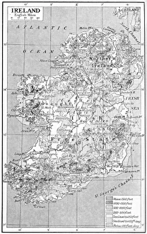
Map of Ireland, c1930s. A print from Countries of the World, edited by JA Hammerton, volume IV, The Fleetway House, c1930s
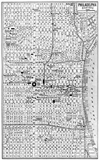
Map of central Philadelphia, Pennsylvania, USA, c1930s. A print from Countries of the World, edited by JA Hammerton, volume V, the Fleetway House, London, c1930s