mail_outline sales@mediastorehouse.com
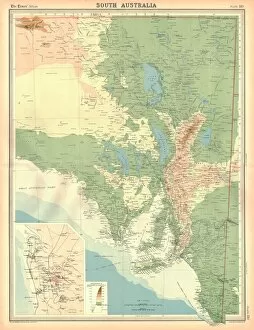
Map of South Australia. Map showing the Spencer and Vincent Gulfs, Kangaroo Island and Adelaide. Plate 110 from The Times Atlas
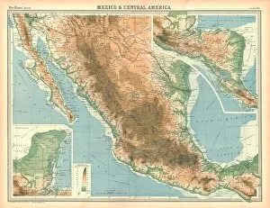
Map of Mexico and Central America. Map showing Baja California, Mexico and the Yucatan peninsula, Plate 95 from The Times Atlas
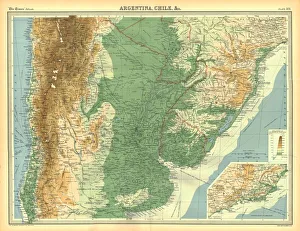
Map of Chile, Argentina etc. Map showing a section of South America, with the Andes mountain range, and the mouth of the River Plate. Plate 101 from The Times Atlas
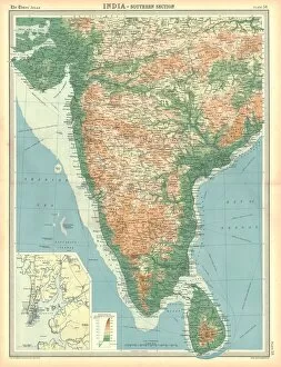
Map of India - Southern Section. Map of the south of India and what is now Sri Lanka. Plate 58 from The Times Atlas
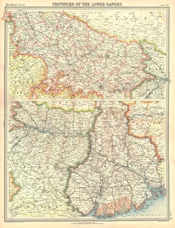
Map of the Provinces of the Lower Ganges. Map in two sections, showing Indian states through which the River Ganges flows, and the Ganges Delta in what is now Bangladesh. Plate 59 from The Times Atlas
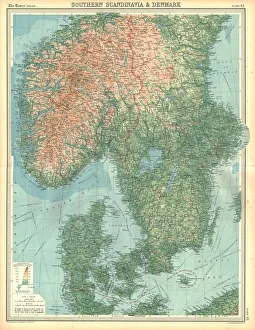
Map of Southern Scandinavia and Denmark. Plate 42 from The Times Atlas
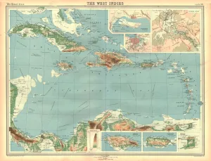
Geographical map of the West Indies. Map of the Caribbean, showing the Isthmus of Panama, the north coast of South America, the Greater Antilles, and various other islands
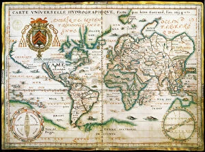
Nautical world map. (Australia is suggested but still unknown territory and, California is shown as an island), 1634. Found in the Collection of Bibliothe que Nationale de France
Map of the European Russia, 1766. Private Collection
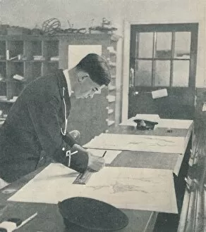
At the Royal Naval College, Dartmouth, 1936. From Shipping Wonders of the World, Vol. 1, edited by Clarence Winchester. [The Amalgamated Press Ltd. London]
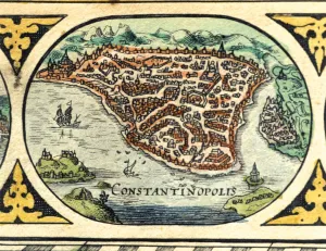
Constantinople, colored engraving from the book Le Theatre du monde or Nouvel Atlas, 1645, created, printed and published in Amsterdam
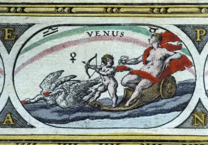
Venus, colored engraving from the book Le Theatre du monde or Nouvel Atlas, 1645, created, printed and published in Amsterdam by William and Jean Bleau
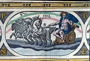
The sun, colored engraving from the book Le Theatre du monde or Nouvel Atlas, 1645, created, printed and published in Amsterdam by William and Jean Bleau
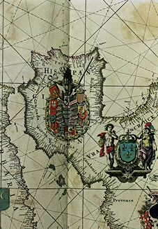
Map of Spain with all their kingdoms, Portugal and the Country of Llenguadoc. Atlas by Frederick de Witt
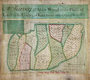
Map of Abbey Wood, part of Erith or Lesnes Manor on the eastern boundary of Woolwich, Kent, 1791. The map shows field names and acreages
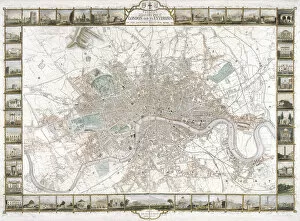
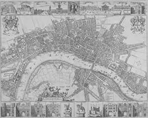
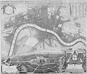
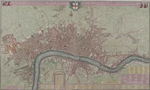
Map of London, 1851. Artist: H LaceyMap of London, 1851. Map produced in commemoration of the Great Exhibition of 1851. It is framed by 48 views of buildings around London
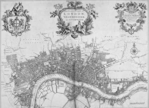
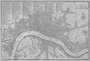
Map of Westminster, the City of London and Southwark, 1720. With the City arms in an ornamental cartouche with Mercury, the title in an ornamental cartouche with Victory, Appollo and Athena
Map of London and surrounding counties, 1710. With inset images of Chelsea Hospital, Greenwich Hospital, Windsor Castle, Hampton Court Palace and Kensington Palace
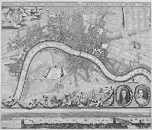
Map of London, 1690. Artist: Johannes de RamMap of London, 1690 Map with a panorama in the lower margin, portraits of William III and Mary II and putti carrying various devices including the City of London and Royal arms
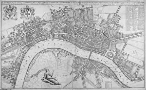
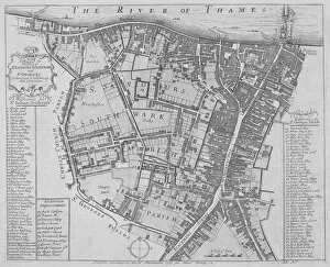
Map of the Cities of London and Westminster, Southwark and the suburbs, 1680. ArtistMap of the Cities of London and Westminster, Southwark and the suburbs, 1680. With the royal arms at top left, a key top right and a female figure holding dividers seated above the scale
Map of the Cities of London and Westminster and Southwark, 1690. With views of buildings and portraits of William III and Mary II in an oval in the top margin and gates
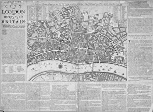
Map of the City of London surrounded by descriptive text, 1676
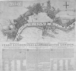
Map of London showing the destruction caused by the Great Fire, 1666. With a description in Dutch, French and English below
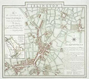
Map of the parish of St Mary, Islington, London, 1793. Artist: Benjamin BakerMap of the parish of St Mary, Islington, London, 1793
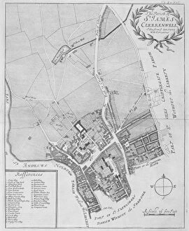
Map of the parish of St James Clerkenwell, London, 1720
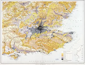
Map of London and south-east England, 1891. Artist: John BartholomewMap of London and south-east England, 1891. Map showing the population density of London and the surrounding counties
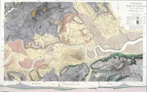
Geological map of London and the surrounding area, 1871. Artist: T WalshGeological map of London and the surrounding area, 1871. Map with geological information shown in colours and a vertical scale in the bottom margin
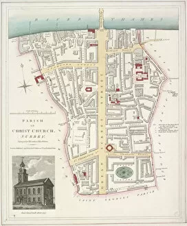
Map of the Parish of Christ Church in Southwark, London, 1821. With an image of the church inset in the bottom left corner
Map of the Parishes of St Georges and St Saviours, Southwark, London, 1755. ArtistMap of the Parishes of St Georges and St Saviour s, Southwark, London, 1755. With keys to the buildings and streets
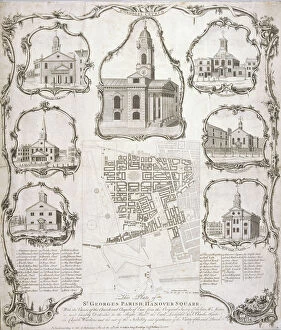
Map of the parish of St George Hanover Square in the City of Westminster, London, 1761. Surmounted by an image of the church and flanked by chapels of ease in the margins
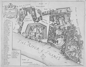
Map of the area around the Tower of London and St Katharine by the Tower, Stepney, London, 1720
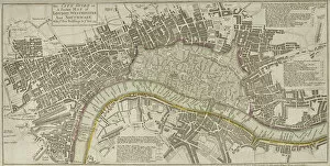
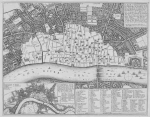
Map of London, 1753. Map of Westminster, the City of London, Southwark, the River Thames and surrounding areas, with two tables detailing Hackney coach fares and watermens fares
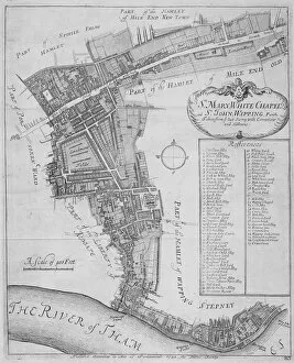
Map of the parishes of St Mary, Whitechapel and St John, Wapping, in Stepney, London, 1755
Map of London, 1690. The upper section shows a map of the City of London, City of Westminster, River Thames, Lambeth and Southwark. The lower section shows a view of Westwood Park, Worcestershire
Maps of London, 1610. The upper left section shows the City of Westminster and River Thames. The upper right section shows the City of London and River Thames
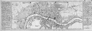
Map of London, 1667. The upper section shows a map of the City of London, City of Westminster, River Thames and part of south London
Map showing the extent of the damage caused by the Great Fire of London, 1666. ArtistMap showing the extent of the damage caused by the Great Fire of London, 1666
Map of London, 1725. Map of the City of London, City of Westminster, River Thames, Lambeth, Southwark and surrounding areas
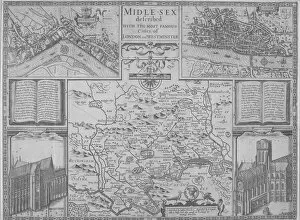
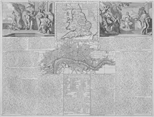
Maps of England, Wales and London, 1718. A map of England, Wales and part of Scotland is placed between two groups of allegorical figures
Map of London, 1700. Artist: Augustae VindelicorumMap of London, 1700. The City of London, City of Westminster, River Thames, Lambeth, Southwark and surrounding areas; either side contains text in German
Map of the City of London, the River Thames, the City of Westminster and surrounding areas, 1700
Map of the City of London and City of Westminster in c1600, 1708
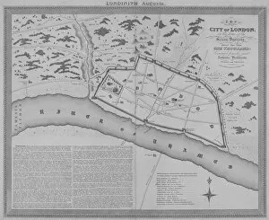
Map of London during the Saxon period, 1835. The section in the lower left contains descriptive text
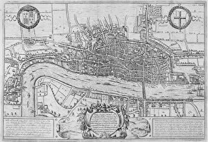
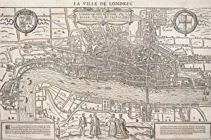
Map of the City of London, Southwark and part of Westminster, 1572
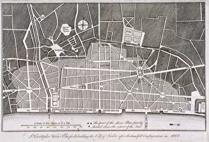
Proposed plan for the rebuilding of the City of London after the Great Fire in 1666
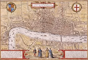
Map of the City of London and City of Westminster with four figures in the foreground, (c1572?). Heraldic shield on left depicts the Tudor royal arms and shield on left depicts the City of London arms
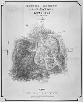
Map of the ancient earthworks at Loughton Camp made around AD 52 in Epping Forest, Essex, 1876
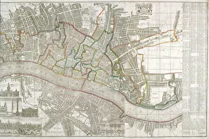
Map of Westminster, the City of London, Southwark and surrounding areas, 1743. ArtistMap of Westminster, the City of London, Southwark and surrounding areas, 1743. With inset images of the Banqueting House at Whitehall, the Treasury, the Royal Exchange