mail_outline sales@mediastorehouse.com
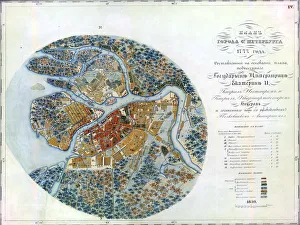
Map of Petersburg, 1777. Found in the collection of State Hermitage, St. Petersburg
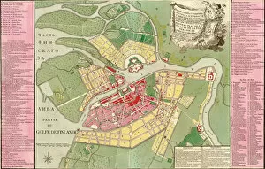
Map of Petersburg, ca 1762. Found in the collection of State Hermitage, St. Petersburg
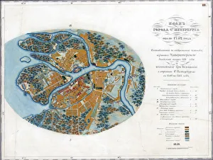
Map of Petersburg, 1776. Found in the collection of State Hermitage, St. Petersburg
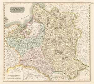
The Third Partition of Poland, 1795. Private Collection
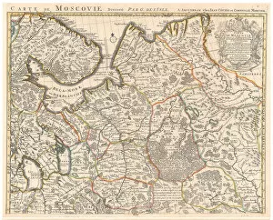
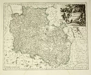
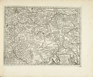
Map of Muscovy. Private Collection
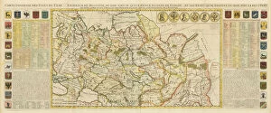
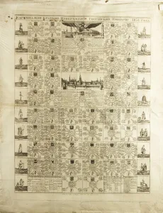
Map of Muscovy, with coats of arms, Russian coins of the day and explanatory panels. Private Collection
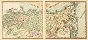
Map of the Russian Empire Divided into its Governments. Private Collection
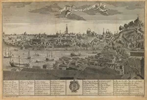
Panoramic view of Porto. Found in the Collection of Biblioteca Nacional, Brasil
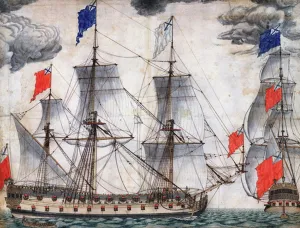
Flagship Goto Predestinatsia (The Providence of God) built by Peter the Great at Voronezh, 1700. Found in the Collection of State Central Navy Museum, St. Petersburg
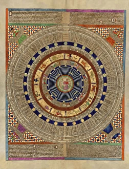
Mapamundi. Calendar. Found in the Collection of Bibliotheque Nationale de France
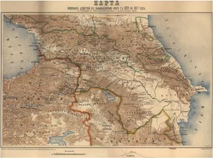
Map of military operations in the Transcaucasian region from 1809 to 1817, 1817. Private Collection
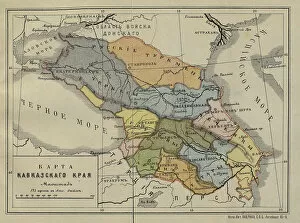
Map of the Caucasus Krai, Mid of the 19th cen.. Found in the collection of Russian State Library, Moscow
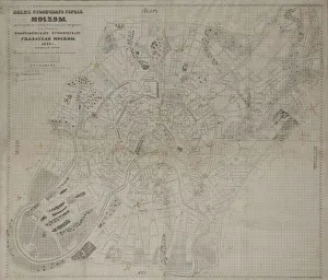
Map of Moscow, 1842. Found in the collection of I. Turgenev Memorial Museum, Moscow
Map of Pskov Governorate, 1792. Private Collection
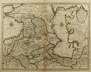
Map of the Caucasus and the Caspian Sea, c. 1800. Private Collection
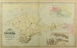
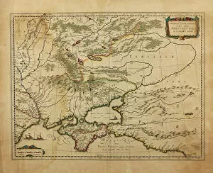
Map of the Crimea. Artist: Anonymous masterMap of the Crimea. Private Collection
Taurica Chersonesus. Map of the Crimea, 1595. Artist: Mercator, Gerardus (1512-1594)Taurica Chersonesus. Map of the Crimea, 1595. Private Collection
Governorates of the Russian Empire in 1831, 1829. Artist: AnonymousGovernorates of the Russian Empire in 1831, 1829. Private Collection
Aztec god Xiuhtecuhtli. The Codex Fejervary-Mayer, 15th century. Artist: Pre-Columbian artAztec god Xiuhtecuhtli. The Codex Fejervary-Mayer, 15th century. Found in the collection of World Museum Liverpool
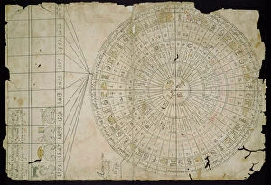
Aztec Calendar, Between 1655 and 1660. Artist: Pre-Columbian artAztec Calendar, Between 1655 and 1660. Found in the collection of Museo Nacional de Antropologia, Mexico
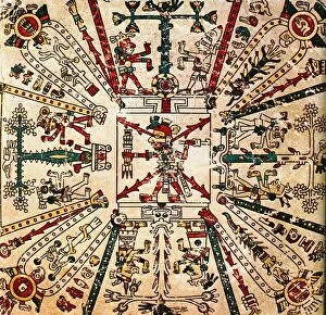
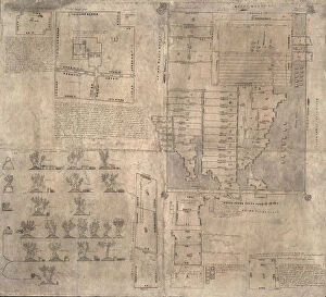
Aztec Oztoticpac map, c. 1540. Artist: Pre-Columbian artAztec Oztoticpac map, c.1540. Found in the collection of Museo Nacional de Antropologia, Mexico
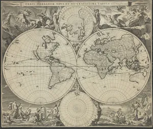
Orbis terrarum nova et accuratissima tabula, ca 1690. Artist: Visscher, Nicolaes (1618-1679)Orbis terrarum nova et accuratissima tabula, ca 1690. Private Collection
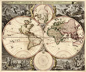
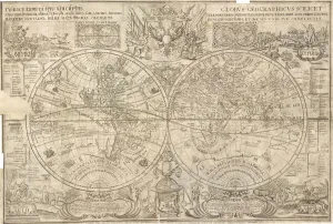
Double hemisphere map of the World, 1662. Artist: Blaeu, Joan (1596-1673)Double hemisphere map of the World, 1662. Private Collection
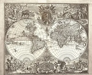
Double hemisphere map of the World, 1713. Artist: Kiprianov, Vasily Anufrievich (1669-after 1723)Double hemisphere map of the World, 1713. Found in the collection of Russian National Library, St. Petersburg
Double hemisphere map of the World, 1707. Artist: Kiprianov, Vasily Anufrievich (1669-after 1723)Double hemisphere map of the World, 1707. Found in the collection of Russian National Library, St. Petersburg
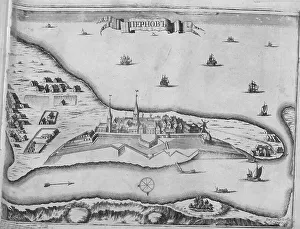
View of the Siege of Parnu on August 1710, 1715. Artist: Pickaert, Pieter (ca 1670-1737)View of the Siege of Parnu on August 1710, 1715. Found in the collection of Russian State Library, Moscow
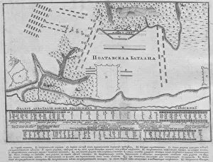
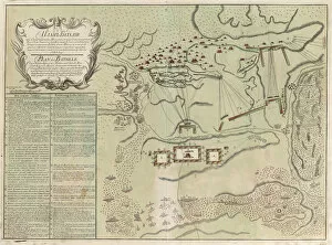
Map of the Battle of Poltava on 27 June 1709, 1713. Artist: AnonymousMap of the Battle of Poltava on 27 June 1709, 1713. Found in the collection of Russian State Library, Moscow
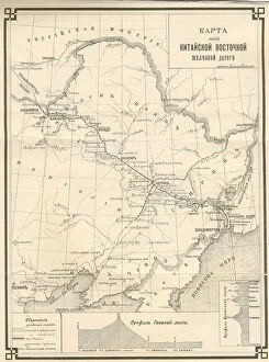
The Chinese Eastern Railway (CER), c. 1903-1906. Artist: Zabello, Aldona (active 1900s-1910s)The Chinese Eastern Railway (CER), c. 1903-1906. Found in the collection of State History Museum, Moscow
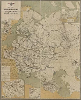
Map of Roads, Railroads and Inland Waterways of the Russian Empire, 1893, 1893. Artist: Anonymous masterMap of Roads, Railroads and Inland Waterways of the Russian Empire, 1893, 1893. Found in the collection of State Museum of Revolution, Moscow
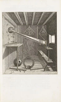
Machinae coelestis pars prior, 1673. Artist: Hevelius, Johannes (1611-1687)Machinae coelestis pars prior, 1673. Private Collection
Selenographia, 1647. Artist: Hevelius, Johannes (1611-1687)Selenographia, 1647. Private Collection
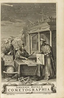
Cometographia. Frontispiece, 1668. Artist: Hevelius, Johannes (1611-1687)Cometographia. Frontispiece, 1668. Private Collection
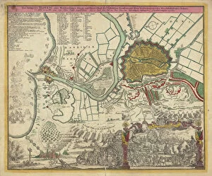
The Siege of Danzig, 1734, 1730s. Artist: AnonymousThe Siege of Danzig, 1734, 1730s. Found in the collection of State History Museum, Moscow
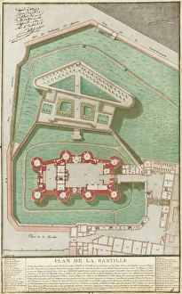
Plan de la Bastille, 1792. Artist: Palloy, Pierre-Francois (1755-1835)Plan de la Bastille, 1792. Private Collection
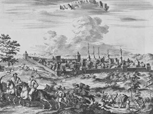
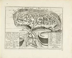
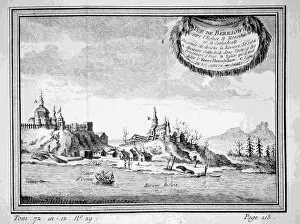
View of Samara, 1710. Artist: Aa, Pieter van der (1659-1733)View of Samara, 1710. Found in the collection of Rijksmuseum, Amsterdam
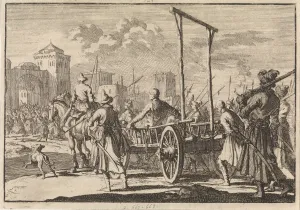
Arrival of Stepan Razin and his brother Frol in an iron cage in Moscow, 1671, 1698. Found in the collection of Rijksmuseum, Amsterdam
Map of Moscovia, 1726. Artist: Aa, Pieter van der (1659-1733)Map of Moscovia, 1726. Found in the collection of Rijksmuseum, Amsterdam
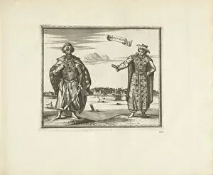
Habitants of Arkhangelsk, 1726. Artist: Aa, Pieter van der (1659-1733)Habitants of Arkhangelsk, 1726. Found in the collection of Rijksmuseum, Amsterdam
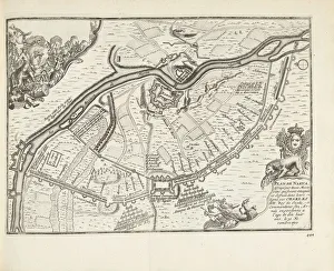
Map of Kamyanets-Podilsky, 1726. Artist: Aa, Pieter van der (1659-1733)Map of Kamyanets-Podilsky, 1726. Found in the collection of Rijksmuseum, Amsterdam
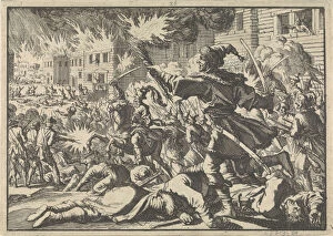
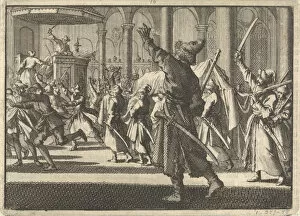
Fighting in the streets of Moscow between Russians and Poles in 1611, 1698. Artist: Aa, Pieter van der (1659-1733)Fighting in the streets of Moscow between Russians and Poles in 1611, 1698. Found in the collection of Rijksmuseum, Amsterdam
The Poles in the Riddarholm Church in Stockholm, 1698. Artist: Aa, Pieter van der (1659-1733)The Poles in the Riddarholm Church in Stockholm, 1698. Found in the collection of Rijksmuseum, Amsterdam
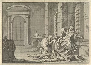
The Death of Tsar Fyodor II Borisovich Godunov, 1605, 1698. Artist: Aa, Pieter van der (1659-1733)The Death of Tsar Fyodor II Borisovich Godunov, 1605, 1698. Found in the collection of Rijksmuseum, Amsterdam
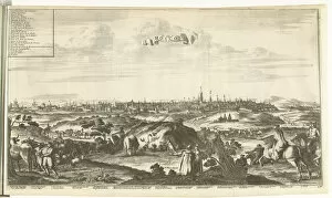
View of Moscow, 1726. Artist: Aa, Pieter van der (1659-1733)View of Moscow, 1726. Found in the collection of Rijksmuseum, Amsterdam
The Siege and Battle of Narva in 1700, 1726. Artist: Aa, Pieter van der (1659-1733)The Siege and Battle of Narva in 1700, 1726. Found in the collection of Rijksmuseum, Amsterdam
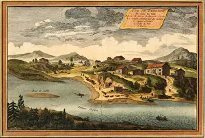
View of Beryozovo from the Sosva River, 1760. Artist: Bellin, Jacques Nicolas (1703-1772)View of Beryozovo from the Sosva River, 1760. Private Collection
View of Beryozovo from the Sosva River, 1770s. Artist: AnonymousView of Beryozovo from the Sosva River, 1770s. Private Collection
Map of Battle of Savuchny, 1739-1740. Artist: AnonymousMap of Battle of Savuchny, 1739-1740. Found in the collection of Russian National Library, St. Petersburg