mail_outline sales@mediastorehouse.com
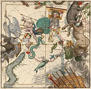
South Pole, Plate 6 from Globi coelestis in tabulas planas redacti descriptio, 1674South Pole, Plate 6 from Globi coelestis in tabulas planas redacti descriptio, Ignace-Gaston Pardies, pub. 1674 (hand coloured engraving)
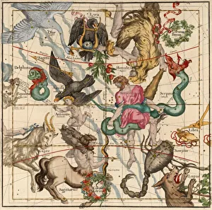
Winter Solstice, Plate 5 from Globi coelestis in tabulas planas redacti descriptio, 1674Winter Solstice, Plate 5 from Globi coelestis in tabulas planas redacti descriptio, Ignace-Gaston Pardies, pub. 1674 (hand coloured engraving)
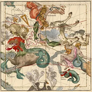
Vernal Equinox, Plate 2 from Globi coelestis in tabulas planas redacti descriptio, 1674Vernal Equinox, Plate 2 from Globi coelestis in tabulas planas redacti descriptio, Ignace-Gaston Pardies, pub. 1674 (hand coloured engraving)
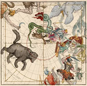
North Pole, Plate 1 from Globi coelestis in tabulas planas redacti descriptio, 1674North Pole, Plate 1 from Globi coelestis in tabulas planas redacti descriptio, Ignace-Gaston Pardies, pub. 1674 (hand coloured engraving)
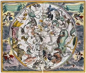
Map of the celestial Southern Hemisphere, 1660-1661. Artist: Andreas CellariusMap of the celestial Southern Hemisphere, 1660-1661. From The Celestial Atlas, or the Harmony of the Universe (Atlas coelestis seu harmonia macrocosmica) by Andreas Cellarius
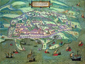
Map of Alexandria, Egypt, c1572. Artist: Joris HoefnagelMap of Alexandria, Egypt, c1572. From Civitates Orbis Terrarum by Georg Braun (1541-1622) and Frans Hogenberg (1535-90)
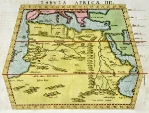
Map of North Africa, c1580s
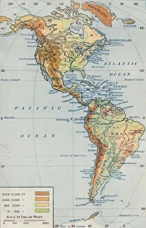
Map - The Continent of America, 1916. From America in Pictures, by H. Clive Barnard, M.A. B.Litt. [A. & C. Black, Limited, London, 1916]
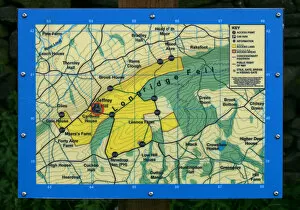
Map of Longridge Fell, Lancashire
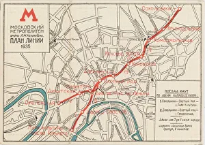
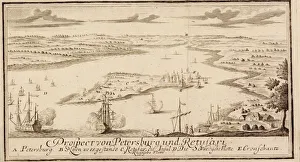
The first map of the Moscow subway, opened on May 15, 1935, 1935. Private Collection
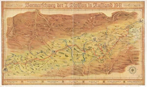
Operation Barbarossa. The route of the 7th Infantry Division from Warsaw to Moscow, 1942. Private Collection
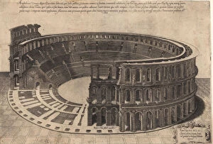
The Amphitheatre in Verona (series Speculum Magnificentiae Romanae), 1560. Private Collection
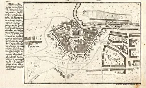
Bender, the Turkish fortress in Bessarabia, ca 1720. Private Collection
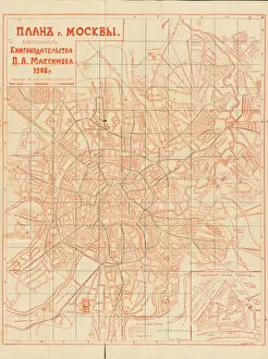
Plan of Moscow, 1908. Private Collection
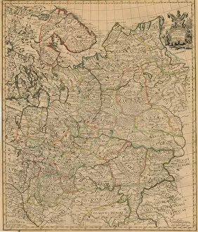
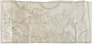
Map of the European Russia, 1721. Private Collection
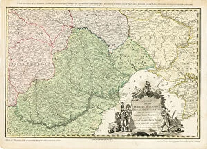
Map of Europe with the shift of borders in the course of the Russo-Turkish War (1787-1792), c. 1789. Private Collection
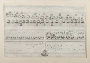
The naval Battle of Chesma. The naval Battle of Lemnos. 1770, 1771. Private Collection
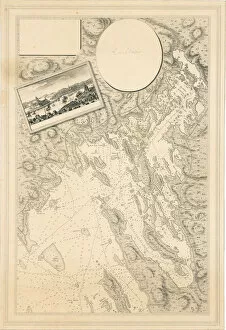
Sea chart of Vyborg bay, Russia, c. 1786-88. Private Collection
The Russo-Swedish seabattle of Krasnaya Gorka near Kronstadt on May 1790, 1790. Private Collection
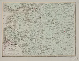
The area between Petersburg and Moscow in Russia, 1812. Found in the Collection of Lunds universitetsbibliotek
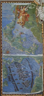
Corfu island and The Battle of Lepanto, 1583. Found in the Collection of Galleria delle Carte Geografiche, Vaticano
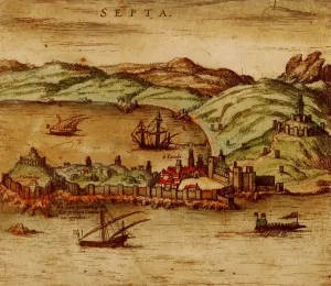
Ceuta (From Civitates Orbis Terrarum), 1572. Private Collection
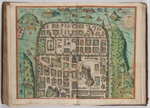
The Jerusalem Map (From: Civitates Orbis Terrarum), 1572. Private Collection
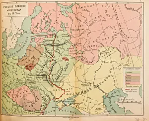
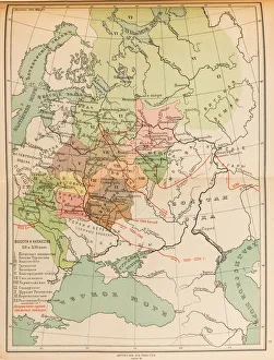
Russian Slavs and their neighbors in the 9th and 10th century (Map), 1914. Private Collection
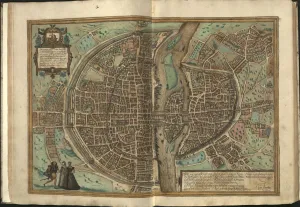
View of Paris, 1572. Private Collection
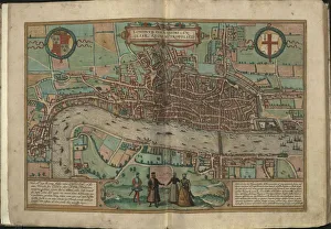
View of London, 1572. Private Collection
Map of Yerevan, 1762. Private Collection
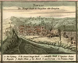
Map of Tiflis, 1762. Found in the Collection of Universiteitsbibliotheek Leiden
Map of the volosts and principalities in the 12th and 13th century, 1914. Private Collection
Map of the Russian Empire, 1787-1790. Private Collection
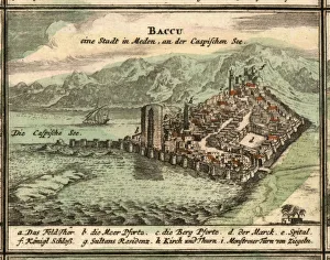
Map of Baku, 1762. Found in the Collection of Universiteitsbibliotheek Leiden
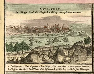
Map of Astrakhan, 1762. Found in the Collection of Universiteitsbibliotheek Leiden
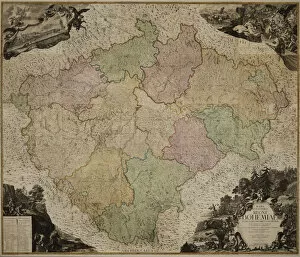
Map of the Kingdom of Bohemia, 1722. Private Collection
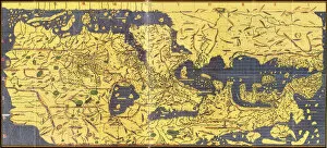
Kitab Rudjdjar (The Tabula Rogeriana), 1154. Found in the collection of Bibliotheque Nationale de France
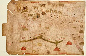
Nautical chart, 1558. Found in the collection of British Museum
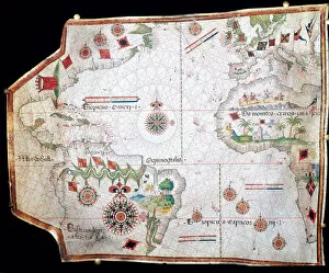
Nautical chart of the Mediterranean Sea, 1508. Found in the collection of Museo Maritimo, Barcelona
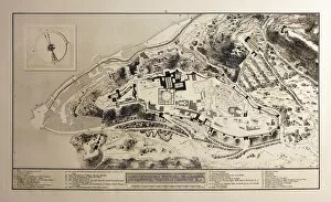
General plan of the Fortress of the Alhambra, 1770. Found in the collection of Real Academia de Bellas Artes de San Fernando, Madrid
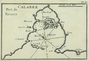
Port of Taranto (Tarentum), 1764. Private Collection
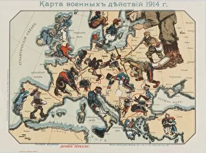
Map of the 1914 war activities, edited by the Moscow magazine New Distorted Mirror, 1914-1915. Found in the collection of State Hermitage, St. Petersburg
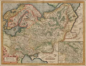
Russia cum Confinijs. Map of Russia, ca 1595. Private Collection
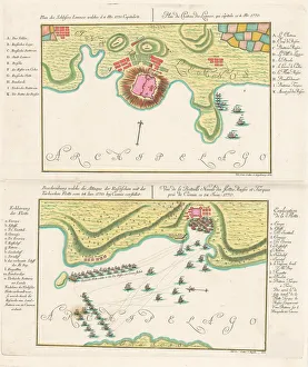
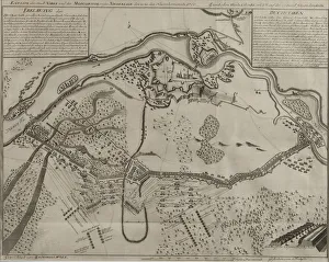
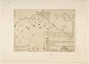
Map of the Battle at Narva, 1700. Private Collection
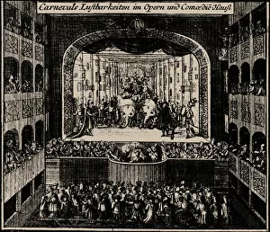
Margrave Theatre in Erlangen, 1721. Private Collection
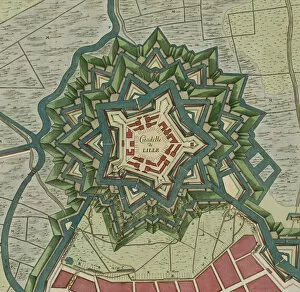
Plan of the Citadel of Lille, 1709. Found in the Collection of Bibliotheque royale de Belgique
Plan of the Battle of Sinope, 1853. Private Collection
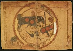
World map. The world, centering on the Persian Gulf, ca 550. Private Collection
The naval Battle of Hogland on 17 July 1788, Late 18th cent. Private Collection
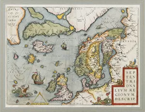
Septentrionalium Regionum Descrip. (The Arctic. Scandinavia), 1572-1575. Private Collection
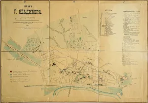
Map of Vladimir, 1889. Found in the Collection of State Museum of Architecture, History and Art, Vladimir