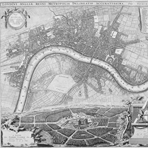
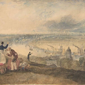
Maps of London, 1610

![]()
Wall Art and Photo Gifts from Heritage Images
Maps of London, 1610
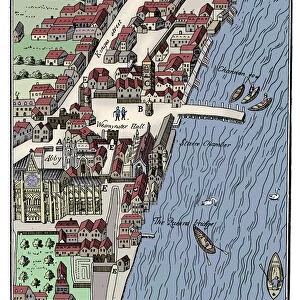
Maps of London, 1610. The upper left section shows the City of Westminster and River Thames. The upper right section shows the City of London and River Thames. The central section shows a map of Greater London and surrounding counties. The panels in the bottom corners show Westminster Abbey (left) and the old St Pauls Cathedral (right)
Media ID 15175468
© London Metropolitan Archives (City of London) / Heritage-Images
Abbey Cartography Map Making Pauls Cathedral Speed St Pauls Cathedral Thames Westminster Abbey
MADE IN THE UK
Safe Shipping with 30 Day Money Back Guarantee
FREE PERSONALISATION*
We are proud to offer a range of customisation features including Personalised Captions, Color Filters and Picture Zoom Tools
SECURE PAYMENTS
We happily accept a wide range of payment options so you can pay for the things you need in the way that is most convenient for you
* Options may vary by product and licensing agreement. Zoomed Pictures can be adjusted in the Basket.