Map of London, 1690

![]()
Wall Art and Photo Gifts from Heritage Images
Map of London, 1690
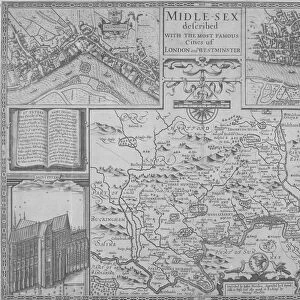
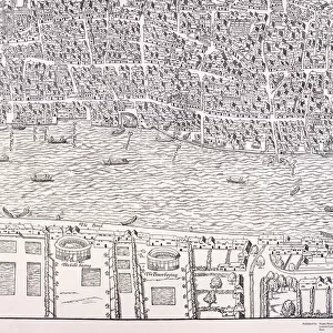
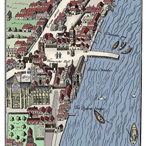
Map of London, 1690. The upper section shows a map of the City of London, City of Westminster, River Thames, Lambeth and Southwark. The lower section shows a view of Westwood Park, Worcestershire. The heraldic arms of the City of London can be seen on the right
Media ID 15175470
© London Metropolitan Archives (City of London) / Heritage-Images
Cartography Coat Of Arms Heraldry Lambeth Map Making Southwark Thames Worcestershire
MADE IN THE UK
Safe Shipping with 30 Day Money Back Guarantee
FREE PERSONALISATION*
We are proud to offer a range of customisation features including Personalised Captions, Color Filters and Picture Zoom Tools
SECURE PAYMENTS
We happily accept a wide range of payment options so you can pay for the things you need in the way that is most convenient for you
* Options may vary by product and licensing agreement. Zoomed Pictures can be adjusted in the Basket.