



Framed Prints
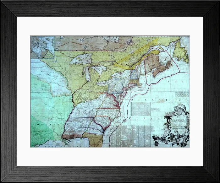
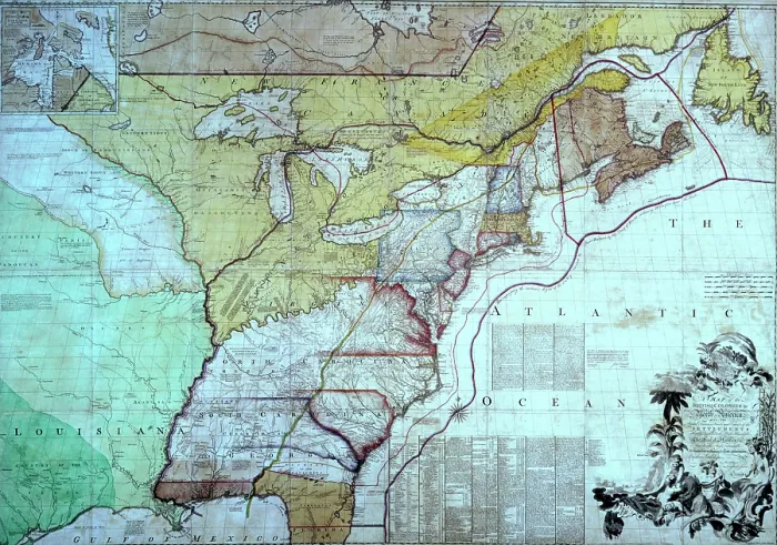
Framed Print of Map of the British Colonies in North America, c1770-c1783. Creator: John Mitchell
Map of the British Colonies in North America, c1770-c1783. This map is the one on which the British negotiators for peace with the Americans marked out their interpretation of the boundary between the United States and the provinces which later formed Canada. The new border was marked in red, so the map became known as the Red-lined map'. It was presented to George III to show him how the settlement worked on the ground. As the map was not included in the final treaty and as the printed map itself contained inaccuracies, further arbitration was later required. In full: Map of the British Colonies in North America with the Roads, Distances, Limits and Extent of the Settlements, Humbly Inscribed to the Right Honourable The Earl of Halifax And the Other Right Honourable The Lords commissioners for Trade and Plantations'. Colonial American physician and botanist John Mitchell (1711-1768) created the most comprehensive and perhaps largest 18th-century map of eastern North America, known today as the Mitchell Map. First published in 1755, in conjunction with the imminent Seven Years War, the map was subsequently used during the Treaty of Paris (1783) to define the boundaries of the newly independent United States and has been resolving border disputes since. Heritage Images features heritage image collections. © Heritage Art/Heritage Images
Your chosen combination is quickly and professionally made to order, our shipping page has more details
If you are not entirely happy with your items, simply return them to us within 30 days for a replacement or full refund. Please read our full returns policy.
Media ID 41579427
Atlantic Ocean Border Boundary British Library Canada Coastline Colony George Iii George Iii King Of Great Britain George Iii Of England John Mitchell King George Iii King George Iii Of England King Of Great Britain King Of Great Britain And Of Ireland Mitchell Mitchell John North America Ocean Owner Ownership Plantation Political Event Slave Trade Slavery Sovereignty Territorial Territory
Modern Frame 14"x12" (36x31cm)
Ready to Hang Contemporary Framed Prints adds style, protection, and a polished touch to your space - effortlessly.
Your artwork will be printed as shown in the preview. To adjust please select Edit Printed Image under the Buy button
Wood effect frame, card mounted, 10x8 fade resistant photo print. Overall outside dimensions 14x12 inches (36x31cm). Environmentally and ozone friendly, 40mm wide x 15mm Polycore® moulding has the look of real wood, is durable and light and easy to hang. Biodegradable and made with non-chlorinated gases (no toxic fumes) it is efficient; producing 100 tons of polystyrene can save 300 tons of trees! Prints are glazed with lightweight, shatterproof, optical clarity acrylic (providing the same general protection from the environment as glass). The back is stapled hardboard with a sawtooth hanger attached. Note: measurements provided are estimated outer dimensions, which include both the image and the frame. While we aim to keep sizing consistent, exact dimensions may vary slightly due to differences in print size or production requirements, which may result in a variation in the overall size (up to approximately 2.5cm (1"))
These are individually made so all sizes are approximate
Estimated Image Size (if not cropped) is 24.4cm x 17.1cm (9.6" x 6.7")
Estimated Product Size is 36cm x 31cm (14.2" x 12.2")
