mail_outline sales@mediastorehouse.com
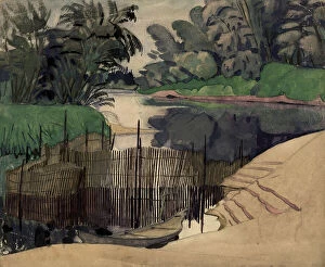
Kotets, Selkups, 1920. Creator: A. G. VarginKotets, Selkups, 1920. V. I. Surikov Museum of Art in Krasnoiarsk
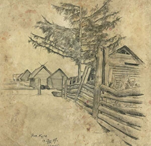
Kur'ia Settlement, Ket River, 1927. Creator: Dmitrii Innokent'evich KaratanovKur'ia Settlement, Ket River, 1927. Novosibirsk State Museum of Regional History and Folklife
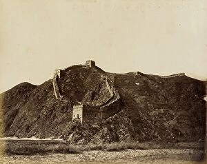
Portion of the Great Wall, 1860. Creator: Felice BeatoPortion of the Great Wall, 1860
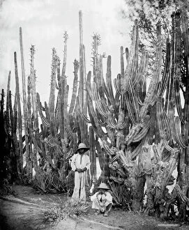
Cactus fence in Salamanca, Salamanca, Mexico, between 1880 and 1900. Creator: UnknownCactus fence in Salamanca, Salamanca, Mexico, between 1880 and 1900
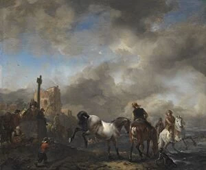
Horsepond near a Boundary Stone, c.1651-c.1654. Creator: Philips WouwermanHorsepond near a Boundary Stone, c.1651-c.1654
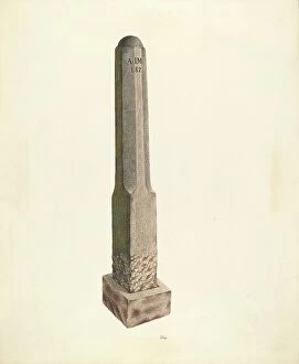
Plantation Boundary Marker, c. 1938. Creator: Joseph L. BoydPlantation Boundary Marker, c. 1938
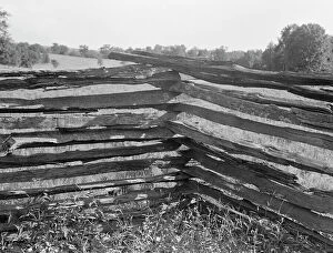
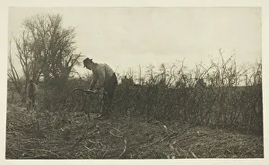
Split-log fence, north central Arkansas, along U.S. 62, 1938. Creator: Dorothea LangeNorth central Arkansas, along U.S. 62. Split-log fence
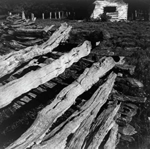
Split-log fence, North central Arkansas, along U.S. 62, 1938. Creator: Dorothea LangeNorth central Arkansas, along U.S. 62. Split-log fence
Split-log fence, North Central Arkansas along U.S. 62, 1938. Creator: Dorothea LangeNorth Central Arkansas along U.S. 62. Split-log fence
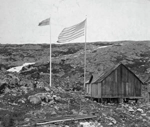
Alaska - Yukon boundary, between c1900 and 1923. Creator: UnknownAlaska - Yukon boundary, between c1900 and 1923. Alaska-Canada border with American and Canadian flags, a building, and people standing on either side
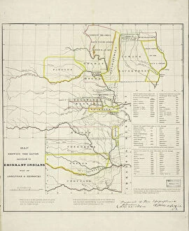
Map showing the lands assigned to emigrant Indians west of Arkansas and Missouri, 1836. Creator: Topographical BureauMap showing the lands assigned to emigrant Indians west of Arkansas and Missouri, 1836. Following passage of the Indian Removal Act in 1830
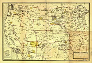
Indian Reservations west of the Mississippi River, 1923. Creator: Office of Indian AffairsIndian Reservations west of the Mississippi River, 1923. This map, created by the Office of Indian Affairs in 1923, shows the location of Indian reservations west of the Mississippi River
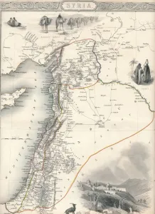
Map of Syria, 1851. Artist: John TallisMap of Syria, 1851. From The Illustrated Atlas, And Modern History Of The World Geographical, Political, Commercial & Statistical edited by R. Montgomery Martin, Esq. [J & F
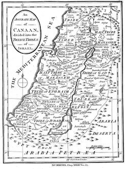
Map of Canaan divided into the twelve tribes of Israel, c1830Map of Canaan divided into the twelve tribes of Israel, 1830. Map of Canaan divided into the territories of the Twelve Tribes of Israel as described in the Bible, Numbers 23:54. Engraving c1830
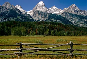
Tetons Fence. Creator: Tom ArtinTetons Fence
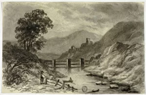
Mountain Stream with Boat, c. 1855. Creator: Elizabeth MurrayMountain Stream with Boat, c. 1855
Fencing in Suffolk, c. 1883 / 87, printed 1888. Creator: Peter Henry EmersonFencing in Suffolk, c. 1883/87, printed 1888. A work made of photogravure, pl. xxiv from the album " pictures of east anglian life" (1888)
Fence and Posts, c. 1936. Creator: Mary E HumesFence and Posts, c. 1936
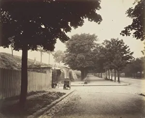
Porte de Gentilly, Bd Kellermann, 1907. Creator: Eugene AtgetPorte de Gentilly, Bd Kellermann, 1907. A work made of albumen print, from " fortifications"
Fence, c. 1940. Creator: Rose Campbell-GerkeFence, c. 1940
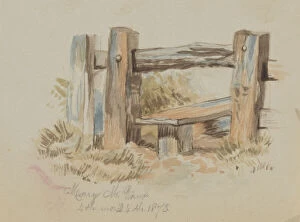
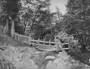
Untitled (Stile), 1873. Creator: Mary Vaux WalcottUntitled (Stile), 1873
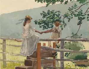
On the Stile, 1878. Creator: Winslow HomerOn the Stile, 1878
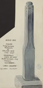
Sugar Plantation Marker, 1935 / 1942. Creator: UnknownSugar Plantation Marker, 1935/1942
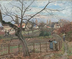
The Fence, 1872. Creator: Camille PissarroThe Fence, 1872
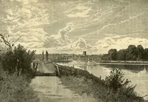
Henley-On-Thames, 1898. Creator: UnknownHenley-On-Thames, 1898. Cattle grid on the banks of the river Thames at Henley-On-Thameson, Oxfordshire, England. From " Our Own Country, Volume VI"
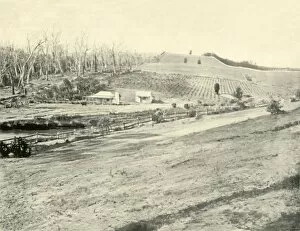
Bush Workmans Home, Gippsland, Victoria, 1901. Creator: Unknown1901. From " Federated Australia". [The Werner Company, London, 1901]
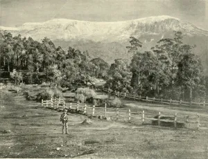
Mount Wellington, from the Huon Road, 1901. Creator: UnknownMount Wellington, from the Huon Road, 1901. The original Huon Road was a two-lane road skirting Mount Wellington. From " Federated Australia". [The Werner Company, London, 1901]
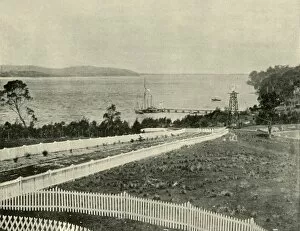
Lake Macquarie, from Toronto, 1901. Creator: UnknownLake Macquarie, from Toronto, 1901.Named after Toronto, Ontario, Canada, in honour of Edward Hanlan, a Canadian world-champion sculler who visited Australia in 1884
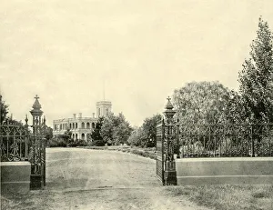
A Victoria Private Residence, 1901. Creator: UnknownA Victoria Private Residence, 1901. From " Federated Australia". [The Werner Company, London, 1901]
In the Berkshire Hills, Massachusetts, c1897. Creator: UnknownIn the Berkshire Hills, Massachusetts, c1897. The Berkshires are a range of the Appalachian Mountains. From " A Tour Through the New World America", by Prof. Geo. R. Cromwell. [C. N
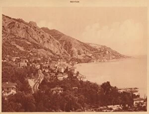
View of Garavan and the Italian Frontier, Menton, 1930. Creator: UnknownView of Garavan and the Italian Frontier, Menton, 1930. From " La Cote d Azur de Marseille a Menton". [Levy & Neurdein, Paris, 1930]
Broad Street and Cornhill Wards, 1897. Creator: UnknownBroad Street and Cornhill Wards, 1897. Map of part of the City of London from the mid 18th century, showing parish divisions
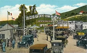
Tijuana, Mexico - International Boundary Line, c1939. From Souvenir of Tijuana, Mexico. [Western Publishing & Novelty Co. Los Angeles, Calif.]
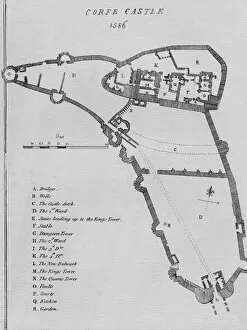
Corfe Castle, 1586. Artist: Ralph TreswellCorfe Castle, 1586
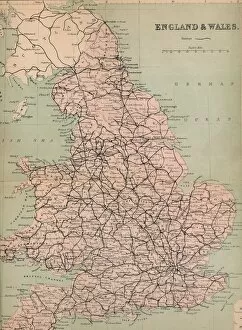
England & Wales, 1859. Jurisdiction covering England and Wales, two of the four countries of the United Kingdom. From The History of England by David Hume & Tobias Smollett. [Virtue & Co
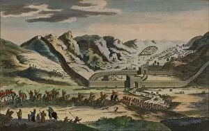
A View of the celebrated Great Wall of China, 1782A View of the celebrated Great Wall of China, which divides that Empire from Tartary, & was originally built to prevent the Invasions of the Tartars, 1782
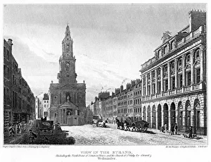
View of the Strand, Westminster, London, 1810. Artist: H le KeuxView of the Strand, Westminster, London, 1810. The view shows the north front of Somerset House and the Church of St Mary-le-Strand, designed by James Gibbs and built in 1714
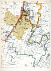
Plan of the Wards and Parishes in Which the Guildhall of the City of London is Situated, 1886. A print from Guildhall of the City of London: Its History and Associations
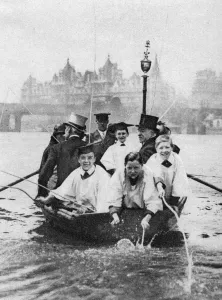
Choirboys of St Clement Danes beating the boundary-marks on the Thames, London, 1926-1927. Boys in mortarboards take part in the old custom of beating the parish bounds
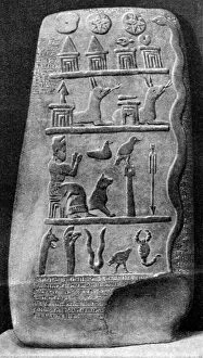
A boundary stone of Babylonia, 1000 BC (1922). Set up to mark the extent of a private individuals estate, the stone is inscribed with certain texts which refer to the ownwership of the land during
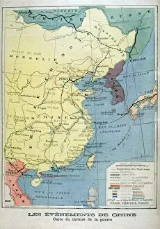
Map of the theatre of the war in China, 1900. Boxer Rebellion was a Chinese rebellion from November 1899 to September 7, 1901, against foreign influence in areas such as trade, politics
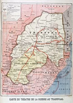
Map of the Theatre of the War in the Transvaal, 1899. An illustration from Le Petit Journal, 26th November 1899
Events in the Transvaal, Africa, 1899. An illustration from Le Petit Journal, 22nd October 1899
Settlements on the shore of the Bosphorus, near the Black Sea, Turkey, 20th century. Artist: CM DixonSettlements on the shore of the Bosphorus, near the Black Sea, Turkey, 20th century. An internationally-significant waterway located in northwestern Turkey forming part of the continental boundary
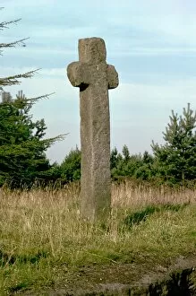
Mauley Cross, standing about six feet tall
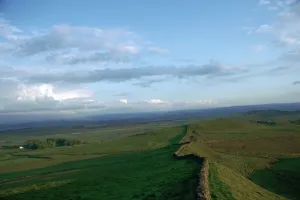
Hadrians Wall at Sewingshields, 2nd centuryHadrians Wall at Sewingshields looking east, 2nd century