mail_outline sales@mediastorehouse.com
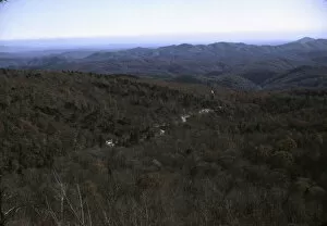
View in the mountains along Skyline Drive in Virginia, ca. 1940. Creator: Jack DelanoView in the mountains along Skyline Drive in Virginia
View in the mountains along the Skyline Drive, Va. ca. 1940. Creator: Jack DelanoView in the mountains along the Skyline Drive, Va
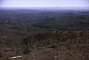
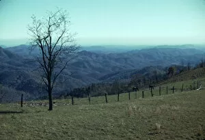
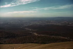
View from the Skyline Drive, Virginia. ca. 1940. Creator: Jack DelanoView from the Skyline Drive, Virginia
View along the Skyline Drive, Va. ca. 1940. Creator: Jack DelanoView along the Skyline Drive, Va
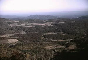
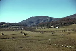
Mountain farms along the Skyline Drive, Va. ca. 1940. Creator: Jack DelanoMountain farms along the Skyline Drive, Va
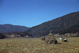
Mountain farm along Skyline Drive, Va. ca. 1940. Creator: Jack DelanoMountain farm along Skyline Drive, Va
Fields along the Skyline Drive in Virginia, ca. 1940. Creator: Jack DelanoFields along the Skyline Drive in Virginia
A mountain farm along the Skyline Drive in Virginia, ca. 1940. Creator: Jack DelanoA mountain farm along the Skyline Drive in Virginia
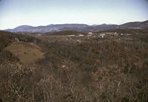
Mountain farms along the Skyline Drive in Virginia, ca. 1940. Creator: Jack DelanoMountain farms along the Skyline Drive in Virginia
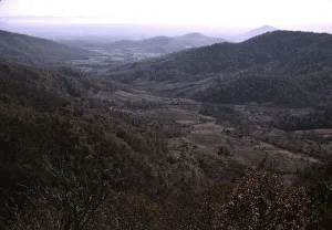
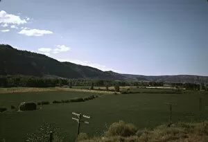
Valley along the Skyline Drive in Virginia, ca. 1940. Creator: Jack DelanoValley along the Skyline Drive in Virginia
Cornshocks in mountain farm along the Skyline Drive in Virginia, ca. 1940. Creator: Jack DelanoCornshocks in mountain farm along the Skyline Drive in Virginia
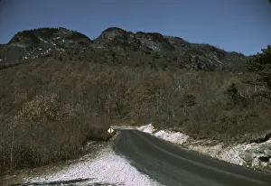
The road along the Skyline Drive, with a light snowfall in the rocks beside, Virginia, ca. 1940. Creator: Jack DelanoThe road along the Skyline Drive, with a light snowfall in the rocks beside, Virginia
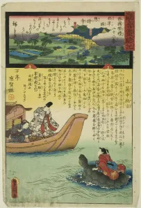
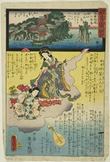
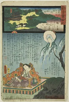
Mount Nachi in Kii Province, No. 1 on the Saikoku Pilgrimage Route (Saikoku junrei ichiban... 1858)Mount Nachi in Kii Province, No. 1 on the Saikoku Pilgrimage Route (Saikoku junrei ichiban Kishu Nachisan), from the series " The Miracles of Kannon (Kannon reigenki)", 1858
Mount Hokke in Harima Province, No. 26 on the Saikoku Pilgrimage Route (Saikoku junrei nij... 1859)Mount Hokke in Harima Province, No. 26 on the Saikoku Pilgrimage Route (Saikoku junrei nijurokuban Harima Hokkezan), from the series " The Miracles of Kannon (Kannon reigenki)", 1859
Ishiyama Temple in Omi Province, No. 13 on the Saikoku Pilgrimage Route (Saikoku junrei ju... 1858)Ishiyama Temple in Omi Province, No. 13 on the Saikoku Pilgrimage Route (Saikoku junrei jusanban Koshu Ishiyamadera), from the series " The Miracles of Kannon (Kannon reigenki)", 1858
Mii Temple in Omi Province, No. 14 on the Saikoku Pilgrimage Route (Saikoku junrei juyonba... 1859)Mii Temple in Omi Province, No. 14 on the Saikoku Pilgrimage Route (Saikoku junrei juyonban Omi Miidera), from the series " The Miracles of Kannon (Kannon reigenki)", 1859
Kachio Temple in Settsu Province, No. 23 on the Saikoku Pilgrimage Route (Saikoku junrei n... 1859)Kachio Temple in Settsu Province, No. 23 on the Saikoku Pilgrimage Route (Saikoku junrei nijusanban Settsu Kachiodera), from the series " The Miracles of Kannon (Kannon reigenki)", 1859
Soji Temple in Settsu Province, No. 22 on the Saikoku Pilgrimage Route (Saikoku junrei nij... 1859)Soji Temple in Settsu Province, No. 22 on the Saikoku Pilgrimage Route (Saikoku junrei nijuniban Settsu no kuni Sojiji), from the series " The Miracles of Kannon (Kannon reigenki)", 1859
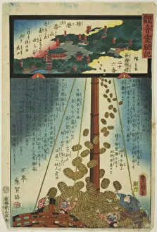
Chikubu Island in Omi Province, No. 30 on the Saikoku Pilgrimage Route (Saikoku junrei... 1859)Chikubu Island in Omi Province, No. 30 on the Saikoku Pilgrimage Route (Saikoku junrei sanjuban Omi Chikubujima), from the series " The Miracles of Kannon (Kannon reigenki)", 1859
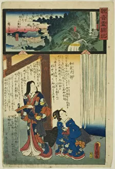
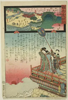
Imakumano in Kyoto, Yamashiro Province, No. 15 on the Saikoku Pilgrimage Route (Saikoku ju... 1859)Imakumano in Kyoto, Yamashiro Province, No. 15 on the Saikoku Pilgrimage Route (Saikoku junrei jugoban Yamashiro Kyo Imakumano), from the series " The Miracles of Kannon (Kannon reigenki)"
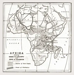
Africa showing souces of Slave Supply, 1888. Creator: UnknownAfrica showing souces of Slave Supply, 1888. From, The Graphic. An Illustrated Weekly Newspaper Volume 38. July to December, 1888
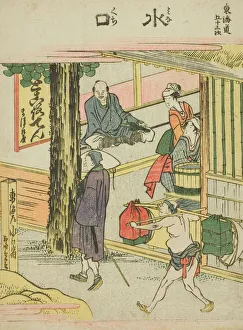
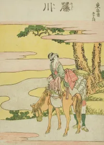
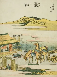
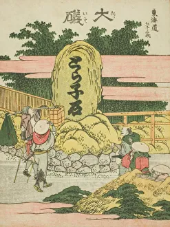
Ishibei, from the series "Fifty-three Stations of the Tokaido (Tokaido gojusan tsugi)Ishibei, from the series " Fifty-three Stations of the Tokaido (Tokaido gojusan tsugi)", Japan, c. 1806
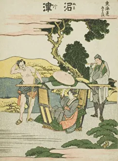
Numatsu, from the series "Fifty-three Stations of the Tokaido (Tokaido gojusan tsugi)Numatsu, from the series " Fifty-three Stations of the Tokaido (Tokaido gojusan tsugi)", Japan, c. 1806
Kuwana, from the series "Fifty-three Stations of the Tokaido (Tokaido gojusan tsugi)Kuwana, from the series " Fifty-three Stations of the Tokaido (Tokaido gojusan tsugi)", Japan, c. 1806
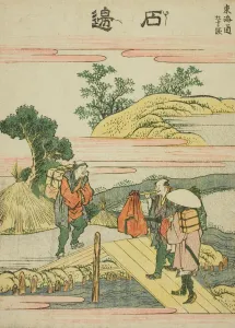
Hakone, from the series "Fifty-three Stations of the Tokaido (Tokaido gojusan tsugi)Hakone, from the series " Fifty-three Stations of the Tokaido (Tokaido gojusan tsugi)", Japan, c. 1806
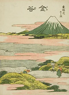
Kanaya, from the series "Fifty-three Stations of the Tokaido (Tokaido gojusan tsugi)Kanaya, from the series " Fifty-three Stations of the Tokaido (Tokaido gojusan tsugi)", Japan, c. 1806
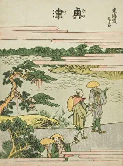
Okitsu, from the series "Fifty-three Stations of the Tokaido (Tokaido gojusan tsugi)Okitsu, from the series " Fifty-three Stations of the Tokaido (Tokaido gojusan tsugi)", Japan, c. 1806
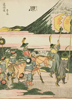
Hara, from the series "Fifty-three Stations of the TokaidoHara, from the series " Fifty-three Stations of the Tokaido (Tokaido gojusan tsugi)", Japan, c. 1806
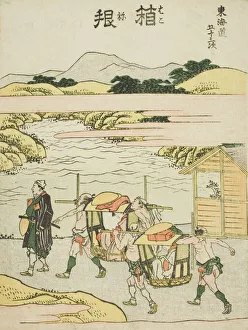
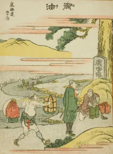
Fukoroi, from the series "Fifty-three Stations of the Tokaido (Tokaido gojusan tsugi)Fukoroi, from the series " Fifty-three Stations of the Tokaido (Tokaido gojusan tsugi)", Japan, c. 1806
Minakuchi, from the series "Fifty-three Stations of the Tokaido (Tokaido gojusan)Minakuchi, from the series " Fifty-three Stations of the Tokaido (Tokaido gojusan tsugi)", Japan, c. 1806
Fujikawa, from the series "Fifty-three Stations of the Tokaido (Tokaido gojusan)Fujikawa, from the series " Fifty-three Stations of the Tokaido (Tokaido gojusan tsugi)", Japan, c. 1806
Arai, from the series "Fifty-three Stations of the Tokaido (Tokaido gojusan tsugi)Arai, from the series " Fifty-three Stations of the Tokaido (Tokaido gojusan tsugi)", Japan, c. 1806
Oiso, from the series "Fifty-three Stations of the Tokaido (Tokaido gojusan tsugi)Oiso, from the series " Fifty-three Stations of the Tokaido (Tokaido gojusan tsugi)", Japan, c. 1806
Hodogaya, from the series "Fifty-three Stations of the Tokaido (Tokaido gojusan)Hodogaya, from the series " Fifty-three Stations of the Tokaido (Tokaido gojusan tsugi)", Japan, c. 1806
Goyu, from the series "Fifty-three Stations of the Tokaido (Tokaido gojusan tsugi)Goyu, from the series " Fifty-three Stations of the Tokaido (Tokaido gojusan tsugi)", Japan, c. 1806
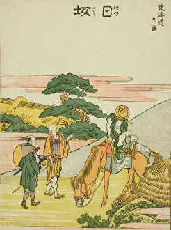
Nissaka, from the series "Fifty-three Stations of the Tokaido (Tokaido gojusan tsugi)Nissaka, from the series " Fifty-three Stations of the Tokaido (Tokaido gojusan tsugi)", Japan, c. 1806
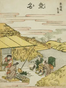
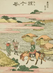
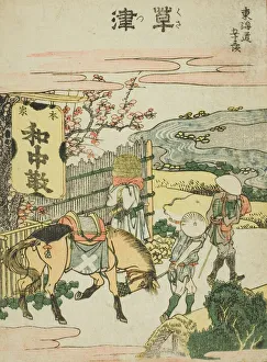
Kusatsu, from the series "Fifty-three Stations of the Tokaido (Tokaido gojusan tsugi)Kusatsu, from the series " Fifty-three Stations of the Tokaido (Tokaido gojusan tsugi)", Japan, c. 1806
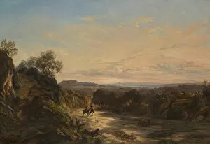
Sur la route de Nice, About 1844. Creator: Paul HuetSur la route de Nice, About 1844
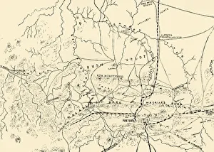
The Battlefields of Pretoria. (From a personal survey). 1901. Creator: UnknownThe Battlefields of Pretoria. (From a personal survey). 1901. From " South Africa and the Transvaal War, Vol. VI", by Louis Creswicke. [T. C. & E. C. Jack, Edinburgh, 1901]
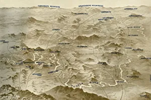
Bird s-Eye View of the Country Covered by General Bullers Operations for the Relief of Ladysmith, 1900. When the Second Boer War broke out on 11 October 1899, the Boers laid siege to Ladysmith
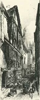
Street in Dartmouth, c1870. In 1864-1867 Higher Street in Dartmouth was widened into Southtown. From " Picturesque Europe - The British Isles, Vol. II"
Germany and the Casement Plot, First World War, c1916, (c1920). Creator: UnknownGermany and the Casement Plot, First World War, c1916, (c1920)....map showing approximately the course taken by the gun-runner and the submarine with Roger Casement on board
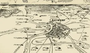
Antwerp and its Roots, 1915. Creator: UnknownAntwerp and its Roots, 1915. Antwerp was ringed by forts known as the National Redoubt, besieged and captured during the German invasion of Belgium in August 1914
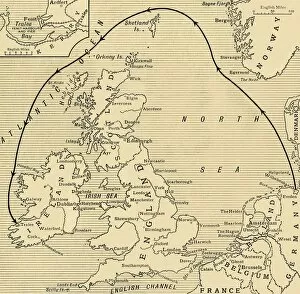
Map of Greater Britain in Relation to the Homeland, 1916. Creator: UnknownMap of Greater Britain in Relation to the Homeland, 1916. From " The War Illustrated Album De Luxe - Volume IV. The Summer Campaign - 1915", edited by J. A. Hammerton
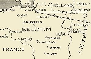
The Route of the Airmen Who Raided Dusseldorf and Cologne, 1915. Creator: UnknownThe Route of the Airmen Who Raided Dusseldorf and Cologne, 1915. On 22 September 1914 and 8 October, the British Royal Naval Air Service bombed Zeppelin bases in Cologne and Dusseldorf
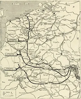
The Steady Progress of the Allies Advance, 1915. Creator: UnknownThe Steady Progress of the Allies Advance, 1915. From " The War Illustrated Album De Luxe - Volume I. The First Phase", edited by J. A. Hammerton
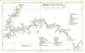
Route between Karaman and Kiz Kale, c1915. Creator: Stanfords Geographical EstablishmentRoute between Karaman and Kiz Kale, c1915. (Note Boyalar is about 8 miles S. of Karaman). Map showing the journey of British writer
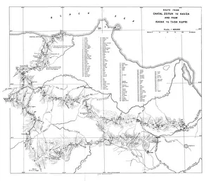
Route from Chatal Zeitun to Kavza and from Kavak to Tash Kupri, c1915. Creator: UnknownRoute from Chatal Zeitun to Kavza and from Kavak to Tash Kupri, c1915. Map showing the journeys of British writer, soldier and diplomatic advisor Mark Sykes in northern Turkey