mail_outline sales@mediastorehouse.com
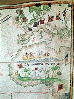
Map by Bastian Lopez showing Europe, the British Isles and part of Africa, Portuguese, 1558. Artist: Bastiaim LopezMap by Bastian Lopez showing Europe, the British Isles and part of Africa, Portuguese, 1558. From the British Museum
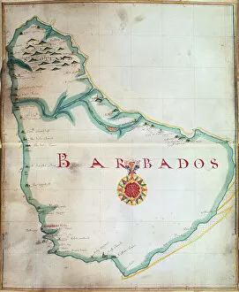
Map of Barbados, 1683. Barbados was first settled by the British in 1627. From the British Museum
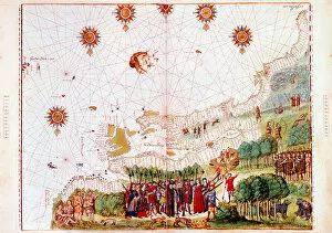
Map of the east coast of North America, early 16th century. Map of pre-1547 based on Jacques Cartiers discoveries of 1534-1541
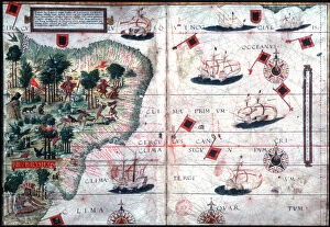
Map of Brazil by Portuguese navigators Pedro Reinel and Lopo Homen, c1525. Artist: Pedro ReinelMap of Brazil by Portuguese navigators Pedro Reinel and Lopo Homen, c1525
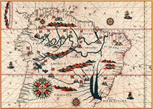
Part of South America, 1582. A Spanish map, showing the Amazon and the River Plate
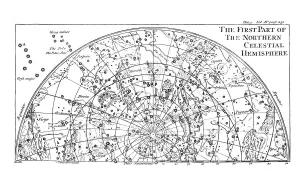
First part of the star chart of the Northern Celestial Hemisphere showing constellations, 1747
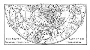
Second part of the star chart of the Southern Celestial Hemisphere showing constellations, 1747
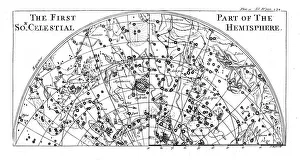
First part of the star chart of the Southern Celestial Hemisphere showing constellations, 1747
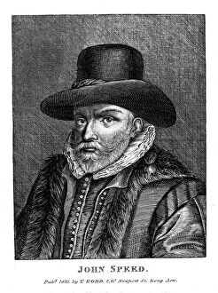
John Speed (1542-1629), English cartographer and historian, 1816. Speed is probably the most famous of British mapmakers. In 1612 he published The Theatre of the Empire of Great Britain
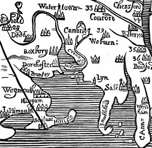
Early map of Massachusetts Bay, USA. Massachusetts was first settled by the Pilgrim Fathers, the Puritans who escaped religious persecution in England and sailed to America from Plymouth, England