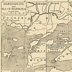
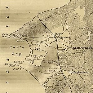
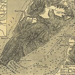
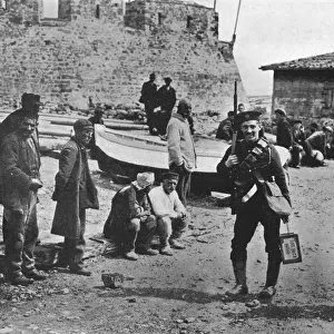
Map of the Dardanelles, First World War, 1915, (c1920). Creator: Unknown
. Creator: Unknown")
![]()
Wall Art and Photo Gifts from Heritage Images
Map of the Dardanelles, First World War, 1915, (c1920). Creator: Unknown
Map of the Dardanelles, First World War, 1915, (c1920). Bird s-eye View of the Dardanelles from the Entrance to the Straits to the Narrows. From " The Great World War - A History" Volume III, edited by Frank A Mumby. [The Gresham Publishing Company Ltd, London, c1920]
Media ID 19175361
© The Print Collector/Heritage Images
Aerial View Dardanelles Dardanelles Campaign Frank Arthur Frank Arthur Mumby George Philip And Son George Philip And Son Ltd Gresham Publishing Co Ltd Gresham Publishing Company Hellespont Keystone Archives London Geographical Institute Mumby Mumby Frank Arthur Philip Strait The Great World War A History Theatre Of War Turkey
MADE IN THE UK
Safe Shipping with 30 Day Money Back Guarantee
FREE PERSONALISATION*
We are proud to offer a range of customisation features including Personalised Captions, Color Filters and Picture Zoom Tools
SECURE PAYMENTS
We happily accept a wide range of payment options so you can pay for the things you need in the way that is most convenient for you
* Options may vary by product and licensing agreement. Zoomed Pictures can be adjusted in the Basket.