mail_outline sales@mediastorehouse.com
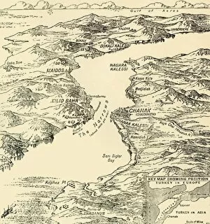
Map of the Dardanelles, First World War, 1915, (c1920). Creator: UnknownMap of the Dardanelles, First World War, 1915, (c1920). Bird s-eye View of the Dardanelles from the Entrance to the Straits to the Narrows
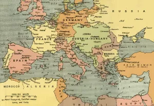
Central Europe and the Mediterranean, 1919. Creator: London Geographical InstituteCentral Europe and the Mediterranean, 1919. Showing naval dockyards, fortified coastal towns, and forts. From " The History of the Great European War: its causes and effects", Vol
Map of Central Europe, Showing the Principal Theatre of War, 1919. Europe during the First World War, 1914-1919. From " The History of the Great European War: its causes and effects", Vol
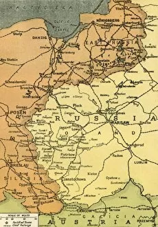
The Eastern Frontier, 1919. Creator: London Geographical InstituteThe Eastern Frontier, 1919. Map showing parts of Germany, Prussia, Russia and Austria during the First World War, 1914-1919, with fortified towns and main railway lines indicated
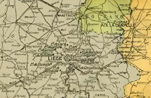
Map Showing the Forts of Liege, 1919. Creator: London Geographical InstituteMap Showing the Forts of Liege, 1919. Forts in Belgium during the First World War, 1914-1919. From " The History of the Great European War: its causes and effects", Vol. II, by W
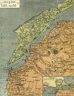
The Dardanelles with its Forts, 1919. Creator: London Geographical InstituteThe Dardanelles with its Forts, 1919. Map of the Turkish coast showing the Gallipoli peninsula which saw heavy fighting during the First World War, 1914-1919, with many casualties on both sides
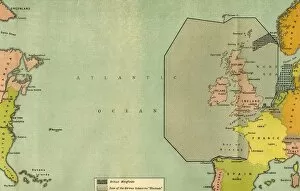
Map To Illustrate the German Submarine Blockade and the British Minefields... 1919Map To Illustrate the German Submarine Blockade and the British Minefields as a Measure of Protection, 1919. Map of the Atlantic Ocean during the First World War, 1914-1919
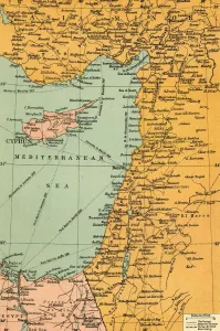
Map To Illustrate The Campaign in Palestine, 1919. Creator: London Geographical InstituteMap To Illustrate The Campaign in Palestine, 1919. Map of the Eastern Mediterrean and the Middle East, showing Cyprus, Port Said in Egypt, parts of Turkey and what are now Syria, the Lebanon
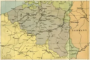
A General Map of Belgium, Indicating the Fortified Towns, 1919. Map of territory in which fighting took place during the First World War, also showing principal railways