mail_outline sales@mediastorehouse.com
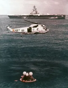
Astronauts being recovered from the sea, Apollo 16 mission, 27 April 1972. Creator: NASAAstronauts being recovered from the sea, Apollo 16 mission, 27 April 1972. Prime recovery helicopter hovering over the Apollo 16 spacecraft after splashdown, 11 days after launch
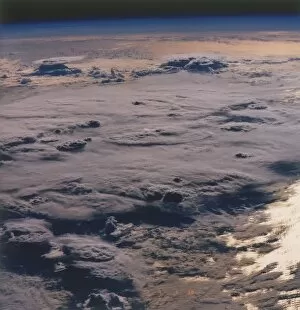
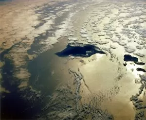
Earth from space - thunderstorm over the Pacific Ocean, c1980s. Creator: NASAEarth from space - thunderstorm over the Pacific Ocean, c1980s. Thick cloud cover
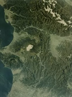
Earth from space - Mount Fujiyama volcano, Japan, second Space Shuttle flight, 1981. Mount Fuji and the Pacific coast, seen from the Space Shuttle
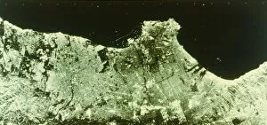
Earth from space - radar image of Los Angeles, USA, second Space Shuttle flight, 1981. The urban area of Los Angeles, California, with the coast of the Pacific Ocean
Earth from space - the Hawaiian Islands, USA, c1980s. Creator: NASAEarth from space - the Hawaiian Islands, USA, c1980s. Cloud cover over Hawaii in the Pacific Ocean
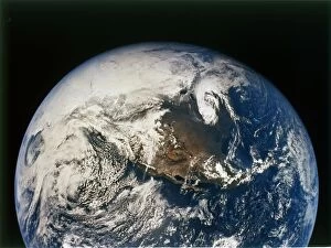
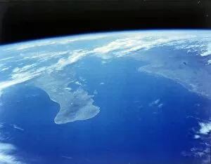
North and Central America from Apollo 16, 16 April 1972. Creator: NASANorth and Central America from Apollo 16, 16 April 1972. Earth from the Apollo 16 spacecraft, showing North America and the Pacific Ocean
Earth from space - Mexico, c1980s. Creator: NASAEarth from space - Mexico, c1980s. Cloud cover over the Pacific Ocean, Gulf of California and Baja California (left), with the Gulf of Mexico on the right
Baja California and the Sea of Cortes, seen from aboard the first Space Shuttle flight, April 1981. The Baja California Peninsula, a state in western Mexico, which protrudes into the Pacific Ocean
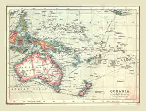
Map of Oceania, 1902. Creator: UnknownMap of Oceania, 1902. Showing Australia and New Zealand, and the East Indies Archipelago. From The Century Atlas of the World. [John Walker & Co, Ltd. London, 1902]
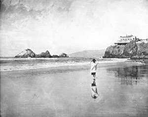
Cliff House and Seal Rocks, San Francisco, California, USA, c1900. Creator: UnknownCliff House and Seal Rocks, San Francisco, California, USA, c1900. View of the beach and Cliff House restaurant, built in 1858. From Scenic Marvels of the New World edited by Prof. Geo.R. Cromwell
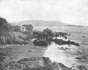
Carmel Bay, California, USA, c1900. Creator: UnknownCarmel Bay, California, USA, c1900. Bay on the Pacific Ocean. From Scenic Marvels of the New World edited by Prof. Geo.R. Cromwell. [C.N.Greig & Co. c1900]
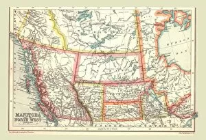
Map of Manitoba and the North West, 1902. Creator: UnknownMap of Manitoba and the North West, 1902. Showing the Pacific coast. From The Century Atlas of the World. [John Walker & Co, Ltd. London, 1902]
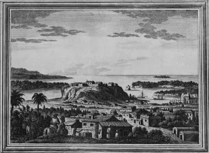
A View of the Haven of Acapulco, c1768. The port of Acapulco, on the Pacific coast of Mexico, became an important trading post after the Spanish conquest of the Americas. From Drakes Voyages
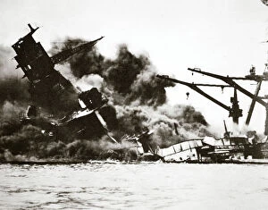
Battleship USS Arizona (BB-39) sinking during the attack on Pearl Harbour, 1941. The Japanese Navy launched a surprise attack on the US military facilities at Pearl Harbour on the morning of 7
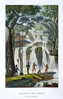
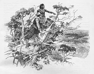
Waterfall of Port Praslin, New Ireland, 19th century. Scene from the circumnavigation of the world undertaken between 1822
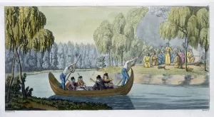
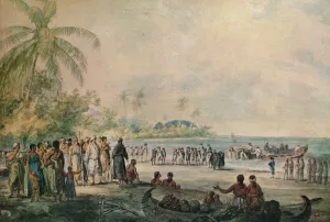
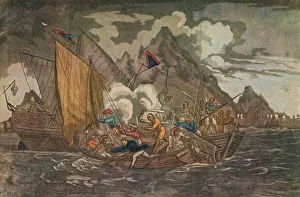
Deception of Captain Wallis by Queen Oberea Artist: G BramatiDeception of Captain Wallis by Queen Oberea, 1820-1839. Scene from Samuel Walliss voyage of circumnavigation in HMS Dolphin, undertaken from 1766-1768
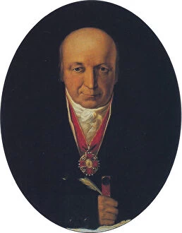
Portrait of Alexander Baranov, chief of the Russian-American Company, first governor of Russian Alaska, 1818. Found in the collection of the State Museum of Arctic and Antarctic, St Petersburg
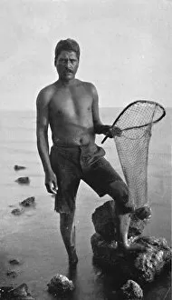
A native shrimper, Hawaii, with his net, 1902. From The Living Races of Mankind, Vol. I. [Hutchinson & Co, London, 1902]
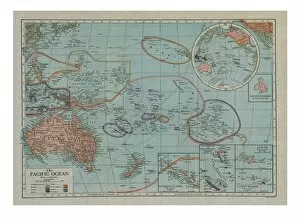
Map of the Pacific Ocean, c1910s. Artist: Emery Walker LtdMap of the Pacific Ocean, c1910s
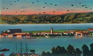
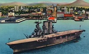
North Island. U. S. Naval Air Station. San Diego, California, c1941North Island. U.S. Naval Air Station. San Diego, California, c1941. From San Diego, California. [Herz, California]
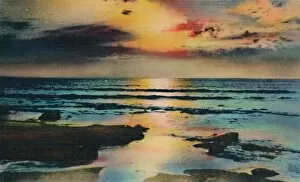
Sunset on the Pacific. La Jolla, California, c1941. From San Diego, California. [Herz, California]
U. S. Navy Plane Carrier at Anchor at Foot of Broadway. San Diego, California, c1941U.S. Navy Plane Carrier at Anchor at Foot of Broadway. San Diego, California, c1941. From San Diego, California. [Herz, California]
Map of South America, c1910. Artist: Gull Engraving CompanyMap of South America, c1910. [Encyclopaedia Britannica Co]
Map of Japan and Korea, c1910. Artist: Gull Engraving CompanyMap of Japan and Korea, c1910. [Encyclopaedia Britannica Co]
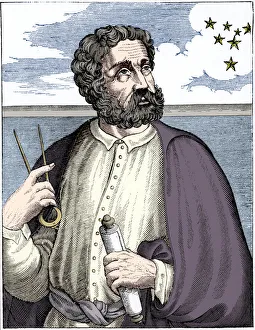
Ferdinand Magellan (c1480-c1521), Portugese navigator. The first explorer to circumnavigate the globe and cross the Pacific Ocean
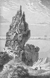
Peak and Barrier-Reef of Borabora, c1885, (1890). Artist: Robert Taylor PritchettPeak and Barrier-Reef of Borabora, c1885, (1890). From Journal of Researchers into the Natural History and Geology of the Countries Visited during the Voyage of H.M.S
Episode in Captain Cooks Voyages, late 18th century. Artist: John WebberEpisode in Captain Cooks Voyages, late 18th century. From Adventures By Sea From Art of Old Time, by Basil Lubbock. [The Studio Ltd. London, 1925]
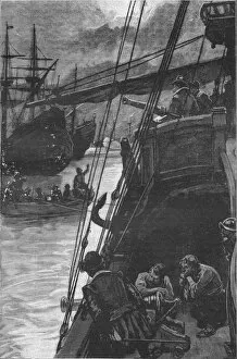
Ships Attacked by Pirates, c1808. Lieutenant Turner and the crew of a boat from the country-ship Tay attacked and made prisoners by the Ladrone pirates in 1806
A View of Botany Bay, 1789. Artist: Robert ClevelyA View of Botany Bay, 1789. The Supply and Sirius bringing in the first convict transports into Botany Bay, New South Wales, in 1787. From Adventures By Sea From Art of Old Time, by Basil Lubbock
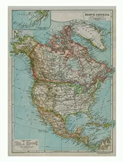
Map of North America, c1910. Artist: Gull Engraving CompanyMap of North America, c1910. [Encyclopaedia Britannica Co]
Sir Francis Drake - The First Englishman To See The Pacific, c1925. Artist: Arthur Percy DixonSir Francis Drake - The First Englishman To See The Pacific, c1925. Sir Francis Drake, (c1540-1596), English navigator and politician
Sir Francis Drakes first sight of the Pacific Ocean, 1578 (1908). From Harmsworth History of the World, Volume 2, by Arthur Mee, J.A. Hammerton, & A.D. Innes, M.A. [Carmelite House, London, 1908]
The first English ship in the Pacific: Sir Francis Drakes Golden Hind at Lima, 1579 (1908). From Harmsworth History of the World, Volume 2, by Arthur Mee, J.A. Hammerton, & A.D. Innes, M.A
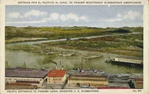
Pacific Entrance to Panama Canal Showing U. S. Submarines, c1920sPacific Entrance to Panama Canal Showing US Submarines, c1920s. The idea of building a canal between the Atlantic and Pacific Oceans was first planned by the French civil engineer
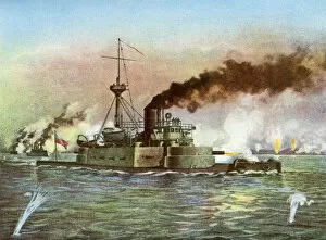
The Puritan at Matanzas, 1898. The US Navy monitor USS Puritan during the bombardment of the Cuban coastal city of Matanzas early in the Spanish-American War
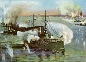
The Olympia at Manila, 1898. The US Navy protected cruiser USS Olympia at the Battle of Manila Bay in the Philippines during the Spanish-American War
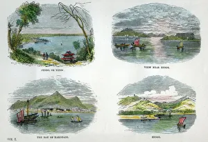
Views of the chief towns and ports of Japan, c1880. Jeddo, or Yeddo (Edo); view near Hiogo (Hyogo); the Bay of Hakodadi (Hakodate); Hiogo
Auckland, New Zealand, c1880
The volcanoes of Mauna Loa and Manua Kea, Hawaii, c1880
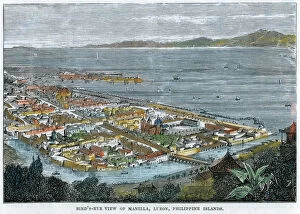
Birds eye view of Manilla, Luzon, Philippine Islands, c1880. The Philippines were a Spanish colony at the time
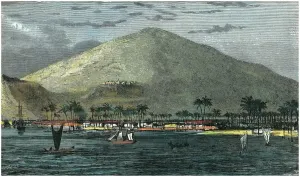
Lahaina, Maui, Hawaii, c1880
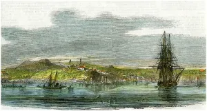
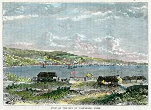
View of the Bay of Valparaiso, Chili, c1880
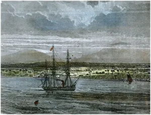
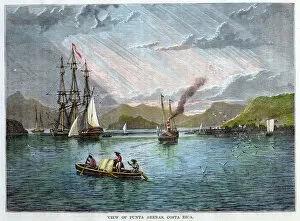
View of Punta Arenas, Costa Rica, c1880
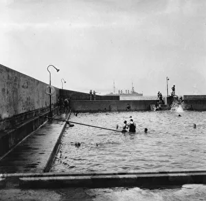
Swimming pool, Balboa, Panama, 1931. Balboa is at the Pacific entrance to the Panama Canal. A warship can be seen offshore in the distance
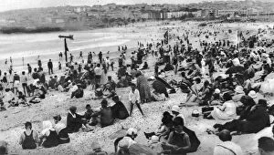
Bondi Beach, Sydney, New South Wales, Australia, c1924. A print from Countries of the World, edited by JA Hammerton, volume six, The Fleetway House, London, c1924
British aircraft carrier HMS Venerable, Sydney, Australia, c1946. Venerable about to leave Sydney en route to Suva, Fiji
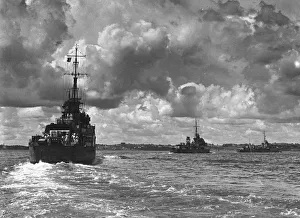
British warships entering Sydney harbour, Australia, 1945. Three destroyers escorting the battleship King George V
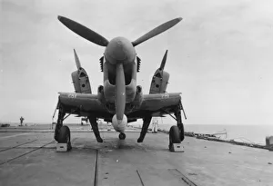
Fairey Firefly aircraft ready to be transported to the hangar lift, HMS Venerable, 1945. HMS Venerable was a Colossus -class aircraft carrier commissioned in 1944