mail_outline sales@mediastorehouse.com
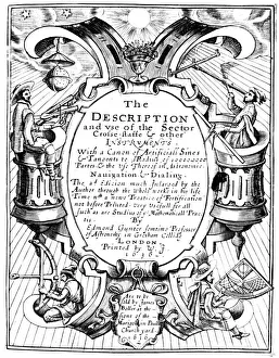
Title page of The Description and Use of the Sector by Edmund Gunter, 1636. It shows mariners holding various navigational instruments, including a sector and a cross-staff at the top
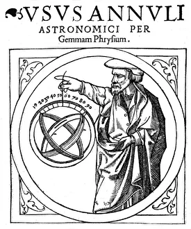
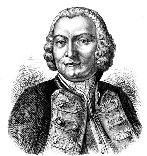
Reiner Gemma Frisius, Dutch astronomer, geographer, cartographer and mathematician, 1539. Gemma Frisius (1508-1555) holding an adjustable ring dial for determining the altitude of the Sun for
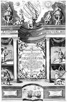
Title page of Samuel Sturmy, Mariners Magazine, London, 1669. Artist: Samuel SturmyTitle page of Samuel Sturmy Mariners Magazine, London, 1669. Sturmy (1633-1669) was a sea captain and sailed to the West Indies and Virginia
Christopher Columbus landing in America, c1760(?)-1770. Artist: Jean Robert AngoChristopher Columbus landing in America, c1760(?)-1770. Piece taken from the collection of paintings of the Baillif of Breteuil in 1770
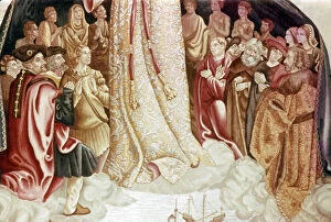
Detail from The Virgin of the Navigators, 16th century. Christopher Columbus (left) at the feet of the Virgin. From the Museo de America, Madrid
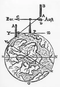
Use of the magnetic compass in map making, 1643. Diagram of the use of the compass by cartographers and surveyors. Bor (Borealis) is north and Aust (Australis) is south
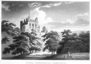
The Royal Greenwich Observatory, Flamsteed House, Greenwich Park, London, c1820. The observatory was built by Christopher Wren (1632-1723)
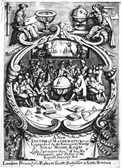
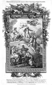
Frontispiece of A New System of Mathematicks by Jonas Moore, 1681. This book, intended for the mathematical school at Christs Hospital
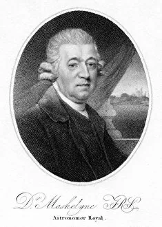
Nevil Maskelyne, English astronomer, 1804. Maskelyne (1732-1811) was Astronomer Royal from 1765-1811. He was made a Fellow of the Royal Society in 1758
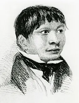
Jemmy Button, the Fuegian adopted by Fitzroys expedition, in 1834 (1839). During 1833 when Jemmy was living with the expedition, he was dressed in European clothes and his hair was cut short
Jemmy Button, the Fuegian adopted by the Fitzroy expedition, as he appeared in 1833 (1839). In 1834, after his return to his tribe, all trace of European influence disappeared
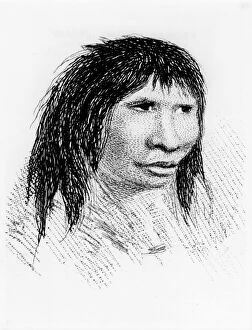
A Patagonian, c1831 (1839). From Narrative of the Surveying Voyages of His Majestys Ships Adventure and Beagle Vol.I, by William Parker King (London, 1839)
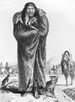
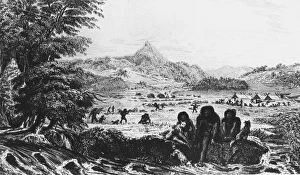
Patagonians at Gregory Bay, 1831 (1839). From Narrative of the Surveying Voyages of His Majestys Ships Adventure and Beagle Vol II, by Robert Fitzroy. (London, 1839)
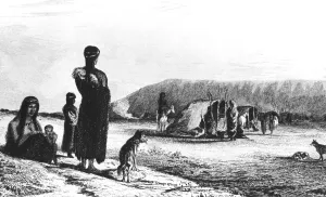
Fuegians at Woollya, with the Fitzroy expeditions camp in the background, 1831 (1839). From Robert Fitzroys Narrative of the Surveying Voyages of His Majestys Ships Adventure and Beagle, Vol. II
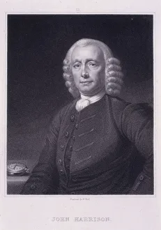
John Harrison, c1835. Artist: William HollJohn Harrison, c1835. Portrait of the English inventor and horologist wearing a wig. Harrison became famous for resolving one of the most problematic issues of his day - how to determine longitude
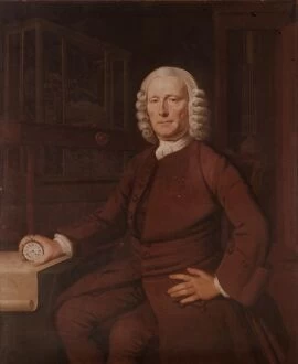
John Harrison (1693-1776). Inventor of the marine chronometer in 1757, (20th century). Artist: Thomas KingJohn Harrison, (1693-1776). Inventor of the marine chronometer in 1757, (20th century). A self-educated English carpenter and clockmaker who invented the marine chronometer
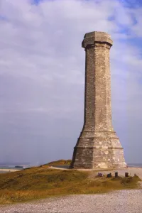
Hardy Monument, to Admiral Sir Thomas Hardy on Blackdown Hill, Dorset, 20th century. Artist: CM DixonHardy Monument, to Admiral Sir Thomas Hardy on Blackdown Hill, Dorset, 20th century. Erected in 1844 by public subscription to the memory of Vice Admiral Sir Thomas Hardy
George Anson, Baron Anson (1697-1762), English naval commander. Anson command a Royal Navy squadron of 6 ships sent to attack Spanish interests in South America at the outset of the War of Austrian
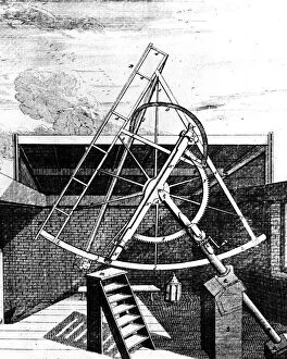
Flamsteeds equatorially mounted sextant fitted with telescope, 1725. Side view showing the gearing for aligning the sextant. Flamsteed (1646-1719) was the first Astronomer Royal
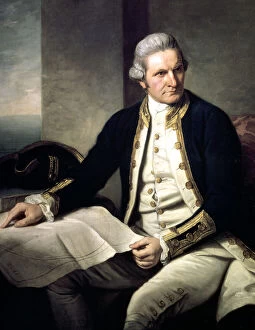
James Cook, English explorer, navigator and hydrographer, 1775-1776. Artist: Nathaniel Dance-HollandJames Cook, English explorer, navigator and hydrographer, 1775-1776. Captain Cook (1728-1779) in naval uniform, seated, with his hand resting on a map of the world
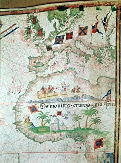
Miller Atlas, c1519. The Portuguese Miller Atlas was discovered in France in 19th century, although its origins are uncertain
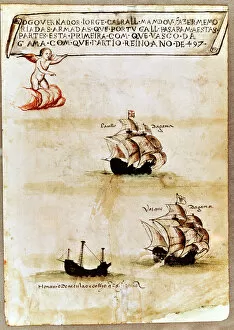
Vasco da Gamas fleet at sea, 1497. In 1497, Vasco da Gama (c1469-1525), Portuguese navigator, became the first westerner to round the Cape of Good Hope, the tip of South Africa
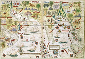
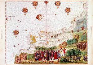
French Map of Central and South America, French, 1550. Map showing Florida, the Gulf of Mexico, the Caribbean islands and Antilles, and South America with the River Plate prominent
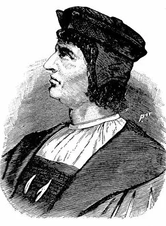
Henry the Navigator, Portuguese prince, founder of school of navigation, 15th centuryHenry the Navigator, Portuguese prince and founder of a school of navigation, 15th century. From his base at Sagres in the Algarve, Henry (1394-1460) sponsored voyages of discovery into the Atlantic
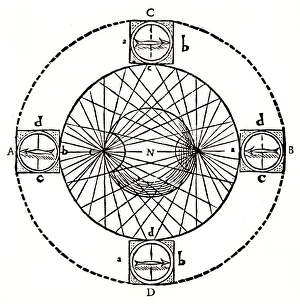
Behaviour of a magnetic compass, 1643. If a compass in a box is carried round a globe-shaped magnet (N, centre of picture) with magnetic poles where lines cross (left and right of N)
Map by Bastian Lopez showing Europe, the British Isles and part of Africa, Portuguese, 1558. Artist: Bastiaim LopezMap by Bastian Lopez showing Europe, the British Isles and part of Africa, Portuguese, 1558. From the British Museum
Greek manuscript of Ptolemys Geography. Artist: Claudius PtolemyGreek manuscript of Ptolemys Geography. Ptolemy (Claudius of Ptolemeus) (c90-168) was an Alexandrian astronomer and geographer
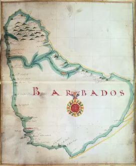
Map of Barbados, 1683. Barbados was first settled by the British in 1627. From the British Museum
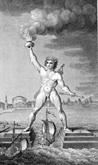
Colossus of Rhodes. The Colossus of Rhodes, one of the Seven Wonders of the Ancient World, was a lighthouse in the form of a giant statue of the god Helios
Map of the east coast of North America, early 16th century. Map of pre-1547 based on Jacques Cartiers discoveries of 1534-1541
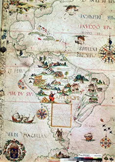
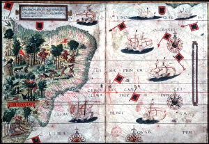
Map of Brazil by Portuguese navigators Pedro Reinel and Lopo Homen, c1525. Artist: Pedro ReinelMap of Brazil by Portuguese navigators Pedro Reinel and Lopo Homen, c1525
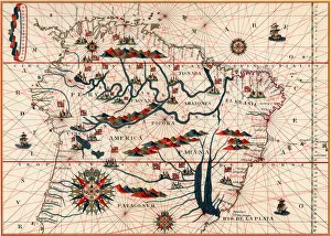
Part of South America, 1582. A Spanish map, showing the Amazon and the River Plate
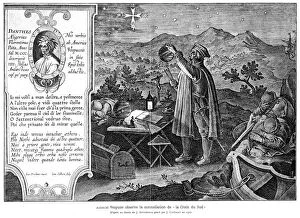
Amerigo Vespucci (1471-1512), Italian-born Spanish explorer. Vespucci observing the constellation of the Southern Cross. During his voyages
Neptune raising James Cook to immortality and fame, late 18th century. The name of Captain Cook (1728-1779), English navigator, explorer and hydrographer, is being written in the book of history
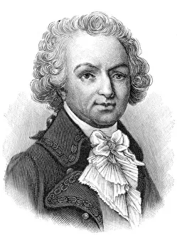
Louis Antoine de Bougainville, French soldier, navigator and mathematician, c1890. Bougainville (1729-1811) was elected a fellow of the Royal Society in 1756 while secretary to the French Embassy in
Bartholemew Diaz (c1455-1500), Portuguese navigator. 19th century wood engraving
English navigator Henry Hudson (1550-1611) on his last voyage. He was set adrift with son and 7 others by mutinous crew. Never seen again. Engraving after picture by John Collier
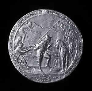
Medal showing Henry Hudson ascending the Hudson River to Albany in 1609Henry Hudson (c.1550-1611) English navigator, medal showing him ascending the Hudson River to Albany in 1609
Henry Hudson, English navigator, being set adrift by mutinous crew, c1880Henry Hudson (c.1550-1611), English navigator, being set adrift with son and 7 others by mutinous crew, c1880. He was never seen again. Wood engraving
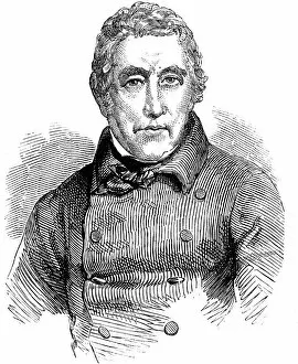
John Barrow (1764-1848), English traveller and naval administrator. Between 1804-1845 Barrow held the position of second secretary to the Admiralty
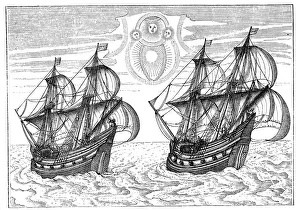
Ships of Willem Barents expedition to the Arctic, 1596. Barents (d 1597) was a Dutch navigator who led expeditions in 1594, 1595 and 1596-1597 in search of a Northeast Passage to Asia
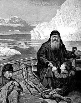
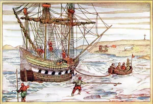
Willem Barents ship among the Arctic ice, 1594-1597. Barents (d 1597) was a Dutch navigator who led expeditions in 1594, 1595 and 1596-1597 in search of a Northeast Passage to Asia
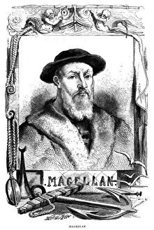
Ferdinand Magellan, 16th century Portugese navigator, 1868. Magellan (c1480-1521) led the first expedition to cirumnavigate the globe
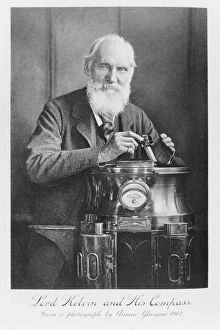
Lord Kelvin and his compass, 1902. Artist: James Craig AnnanLord Kelvin and his compass, 1902. Kelvin was born William Thomson and was educated at Glasgow and Cambridge. He was professor of Natural Philosophy (Physics)