mail_outline sales@mediastorehouse.com
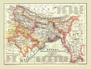
Map of Bengal, the North West and Central Provinces, and Assam, 1902. Creator: UnknownMap of Bengal, the North West and Central Provinces, and Assam, 1902. From The Century Atlas of the World. [John Walker & Co, Ltd. London, 1902]
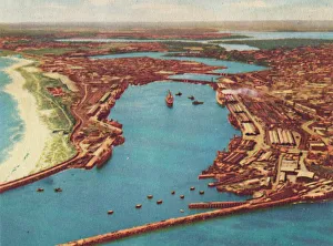
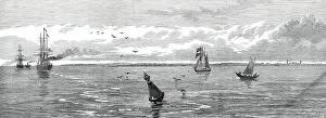
Fremantle Harbour from the Air, c1947. Creator: UnknownFremantle Harbour from the Air, c1947. From " Perth - City of Sunshine". [Australia House Bookshop, London, c1947]
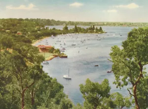
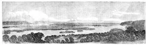
Mosman Bay, Keanes Point, Peppermint Grove, c1947. Creator: UnknownMosman Bay, Keanes Point, Peppermint Grove, c1947. From " Perth - City of Sunshine". [Australia House Bookshop, London, c1947]
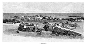
Fremantle, 1886. Artist: Julian AshtonFremantle, 1886. Fremantle, here depicted as a small settlement, is now a city located within the Perth metropolitan area on Australias western coast
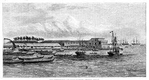
The Custom-House and inner harbour, Colombo, Ceylon, 1864. Creator: UnknownThe Custom-House and inner harbour, Colombo, Ceylon [now Sri Lanka], 1864. Engraving from a photograph by Messrs. Slinn and Co
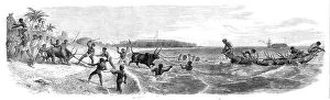
Embarking cattle at the port of Tamatave, Madagascar, 1864. Creator: Mason JacksonEmbarking cattle at the port of Tamatave, Madagascar, 1864. Engraving from a sketch by Lieutenant S. P. Oliver showing '...the mode of putting cattle on shipboard in a port of Madagascar
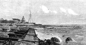
The lighthouse and flagstaff at Colombo, Ceylon, 1864. Creator: UnknownThe lighthouse and flagstaff at Colombo, Ceylon, 1864. Engraving from a photograph by Messrs. Slinn and Co. Coastal scene in what is now Sri Lanka
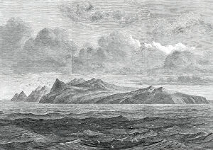
Barren Island, in the Bay of Bengal, 1858. Creator: UnknownBarren Island, in the Bay of Bengal, 1858. This island...north-east of the Andaman Islands...was visited by the Hon. East India Company's steam-frigate Semiramis...and the British ensign was
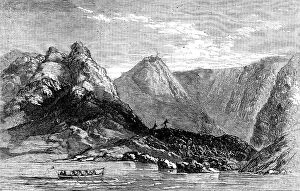
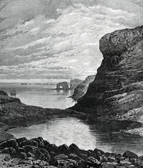
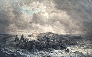
Sketches from H.M.S. Challenger, by Mr. J. J. Wild: Christmas Harbour, Kerguelen Island, 1876. Creator: UnknownSketches from H.M.S. Challenger, by Mr. J. J. Wild: Christmas Harbour, Kerguelen Island, 1876. The gigantic natural arch at its entrance
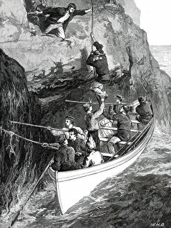
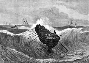
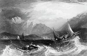
The Wreck of the Strathmore: taking the Survivors from the Island...1876. Creators: W. J. P. W. H. OThe Wreck of the Strathmore: taking the Survivors from the Island, from a sketch supplied by Mr. Spencer Joslen, 1876....the emigrant-ship Strathmore [was wrecked], in July last
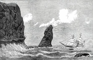
The Strathmore on the Crozet Islands, sketched by the carpenter of the ship, 1876. Creator: H. E. TozerThe Strathmore on the Crozet Islands, sketched by the carpenter of the ship, 1876. View of the wreck....the Strathmore, an iron clipper-ship, which sailed from Gravesend on April 19 last year
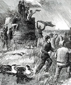
Wreck of the Strathmore on the Crozet Islands: Turf Tower erected by the Survivors...1876. Creator: W. H. OWreck of the Strathmore on the Crozet Islands: Turf Tower erected by the Survivors - making signals to a ship, from sketches supplied by Mr. Spencer Joslen, First-Class Passenger, 1876
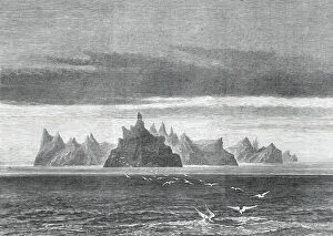
Hog Island (one of the Crozet Group), from sketches by Captain Ashby...1876. Creator: UnknownHog Island (one of the Crozet Group), from sketches by Captain [William] Ashby, late of the ship City of Auckland, 1876. These islands are remote from any other land
Possession Island...Southern Indian Ocean, where the Strathmore was wrecked...1876. Creator: UnknownPossession Island (one of the Crozet Group), Southern Indian Ocean, where the [New Zealand emigrant-ship] Strathmore was wrecked, 1876
Saugor Lighthouse, off the mouth of the Hooghly, 1876. Creator: UnknownSaugor Lighthouse, off the mouth of the Hooghly, [India], 1876. The island of Saugor, upon which stands the iron lighthouse to guide ships approaching Calcutta as they enter the Hooghly river
Illumination of the surf at Madras, 1876. Creator: UnknownIllumination of the surf at Madras, 1876. Water fireworks in India, consisting of...splendid flights of rockets from the pier and from the fleet, of coloured fires in boats and catamarans
Georgetown, Penang, near Perak, in the Malay Peninsula, 1876. Creator: E. HastieGeorgetown, Penang, near Perak, in the Malay Peninsula, 1876. The nearest British settlement to Perak is that of Pulo Penang, or Prince of Wales's Island
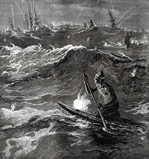
Surf-boat at Madras going out to a ship, 1876. Creator: J GreenawaySurf-boat at Madras going out to a ship, 1876. Engraving from a sketch by Captain H. G. Robley, of the 91st Highlanders, of...a "Masoolah, " or surf-boat
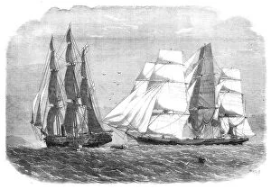
The slaver "Sunny South", alias "Emanuela" surrendering to H.M.S. "Brisk", bearing the flag of Rear-Admiral Sir H
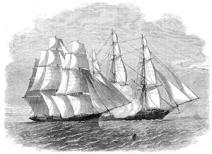
H.M.S. "Brisk", bearing the flag of Rear-Admiral Sir Henry Keppel, closing with "The Sunny... 1860H.M.S. "Brisk", bearing the flag of Rear-Admiral Sir Henry Keppel, closing with "The Sunny South" slaver, 1860....her Majesty's ship Brisk
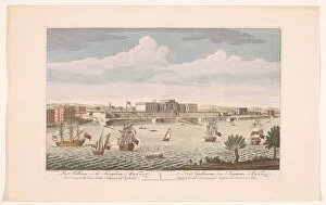
View of Fort William at Calcutta, 1754. Creator: AnonView of Fort William at Calcutta, 1754. Fort William in the Kingdom of Bengal. Belonging to the East India Company of England
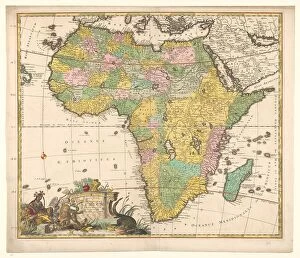
Map of Africa, c.1690. Creator: Carel AllardMap of Africa, c.1690. Novissima et perfectissima Africae descriptio'. Compass rose bottom left the cartouche with title and allegorical figures
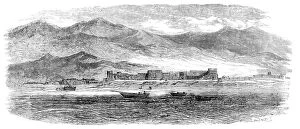
Bunder Deelum, in the Persian Gulf, 1857. Creator: UnknownBunder Deelum, in the Persian Gulf, 1857. The accompanying view of one of the numerous forts in the Persian Gulf has been sketched from the deck of the Hon
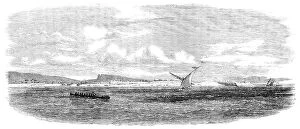
The Island of Karrak, in the Persian Gulf, 1857. Creator: UnknownThe Island of Karrak, in the Persian Gulf, 1857. Engraving after a sketch by Mr. A. Harrison, Master, Indian Navy...The Island of Karrak...is situated thirty miles W.N.W
View of the Coast of Natal, 1857. Creator: UnknownView of the Coast of Natal, 1857. Engraving from a sketch by Mr. James B. West. Natal has been described as a long strip of country in South Africa
The Bay of Natal, 1857. Creator: UnknownThe Bay of Natal, 1857. View in South Africa, from a sketch by Mr. James B. West. Natal has been described as a long strip of country in South Africa
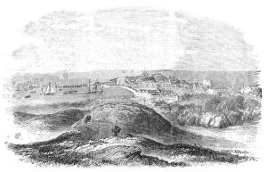
Fremantle in Western Australia: Rottnest Island, the Proposed New Convict Establishment... 1857. Creator: UnknownFremantle in Western Australia: Rottnest Island, the Proposed New Convict Establishment, in the distance, 1857. By reference to the report of the important measure introduced to the House of
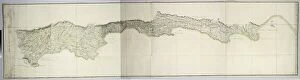
Map of the south coast of South Africa between Cape Agulhas and the Sundays River, after 1789-1790
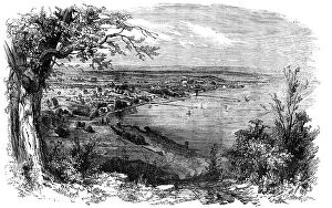
Perth, Western Australia, from Mount Eliza, 1856. Creator: UnknownPerth, Western Australia, from Mount Eliza, 1856. Europeans colonising the continent of Australia. View of Perth, ... the seat of government...[it might]...become a wine-growing country - the vine
La fin de L "Emden"; L "Emden", a la cote de l'ile Koeling Nord, du groupe des Cocos, 1914'La fin de L "Emden"; L "Emden", a la cote de l'ile Koeling Nord, du groupe des Cocos, le 29 novembre 1914: surpris a son tour par le navire australien "Sydney"
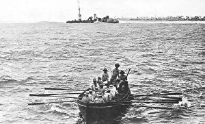
La fin de L "Emden"; Les blesses de "Emden" sont embarques a bord du "Sydney", 1914'La fin de L "Emden"; Les blesses de "Emden" sont embarques a bord du "Sydney", qui fit prisonnier le reste de l'equipage, 1914
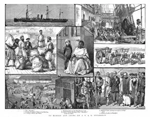
To Bombay and China on a P&O Steamship, 1886. Creator: Unknown. To Bombay and China on a P&O Steamship, 1886To Bombay and China on a P&O Steamship, 1886. From "The Graphic. An Illustrated Weekly Newspaper Volume 33. January to June, 1886"
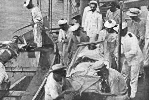
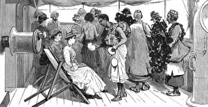
From Brindisi to Burma - Traders on board the P&O SS"Clyde" at Aden, 1886. Creator: UnknownFrom Brindisi to Burma - Traders on board the P&O SS"Clyde" at Aden, 1886. From "The Graphic. An Illustrated Weekly Newspaper Volume 33. January to June, 1886"
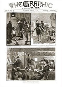
The Graphic, Front Cover March 6th.1886, 1886. Creator: UnknownThe Graphic, Front Cover March 6th. 1886, 1886. From Brindisi to Burma. From "The Graphic. An Illustrated Weekly Newspaper Volume 33. January to June, 1886"
Bombay Harbour: - Fishing boats, in the Monsoon, 1845. Creator: UnknownBombay Harbour: - Fishing boats, in the Monsoon, 1845. Sailing boat and raft off the coast of what is now Mumbai, India. From "Hindostan, The Shores of the Red Sea, and The Himalaya Mountains
The island of St. Paul in the Indian Ocean, undated. (c1850s) Creator: Joseph SellenyThe island of St. Paul in the Indian Ocean, undated. (c1850s)
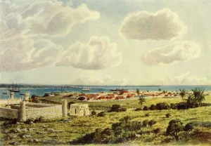
Delagoa Bay, 1902. Creator: Donald McCrackenDelagoa Bay, 1902. Maputo Bay formerly Delagoa Bay, an inlet of the Indian Ocean on the coast of Mozambique, a strategic position, in terms of trade, transport and labour links
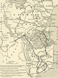
Map illustrating the Closing Phases of the East African Campaign, 1917-18, (c1920). European powers in Africa during the First World War
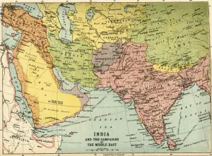
India and the Campaigns of the Middle East, First World War, 1914-1918, (c1920). Map showing British India coloured pink as part of the British Empire, Afghanistan, Persia, Asia Minor, Arabia
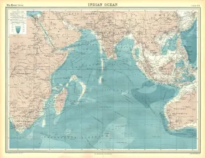
Map of the Indian Ocean. Map showing the Indian subcontinent, East Africa, the Arabian peninsula, Indo-China and Western Australia. Plate 54 from The Times Atlas
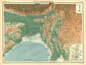
Geographical map of the north-eastern section of India, early 20th century. Pre-partition map showing the Bay of Bengal and the Ganges Delta, and what are now Bangladesh and Myanmar
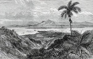
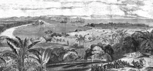
Harbour of the Point de Galle; Four Months in Ceylon, 1875. Creator: UnknownHarbour of the Point de Galle; Four Months in Ceylon, 1875. [Port city in the south of what is now Sri Lanka]. From, Illustrated Travels by H.W. Bates
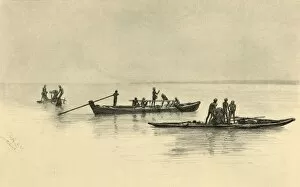
Fishing boats, Ceylon, 1898. Creator: Christian Wilhelm AllersFishing boats, Ceylon, 1898. Fishermen on the Indian Ocean off the coast of what is now Sri Lanka. From " Rund um die Erde" [Round the Earth], written and illustrated by C. W. Allers
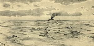
Steamship on the Indian Ocean, 1898. Creator: Christian Wilhelm AllersSteamship on the Indian Ocean, 1898. Im Indischen Ozean. From " Rund um die Erde" [Round the Earth], written and illustrated by C. W. Allers
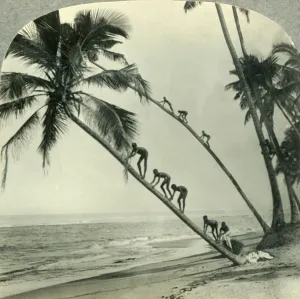
Natives Climbing Palm Trees Overhanging an Orient Sea, Island of Ceylon, c1930s. Sri Lanka on the Indian Ocean was known from the beginning of British colonial rule as Ceylon
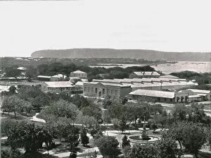
View from the Town Hall, Durban, South Africa, 1895. Creator: William Laws CaneyView from the Town Hall, Durban, South Africa, 1895. The town with Durban Harbour beyond. The city lies at the mouth of the Umgeni River which opens into the Indian Ocean
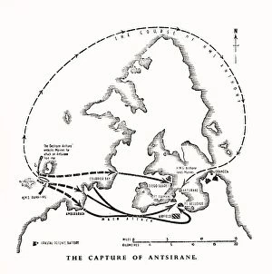
The capture of Antsiranana, Madagascar, by the Royal Marines, World War II, 1942 (1944). From " The Royal Marines - The Admiralty Account of Their Achievement 1939-43"
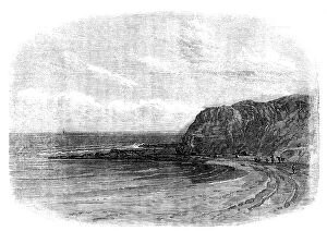
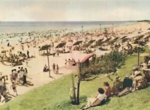
Scarborough, c1947. Creator: UnknownScarborough, c1947. From " Perth - City of Sunshine". [Australia House Bookshop, London, c1947]