mail_outline sales@mediastorehouse.com
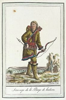
Costumes de Différents Pays, Sauvage de la Baye de Hudson, c1797. Creator: Jacques Grasset de Saint-SauveurCostumes de Differents Pays, Sauvage de la Baye de Hudson, c1797
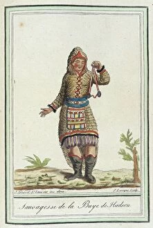
Costumes de Différents Pays, Sauvagesse de la Baye de Hudson, c1797. Creator: Jacques Grasset de Saint-SauveurCostumes de Differents Pays, Sauvagesse de la Baye de Hudson, c1797
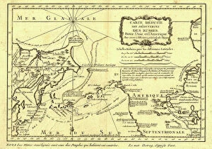
Carte re´duite des de´couvertes des Russes, entre l'Asie et l'Amerique, (1747?). This French map of Alaska, Siberia, and the North Pacific, published in 1747
Map of North America, showing the... positions of Texas and Oregon with the United StatesMap of North America, showing the relative positions of Texas and Oregon with the United States, 1845. It may...be requisite to subjoin here a few leading details of the Oregon Territory
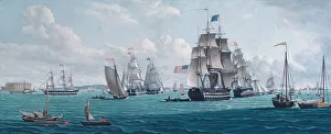
The U. S. Ship Franklin, with a View of the Bay of New York, 1820s or 1830s. CreatorThe U. S. Ship Franklin, with a View of the Bay of New York, 1820s or 1830s
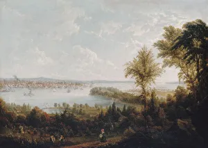
View of the Bay and City of New York from Weehawken, 1840. Creator: Robert HavellView of the Bay and City of New York from Weehawken, 1840
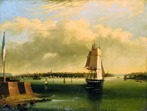
Bay and Harbor of New York from Bedlows Island, 1850-60. Creator: Edmund CoatesBay and Harbor of New York from Bedlows Island, 1850-60
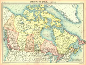
Political map of the Dominion of Canada. Canada was known as the Dominion of Canada from 1867 until after the Second World War. Plate 82 from The Times Atlas