mail_outline sales@mediastorehouse.com
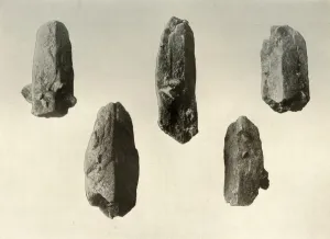
Feldspar Crystals from Summit of Mount Erebus (Natural Size), 1909. Specimens of crystallised magma from the volcano Erebus
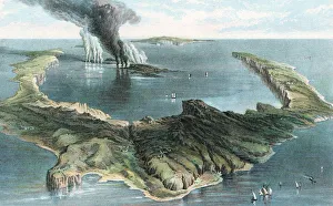
Volcano on the island of Thera (Santorini) in eruption, 1866. The horseshoe shape of the island was created during a cataclysmic eruption c1500 BC
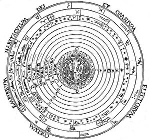
Diagram showing Geocentric system of universe, 1539. Artist: Petrus ApianusDiagram showing Geocentric system of universe, 1539. Geocentric (earth-centred) system of universe showing Aristotles 4 elements surrounded by sphere of fixed stars, spheres of planets
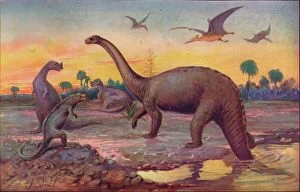
In the Saurian Age, when the Worlds inhabitants were gigantic peptiles, 1907. From Harmsworth History of the World, Volume 1, by Arthur Mee, J.A. Hammerton, & A.D. Innes, M.A
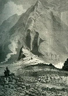
The Giants Causeway, c1870. Interlocking volcanic basalt columns at UNESCO World Heritage Site - the Giants Causeway, in County Antrim on the north coast of Northern Ireland
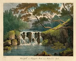
Waterfall on Clapgate Beck, near Richmond, York, late 18th-early 19th century. CreatorWaterfall on Clapgate Beck, near Richmond, York, late 18th-early 19th century. River view in North Yorkshire
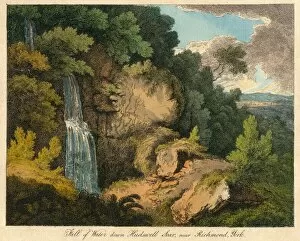
Fall of Water down Hudswell Scar, near Richmond, York, 19th century? Creator: UnknownFall of Water down Hudswell Scar, near Richmond, York, 19th century? Waterfall in the Yorkshire Dales
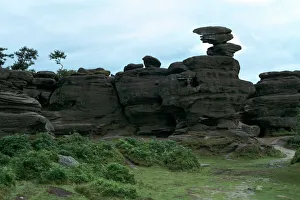
Rocking-Stone at Brimham Rocks near Pately Bridge in Yorkshire. This shows wind erosion of horizontally-bedded sedimentary rock
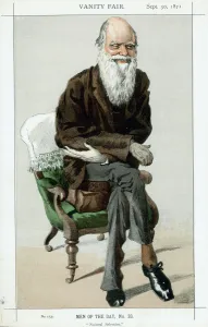
Charles Darwin, English naturalist, 1871. Darwin (1809-1882) was employed as naturalist on HMS Beagle from 1831-1836. He first made his name as a geologist
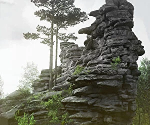
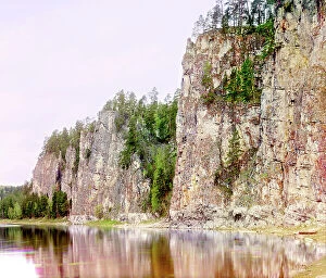
Chertovo Gorodishche [rock formation], 1910. Creator: Sergey Mikhaylovich Prokudin-GorskyChertovo Gorodishche [rock formation], 1910.
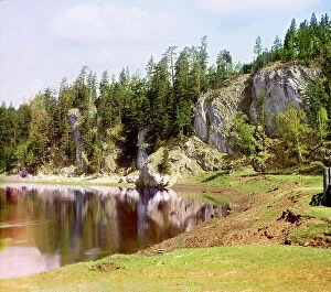
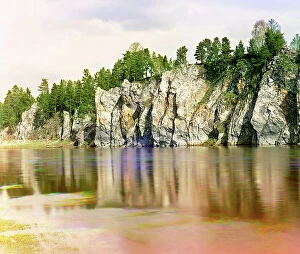
Vysokiy Rock below the village of Treki, Chusovaya River, 1912. Creator: Sergey Mikhaylovich Prokudin-GorskyVysokiy Rock below the village of Treki, Chusovaya River, 1912.
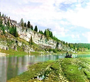
Slizkoi Rock, Chusovaya River, 1912. Creator: Sergey Mikhaylovich Prokudin-GorskySlizkoi Rock, Chusovaya River, 1912.
Oleniy Rock, Chusovaya River, 1912. Creator: Sergey Mikhaylovich Prokudin-GorskyOleniy Rock, Chusovaya River, 1912.
Nova Scotian Goldfields: horizontal formation of auriferous quartz at Laidlaw's Farm, 1862. Creator: UnknownNova Scotian Goldfields: horizontal formation of auriferous quartz at Laidlaw's Farm, [Canada], 1862. Engraving of a photograph by Captain W. D. Tompson, of the 17th Regiment
Shaitan Rock; general view from the village of Novaia Derevnia, Chusovaya River, 1912.
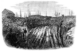
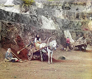
Work at the Bakalskii mine, 1910. Creator: Sergey Mikhaylovich Prokudin-GorskyWork at the Bakalskii mine, 1910. A family, with shovels and horse-drawn carts, working at the iron mines in the Bakaly hills
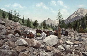
Path Along a Rock Field in the Valley of the Kuragan River, a Tributary of the Katun..., 1911-1913Path Along a Rock Field in the Valley of the Kuragan River, a Tributary of the Katun River; in the Vicinity of Belukha Mountain, 1911-1913
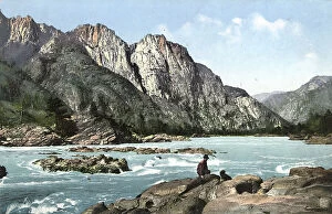
Rapid on the Katun River Above the Village of Chemal, 1911-1913. Creator: Sergei Ivanovich BorisovRapid on the Katun River Above the Village of Chemal, 1911-1913. From a collection of color postcards of the Altay, or Altai, Mountains region of southern Siberia early in the 20th century
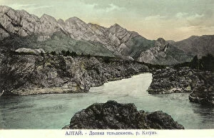
Valley of the Katun River near the Village of Chemal, Teldekpen Rapid (Edigan Rapid), 1911-1913. From a collection of color postcards of the Altay, or Altai
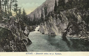
Valley of the Kumir River, a Tributary of the Charysh River; cliffs by the name..., 1911-1913Valley of the Kumir River, a Tributary of the Charysh River; cliffs by the name "Maiden Reach"., 1911-1913. From a collection of color postcards of the Altay, or Altai
Valley of the Kumir River, a Tributary of the Charysh River; cliffs by the mame..., 1911-1913Valley of the Kumir River, a Tributary of the Charysh River; cliffs by the mame "Maiden Reach", 1911-1913. From a collection of color postcards of the Altay, or Altai
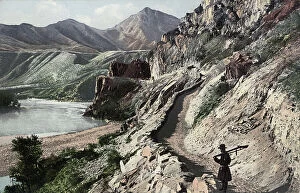
Chuyskiy Tract, on the Slopes of Kyngrar Cliff above the Confluence of the Yaloman... 1911-1913Chuyskiy Tract, on the Slopes of Kyngrar Cliff above the Confluence of the Yaloman River into the Katun River, 1911-1913. From a collection of color postcards of the Altay, or Altai
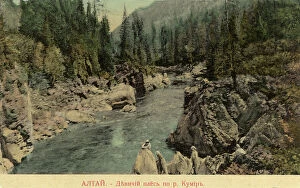
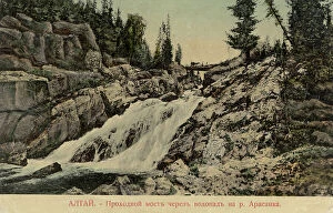
Bridge Across a Waterfall on the Arasan River, 1911-1913. Creator: Sergei Ivanovich BorisovBridge Across a Waterfall on the Arasan River, 1911-1913. From a collection of color postcards of the Altay, or Altai, Mountains region of southern Siberia early in the 20th century
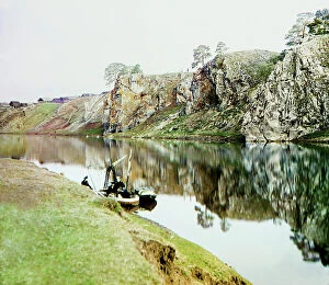
Upper Georgievskii Rock and a general view of the settlement of Utka, Chusovaya River, 1912. Several people with a small fishing boat.
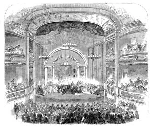
The British Association at Bath: Sir Charles Lyell delivering the presidential address..., 1864. Creator: UnknownThe British Association at Bath: Sir Charles Lyell delivering the presidential address in the theatre, 1864. 'The New Theatre Royal...was erected...upon the site of the former theatre
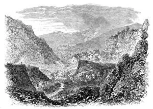
The British Association at Bath: the village and quarries at Holwell, near Bath, 1864. Creator: UnknownThe British Association at Bath: the village and quarries at Holwell, near Bath, 1864. 'Two hundred persons, on Saturday, accompanied Mr. C
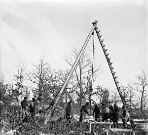
Mikhail Alekseevich Pavlov by the Chute of an Exploratory Mine, 1920-1929. Creator: UnknownMikhail Alekseevich Pavlov by the Chute of an Exploratory Mine, 1920-1929. From the family archive of prominent geologist Mikhail Alekseevich Pavlov (1884-1938)
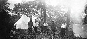
Mikhail Alekseevich Pavlov with Members of an Expedition at Base Camp, 1920-1929. Creator: UnknownMikhail Alekseevich Pavlov with Members of an Expedition at Base Camp, 1920-1929. From the family archive of prominent geologist Mikhail Alekseevich Pavlov (1884-1938)
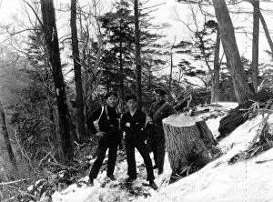
Members of an Expedition in Suchan, 1920-1929. Creator: Mikhail Alekseevich PavlovMembers of an Expedition in Suchan, 1920-1929. From a collection consisting of an album and individual photographs from the family archive of geologist Mikhail Alekseevich Pavlov (1884-1938)
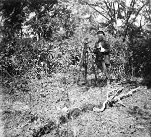
Members of an Expedition at Base Camp, 1920-1929. Creator: Mikhail Alekseevich PavlovMembers of an Expedition at Base Camp, 1920-1929. From a collection consisting of an album and individual photographs from the family archive of geologist Mikhail Alekseevich Pavlov (1884-1938)
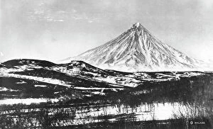
Klyuchevskoy volcano, 1922-1923. Creator: Rene MalaiseKlyuchevskoy volcano, 1922-1923. From an album of 296 works which offer a glimpse of life in the Russian Far Northeast in the first third of the twentieth century
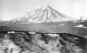
Koryaksky volcano, 1922-1923. Creator: Rene MalaiseKoryaksky volcano, 1922-1923. From an album of 296 works which offer a glimpse of life in the Russian Far Northeast in the first third of the twentieth century
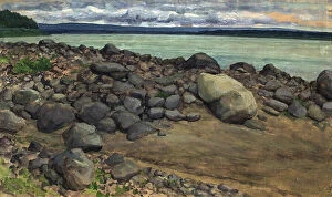
Stones on the bank of the Yenisei, Hag, 1921. Creator: Dmitrii Innokent'evich KaratanovStones on the bank of the Yenisei, Hag, 1921. V. I. Surikov Museum of Art in Krasnoiarsk
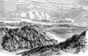
Filey, Yorkshire - from the South Cliff, 1858. Creator: UnknownFiley, Yorkshire - from the South Cliff, 1858. This town is situated...at the head of a bay, upon cliffs more than a hundred feet above the level of the ocean; its clayey encampment forming a curious
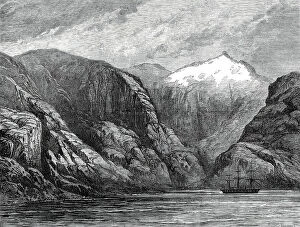
Sketches from H.M.S. Challenger, by Mr. J. J. Wild: the Challenger at Desolation Island...1876. Creator: UnknownSketches from H.M.S. Challenger, by Mr. J. J. Wild: the Challenger at Desolation Island, Magellan Strait, 1876. [Captain] Cook - probably not aware of the previous discovery of the island by
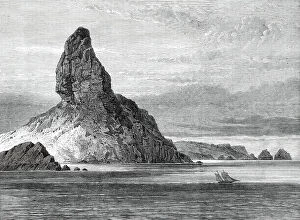
Sketches from H.M.S. Challenger, by Mr. J. J. Wild: Peak of Fernando Noronha, 1876. Creator: UnknownSketches from H.M.S. Challenger, by Mr. J. J. Wild: Peak of Fernando Noronha, 1876. The island of Fernando Noronha, in the Atlantic, three or four degrees south of the Equator
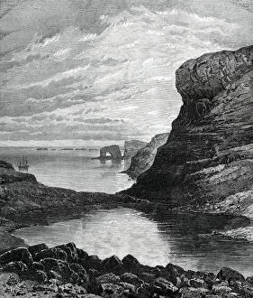
Sketches from H.M.S. Challenger, by Mr. J. J. Wild: Christmas Harbour, Kerguelen Island, 1876. Creator: UnknownSketches from H.M.S. Challenger, by Mr. J. J. Wild: Christmas Harbour, Kerguelen Island, 1876. The gigantic natural arch at its entrance
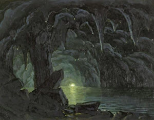
Grotto with Two Boats, 1987. Creator: Minol ArakiGrotto with Two Boats, 1987
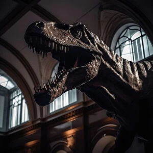
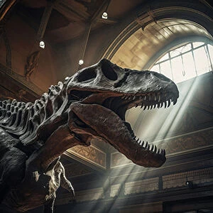
AI IMAGE - Tyrannosaurus rex in a museum, 2023. Creator: Heritage ImagesAI IMAGE - Tyrannosaurus rex in a museum, 2023
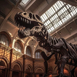
AI IMAGE - Fossilised remains of a Tyrannosaurus rex in a museum, 2023. Creator: Heritage ImagesAI IMAGE - Fossilised remains of a Tyrannosaurus rex in a museum, 2023
The Blue Grotto, Capri, 1857-1860. Creator: Albert BierstadtThe Blue Grotto, Capri, 1857-1860
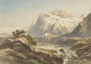
Mountain landscape, 1869. Creator: Willem Jan van den BergheMountain landscape, 1869
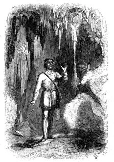
"The Oreseeker; a Tale of the Hartz", 1860. Creator: Pearson. "The Oreseeker; a Tale of the Hartz""The Oreseeker; a Tale of the Hartz", 1860. Illustration from a "gift-book" by A. S. M. [Macmillan and Co.] The pictorial illustrations...are executed by L.C.H...in
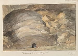
Exterior of cave Santa Maria Capella, 1778. Creator: Louis DucrosExterior of cave Santa Maria Capella, 1778