mail_outline sales@mediastorehouse.com
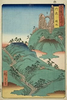
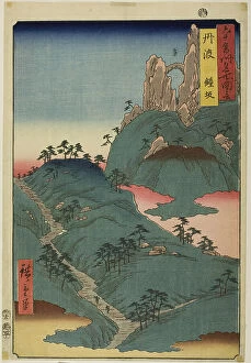
Tanba Province: Kane Slope (Tanba, Kanesaka), from the series "Famous Places in the... 1853Tanba Province: Kane Slope (Tanba, Kanesaka), from the series "Famous Places in the Sixty-odd Provinces (Rokujuyoshu meisho zue)", 1853
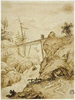
Man Crossing Log Bridge over Torrent, n.d. Creator: Jan van EyckMan Crossing Log Bridge over Torrent, n.d
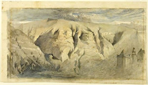
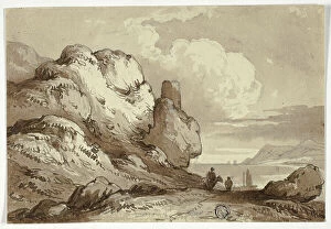
Mont Saleve, c.1840. Creator: John RuskinMont Saleve, c.1840
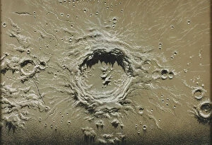
Copernicus, 1867. Creator: James NasmythCopernicus, 1867
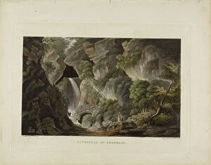
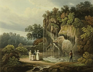
Waterfall at Shanklin, c. 1794. Creator: Piercy RobertsWaterfall at Shanklin, c. 1794
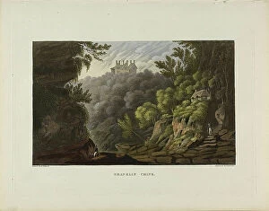
Shaklin Chine, c. 1794. Creator: Piercy RobertsShaklin Chine, c. 1794
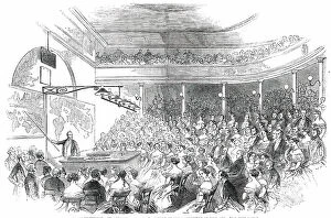
Royal Institution - Sir Roderick Murchison's Lecture on the Distribution of Gold Ore, 1850. Creator: UnknownRoyal Institution - Sir Roderick Murchison's Lecture on the Distribution of Gold Ore, 1850. Geological talk in London
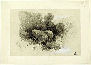
Rocky Scene, n.d. Creator: Henry BrightRocky Scene, n.d
View of Lake with Cliffs in Foreground, n.d. Creator: James RobertsonView of Lake with Cliffs in Foreground, n.d
Brimham Rocks, near Pateley Bridge Yorkshire, 1821. Creator: Francis NicholsonBrimham Rocks, near Pateley Bridge Yorkshire, 1821
The Dropping Well at Knar Knarcsborough, n.d. Creator: Francis NicholsonThe Dropping Well at Knar Knarcsborough, n.d
Arthur's Seat, n.d. Creator: John ClerkArthur's Seat, n.d
Fjallforsen, 1913. Creator: Leander EngstromFjallforsen, 1913
Forest interior, (c1930s). Creator: Ida Eléonora de SchulzenheimForest interior, (c1930s). Graberget outside Gavle
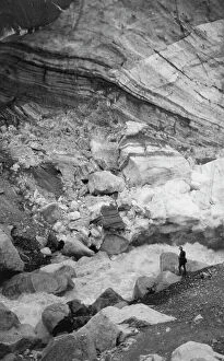
Glacier and glacial stream, between c1900 and 1923. Creator: UnknownGlacier and glacial stream, between c1900 and 1923
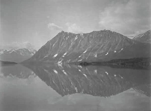
Cathedral Mountain and Lake Atlin, between c1900 and 1927. Creator: UnknownCathedral Mountain and Lake Atlin, between c1900 and 1927
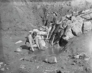
Men panning gold, between c1900 and 1927. Creator: Lomen BrothersMen panning gold, between c1900 and 1927
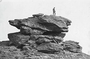
Anvil Rock, between c1900 and c1930. Creator: Lomen BrothersAnvil Rock, between c1900 and c1930
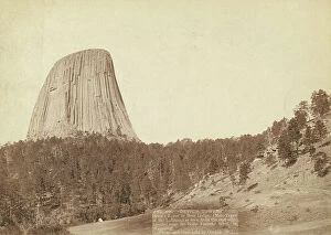
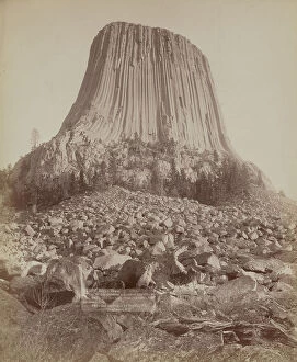
Devil's Tower Devil's Tower or Bear Lodge (Mato [ie Mateo] Tepee of the... 1888. Creator: John C. H. Grabill)Devil's Tower. Devil's Tower or Bear Lodge. (Mato [i.e. Mateo] Tepee of the Indians), as seen from the east side. Located near the Belle Fourche river, in Wyoming []
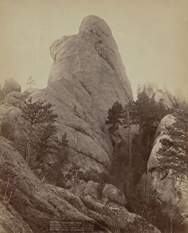
Lake Harney Peaks, near Custer City, SD, on B & M Ry, 1891. Creator: John C. H. GrabillLake Harney Peaks, near Custer City, SD, on B & M Ry, 1891. Close view of peaks; hikers sitting and standing on ridges
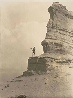
Calamnity [ie Calamity] Peak Near Custer City on B & M R'y Title of Peak from the most noted...1891Calamnity [i.e. Calamity] Peak. Near Custer City on B. & M. R'y. Title of Peak from the most noted character in Black Hills []. Center view of Calamity Peak
The offering-San Ildefonso, c1927. Creator: Edward Sheriff CurtisThe offering-San Ildefonso, c1927. Photograph shows a barechested Tewa man, standing high on a cliff, arms stretched before him as he sprinkles cornmeal as an offering at the start of a day
Cornfields of Cañon del Muerto, 1906, c1907. Creator: Edward Sheriff CurtisCornfields of Canon del Muerto, 1906, c1907. Navajo Indian cornfield, cliffs in background
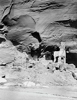
Antelope ruins showing prehistoric decorations, 1907, c1907. Creator: Edward Sheriff CurtisAntelope ruins showing prehistoric decorations, 1907, c1907. Ruins of Navajo Indian cliff dwellings
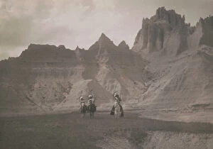
In the Bad Lands-Sioux, c1905. Creator: Edward Sheriff CurtisIn the Bad Lands-Sioux, c1905. Three Native Americans on horseback
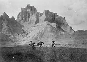
Entering the Bad Lands. Three Sioux Indians on horseback, c1905. Creator: Edward Sheriff CurtisEntering the Bad Lands. Three Sioux Indians on horseback, c1905
Expedition caravan in the Akkem River valley, 1895. Creator: Vasilii Vasilevich SapozhnikovExpedition caravan in the Akkem River valley, 1895. From a collection of 60 photos by V.V. Sapozhnikov (1861-1924), a geographer, botanist, ethnographer
On the bank of the Katun River near the village of Tavdy, 1895. Creator: Vasilii Vasilevich SapozhnikovOn the bank of the Katun River near the village of Tavdy, 1895. From a collection of 60 photos by V.V. Sapozhnikov (1861-1924), a geographer, botanist, ethnographer
Devil's Tower From West side showing millions of tons of fallen rock Tower 800... 1890. Creator: John C. H. GrabillDevil's Tower From West side showing millions of tons of fallen rock Tower 800... 1890
Phantom Ridge, Black Hills, Dak, 1890. Creator: John C. H. GrabillPhantom Ridge, Black Hills, Dak, 1890. Showing horse-drawn coach making its way down a dry riverbed, surrounded by steep ridges and rock formations
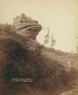
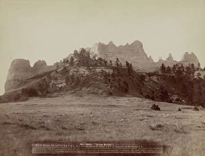
The Frog's Head Rock On old Deadwood stage road, 1890. Creator: John C. H. GrabillThe Frog's Head Rock On old Deadwood stage road, 1890. Rock formation resembling a frog's head
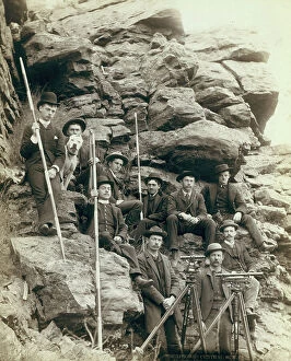
Deadwood Central RR Engineer Corps, 1888. Creator: John C. H. GrabillDeadwood Central RR Engineer Corps, 1888. Outdoor group portrait of ten railroad engineers and a dog, posing with surveyors transits on tripods and measuring rods, on the side of a mountain
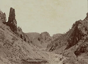
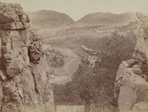
Echo Canyon Looking through Sioux Pass On FE and MV Ry, Hot Springs, SD, 1891. Creator: John C. H. GrabillEcho Canyon Looking through Sioux Pass On FE and MV Ry, Hot Springs, SD, 1891. House and road in plains area as seen from above and between two large rock formations; mountains in distance
Crow Butte Near Ft Robinson, Neb and FE & MV RR -- In battle, the Indians drove the "Crows" up on the mountain and camped on the only approach
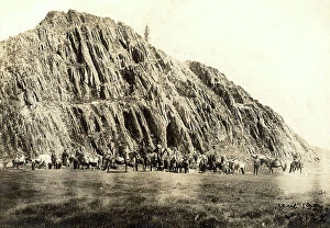
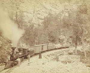
Giant Bluff Elk Canyon on Black Hills and Ft P RR, 1890. Creator: John C. H. GrabillGiant Bluff Elk Canyon on Black Hills and Ft P RR, 1890. A wood-burning locomotive with four cars, on a track below a cliff; several people are posing in front of the train
Giant Bluff Elk Canyon on Black Hills and Ft P RR, 1890. Creator: John C. H. GrabillGiant Bluff Elk Canyon on Black Hills and Ft P RR, 1890. A two-car train in front of a steep cliff; several passengers are posing in front of the train
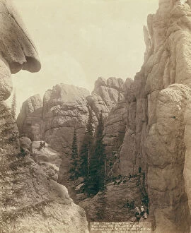
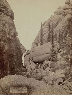
Our picnic party at Sunday Gulch Photographed between the walls of the grandest mountain... 1891. Creator: John C. HOur picnic party at Sunday Gulch Photographed between the walls of the grandest mountains of the Dakotas, near Custer City on the B & M Ry, 1891
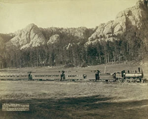
Harney Range Horseshoe Curve on the B[urlington] and M[issouri River] Ry near Custer City, SD, 1891. Creator: John CHarney Range Horseshoe Curve on the B[urlington] and M[issouri River] Ry near Custer City, SD, 1891. Full view of train in a valley with mountains in background
Ural Mountains. Taiga in the Zlatoust Region, 1904. Creator: Boris Vasilievich SmirnovUral Mountains. Taiga in the Zlatoust Region, 1904. Boris Vasilievich Smirnov (1881-1954) was a Russian artist who in 1904 traveled by prisoner transport from western Russia across Siberia
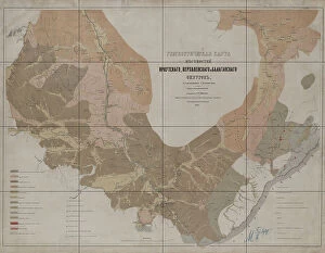
Geognostic Map of the Localities of Irkutsk, Verkholensk, and Balagansk Districts, 1873. The first geological (geognostic) maps in Russia were produced in the 1850s
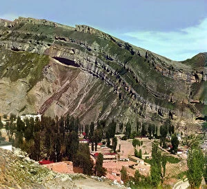
Village of Nizhnii Gunib in Dagestan, between 1905 and 1915. Creator: Sergey Mikhaylovich Prokudin-GorskyVillage of Nizhnii [or Nizhny] Gunib in Dagestan, between 1905 and 1915. {/33310/}, leader of the Chechen and Daghestani tribes, made his last stand against the Russians at Ghunib
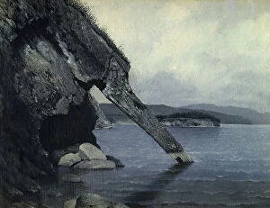
Cliff "Trunk" and Shaman's Rock, 1880-1897. Creator: Pavel Mikhailovich KosharovCliff "Trunk" and Shaman's Rock, 1880-1897. From a collection of paintings, lithographs, sketches, studies, and drawings
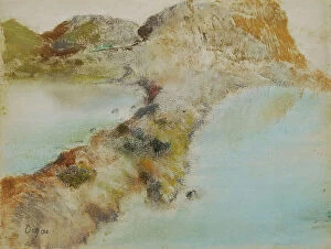
Rocky coast, about 1890/1892. Creator: Edgar DegasRocky coast, about 1890/1892
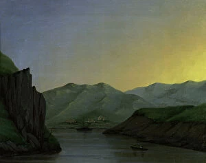
The River Irtysh Between the Fortress of Bukhtarminsk and the Town of Ust'-Kamenogorsk, 1880-1897. From a collection of paintings, lithographs, sketches, studies, and drawings
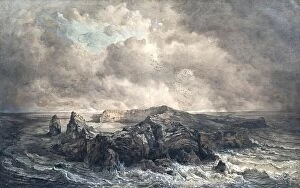
The island of St. Paul in the Indian Ocean, undated. (c1850s) Creator: Joseph SellenyThe island of St. Paul in the Indian Ocean, undated. (c1850s)