Plan of a Portion of Westminster Between 1734 and 1748 - Before the Erection of

![]()
Wall Art and Photo Gifts from Heritage Images
Plan of a Portion of Westminster Between 1734 and 1748 - Before the Erection of
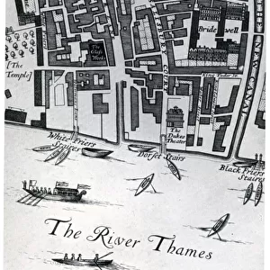
Plan of a Portion of Westminster Between 1734 and 1748 - Before the Erection of Great George Street, (1881). Map of the area near the Houses of Parliament in London, showing Broad Sanctuary, St Margarets Church, Bow Street, Thieving Lane, King Street, Charles Street, Duke Street and Long Ditch. From Old and New London: A Narrative of Its History, Its People, and Its Places. Westminster and the Western Suburbs, by Edward Walford, Vol. III. [Cassell, Petter, Galpin & Co. London, Paris & New York, 1881]
Media ID 18098010
© The Print Collector / Heritage-Images
Cassell Company Ltd Edward Edward Walford Galpin Co Galpin Company Houses Of Parliament Houses Of Westminster King Street Old And New London Palace Of Westminster Petter Publisher Street Plan Walford
MADE IN THE UK
Safe Shipping with 30 Day Money Back Guarantee
FREE PERSONALISATION*
We are proud to offer a range of customisation features including Personalised Captions, Color Filters and Picture Zoom Tools
SECURE PAYMENTS
We happily accept a wide range of payment options so you can pay for the things you need in the way that is most convenient for you
* Options may vary by product and licensing agreement. Zoomed Pictures can be adjusted in the Basket.