mail_outline sales@mediastorehouse.com
Choose a picture from our Maps Charts & Plans Collection for your Wall Art and Photo Gifts
41 items
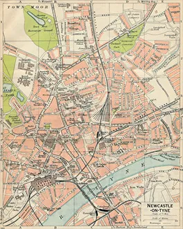
Newcastle-on-Tyne, c20th Century. Artist: John BartholomewNewcastle-on-Tyne, c20th Century. [John Bartholomew & Son, Edinburgh]
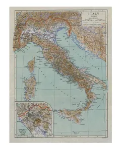
Map of Ancient Italy, c1910s. Artist: Emery Walker LtdMap of Ancient Italy, c1910s
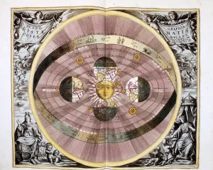
Copernican (heliocentric / Sun-centred) system of the Universe, 1708Copernican (heliocentric/Sun-centred) system of the Universe, 1761. Illustration showing ecliptic and the orbit of the Earth and the planets
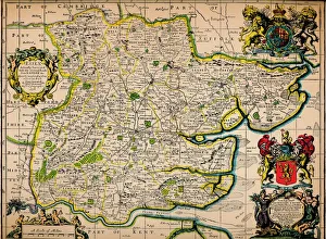
Map of Essex, 1678. Artists: John Ogilby, William MorganMap of Essex, 1678. From Essex, actually surveyed, with the several Roads from London &c. by Francis Lamb. [Philip Lea, Essex, 1678]
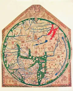
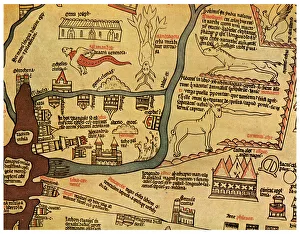
The Hereford Mappa Mundi, (c1285), 1912. Artist: Richard de BelloThe Hereford Mappa Mundi c1285. The Hereford Mappa Mundi is currently on display at Hereford Cathedral in Hereford, England. It is the largest medieval map known to still exist
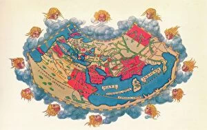
Ptolemys Map of the World cA. D 150. (1912) Artist: Claudius PtolemyPtolemys Map of the World cA.D 150. The Ptolemy world map is a map of the known world to Hellenistic society in the 2nd century AD
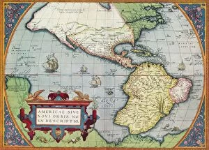
America, or the New World: From the Theatrum Orbis Terrarum by Abraham Ortelius, 1570, 1570America, or the New World: From the Theatrum Orbis Terrarum by Abraham Ortelius, 1570, (1936). From The Connoisseur, Vol. 98, edited by H. Granville Fell. [International Studio, London, 1936]
Map of Magellans round the world voyage, 1519-1521. A Portuguese-born navigator sponsored by Spain, Ferdinand Magellan (c1480-1521)
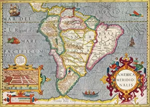
South America (America Meridionalis): from the Atlas of Gerardus Mercator, 1633, (1936). Artist: Gerardus MercatorSouth America (America Meridionalis): from the Atlas of Gerardus Mercator, 1633, (1936). Published at Antwerp by Hondius From The Connoisseur, Vol. 98, edited by H. Granville Fell
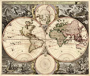
Orbis terrarum nova et accuratissima tabula, ca 1690. Artist: Visscher, Nicolaes (1618-1679)Orbis terrarum nova et accuratissima tabula, ca 1690. Private Collection
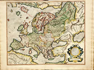
Atlas sive Cosmographicae Meditationes de Fabrica Mundi et Fabricati Fugura (Europe: Livonia, Russia Artist: Mercator)Atlas sive Cosmographicae Meditationes de Fabrica Mundi et Fabricati Fugura (Europe: Livonia, Russia, Lithuania). Private Collection
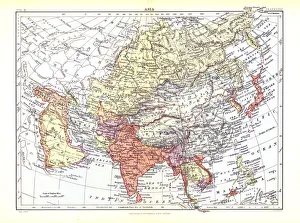
Map of Asia, c1902. Artist: W & AK JohnstonMap of Asia, c1902. From Encyclopedia Britannica Ninth Edition. [W&AK Johnston]
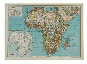
Map of Africa, c1910. Artist: Gull Engraving CompanyMap of Africa, c1910 with insert as known in 1850. [Encyclopaedia Britannica Co]
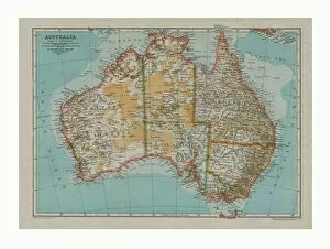
Map of Australia, c1910. Artist: Gull Engraving CompanyMap of Australia, c1910. [Encyclopaedia Britannica Co]
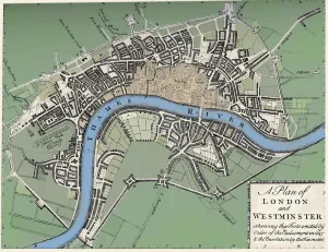
Plan of London and Westminster, 1749 (1903). A plan of London published in The Gentlemans Magazine in June 1749 showing the 1643 defences for the Civil War
Chart of the Spanish Armadas course, 1588 (1893). Pines engraving of 1739, of a tapestry then in the House of Lords. An illustration from A Short History of the English People, by John Richard Green
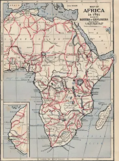
Map of Africa in 1891 showing Routes of Explorers
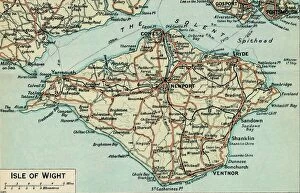
Isle of Wight. c20th Century. Artist: John BartholomewIsle of Wight. c20th Century. [John Bartholomew & Son, Edinburgh]
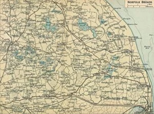
Norfolk Broads, c20th Century. Artist: John BartholomewNorfolk Broads, c20th Century. [John Bartholomew & Son, Edinburgh]
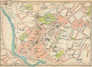
Exeter, c20th Century. Artist: John BartholomewExeter, c20th Century. [John Bartholomew & Son, Edinburgh]
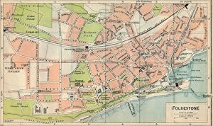
Folkestone, c20th Century. Artist: John BartholomewFolkestone, c20th Century. [John Bartholomew & Son, Edinburgh]
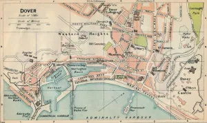
Dover, c20th Century. Artist: John BartholomewDover, c20th Century. [John Bartholomew & Son, Edinburgh]
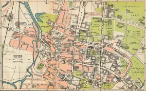
Oxford, c20th Century. Artist: John BartholomewOxford, c20th Century. [John Bartholomew & Son, Edinburgh]
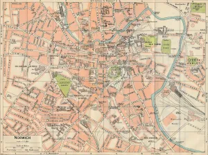
Norwich, c20th Century. Artist: John BartholomewNorwich, c20th Century. [John Bartholomew & Son, Edinburgh]
Cambridge, c20th Century. Artist: John BartholomewCambridge, c20th Century. [John Bartholomew & Son, Edinburgh]
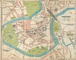
Shrewsbury, c20th Century. Artist: John BartholomewShrewsbury, c20th Century. [John Bartholomew & Son, Edinburgh]
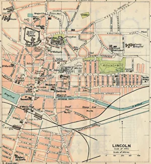
Lincoln, c20th Century. Artist: John BartholomewLincoln, c20th Century. [John Bartholomew & Son, Edinburgh]
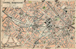
Central Birmingham, c20th Century. Artist: John BartholomewCentral Birmingham, c20th Century. [John Bartholomew & Son, Edinburgh]
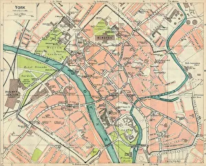
York, c20th Century. Artist: John BartholomewYork, c20th Century. [John Bartholomew & Son, Edinburgh]
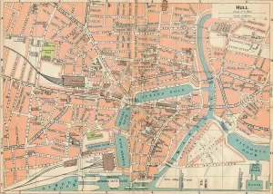
Hull, c20th Century. Artist: John BartholomewHull, c20th Century. [John Bartholomew & Son, Edinburgh]
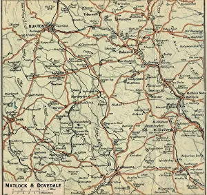
Matlock & Dovedale, c20th Century. Artist: John BartholomewMatlock & Dovedale, c20th Century. [John Bartholomew & Son, Edinburgh]
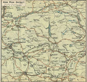
High Peak District, c20th Century. Artist: John BartholomewHigh Peak District, c20th Century. [John Bartholomew & Son, Edinburgh]
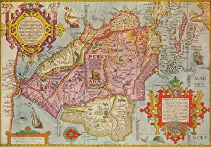
Map of Peru, c1599. Artist: Arnoldus FlorentiusMap of Peru, c1599. A map of South America and the Caribbean, with Chile, Peru, Brazil, Cuba and Florida. From Adventures By Sea From Art of Old Time, by Basil Lubbock. [The Studio Ltd. London, 1925]
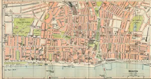
Brighton, c20th Century. Artist: John BartholomewBrighton, c20th Century. [John Bartholomew & Son, Edinburgh]
Plan of Paris, c1630 (1915). From Paris Past and Present. [London Offices of the Studio, London, 1915]
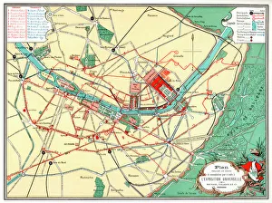
Plan of the Universal Exposition, Paris, 1889. The Exposition Universelle of 1889 was staged in commemration of the centenary of the French Revolution
The Nile Delta, Egypt, c1280 (1956). Detail from the Hereford Mappa Mundi, Hereford Cathedral. Attributed to Richard de Bello, the Hereford Mappa Mundi is the largest known existing medieval map
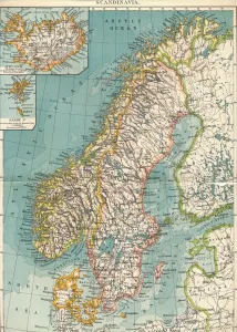
Scandinavia, c1906, (1907). From The Worlds History, Volume VI. Edited by Dr. H. F. Helmolt [William Heinemann, London, 1907]
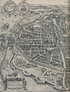
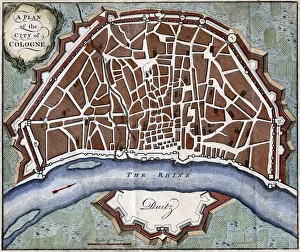
A plan of the city of Cologne. Hand-coloured later
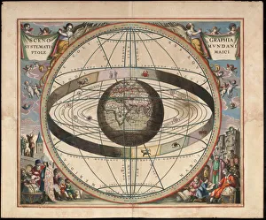
Scenography of the Ptolemaic cosmography (From Andreas Cellarius Harmonia Macrocosmica), c. 1660. From a private collection
Mexico City in the early 16th century. Depiction probably based on a sketch in the conquistador Hernan Cortes book of 1524. From the British Museum