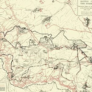
Map showing the Scene of the German Attacks... First World War, February 1916, (c1920)
")
![]()
Wall Art and Photo Gifts from Heritage Images
Map showing the Scene of the German Attacks... First World War, February 1916, (c1920)
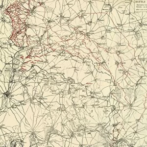
Map showing the Scene of the German Attacks East and South-east of Ypres, [Belgium], First World War, February 1916, (c1920). The " Bluff" and International Trench lie on the wooded hill north of the Ypres-Comines Canal and south of Hill 60. From " The Great World War: A History", Volume V, edited by Frank A Mumby. [The Gresham Publishing Company Ltd, London, c1920]
Media ID 19664842
© The Print Collector/Heritage Images
Canal Frank A Frank A Mumby Frank Arthur Frank Arthur Mumby Front Line Frontline Gresham Publishing Co Ltd Gresham Publishing Company Keystone Archives Mumby Mumby Frank A Mumby Frank Arthur Railways The Great World War A History Theatre Of War Western Front Ypres Ypres Flanders Belgium
MADE IN THE UK
Safe Shipping with 30 Day Money Back Guarantee
FREE PERSONALISATION*
We are proud to offer a range of customisation features including Personalised Captions, Color Filters and Picture Zoom Tools
SECURE PAYMENTS
We happily accept a wide range of payment options so you can pay for the things you need in the way that is most convenient for you
* Options may vary by product and licensing agreement. Zoomed Pictures can be adjusted in the Basket.