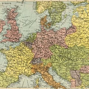
Map To Illustrate the Eastern Battle Fronts, 1919. Creator: George Philip & Son Ltd

![]()
Wall Art and Photo Gifts from Heritage Images
Map To Illustrate the Eastern Battle Fronts, 1919. Creator: George Philip & Son Ltd
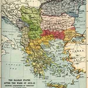
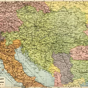
Map To Illustrate the Eastern Battle Fronts, 1919. Map showing areas of eastern Europe and the Balkans which saw fighting during the First World War, 1914-1919, including Italy, Austria-Hungary, Albania, Montenegro, Greece, Serbia, Bulgaria, Romania, and parts of Russia and Turkey. From " The History of the Great European War: its causes and effects", Vol. V, by W. Stanley Macbean Knight. [Caxton Pulishing Company, Limited, London, 1919]
Media ID 19047833
© The Print Collector/Heritage Images
Adriatic Aegean Albania And Son Ltd Austria Hungary Austro Hungarian Balkans Black Sea Bulgaria Caxton Publishing Company Caxton Pulishing Company Caxton Pulishing Company Lim Caxton Pulishing Company Limited Caxton Pulishing Company Ltd Eastern Front George Philip And Son George Philip And Son Ltd Knight Limited Montenegro Philip Romania Serbia Stanley Macbean Stanley Macbean Knight Turkey Turkish W Stanley Macbean W Stanley Macbean Knight William Stanley Macbean William Stanley Macbean Knight
MADE IN THE UK
Safe Shipping with 30 Day Money Back Guarantee
FREE PERSONALISATION*
We are proud to offer a range of customisation features including Personalised Captions, Color Filters and Picture Zoom Tools
SECURE PAYMENTS
We happily accept a wide range of payment options so you can pay for the things you need in the way that is most convenient for you
* Options may vary by product and licensing agreement. Zoomed Pictures can be adjusted in the Basket.