mail_outline sales@mediastorehouse.com
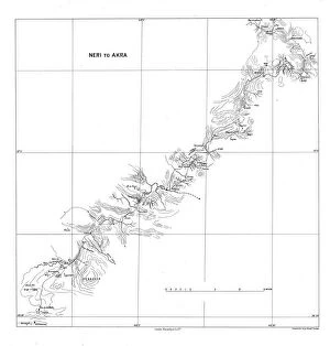
Neri to Akra, c1915. Creator: Stanfords Geographical EstablishmentNeri to Akra, c1915. Map showing the journey of British writer, soldier and diplomatic advisor Mark Sykes in Turkey, (at that time part of the Ottoman Empire)
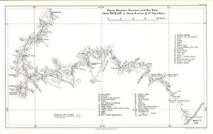
Route between Karaman and Kiz Kale, c1915. Creator: Stanfords Geographical EstablishmentRoute between Karaman and Kiz Kale, c1915. (Note Boyalar is about 8 miles S. of Karaman). Map showing the journey of British writer
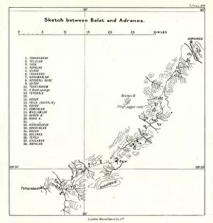
Sketch between Balat and Adranos, c1915. Creator: Stanfords Geographical EstablishmentSketch between Balat and Adranos, c1915. Map showing the journey of British writer, soldier and diplomatic advisor Mark Sykes between Balat and Adranos in Turkey
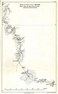
Route to Petra from Teyaha, c1915. Creator: Stanfords Geographical EstablishmentRoute to Petra from Teyaha, c1915. (Note: None of these watercourses contain perennial streams). Map showing the journey of British writer
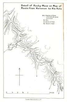
Detail of Rocky Maze on Map of Route from Karaman to Kiz Kale, c1915. Map showing part of the journey of British writer, soldier and diplomatic advisor Mark Sykes between Karaman (in Central Anatolia)
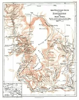
The Western Bend of the Euphrates, c1915. Creator: Mark SykesThe Western Bend of the Euphrates, c1915. Map of the River Euphrates and surrounding areas. From " The Caliphs Last Heritage, a short history of the Turkish Empire" by Lt.-Col
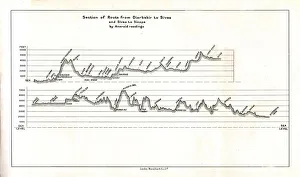
Section of Route from Diarbekir to Sivas and Sivas to Sinope by Aneroid readings, c1915. Map showing the journeys, with altitude above sea level, of British writer
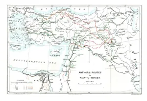
Authors Routes in Asiatic Turkey, c1915. Creator: Stanfords Geographical EstablishmentAuthors Routes in Asiatic Turkey, c1915. Map showing the journeys of British writer, soldier and diplomatic advisor Mark Sykes (1879-1919) who travelled through Palestine, Iraq, Syria
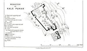
Monastery at Kale Punar, c1915. Creator: Stanfords Geographical EstablishmentMonastery at Kale Punar, c1915. Plan of monastic buildings in Turkey, at that time part of the Ottoman Empire, showing chapels, cisterns, caves and fountains
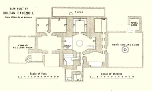
Bath built by Sultan Bayezid I, circa 1390 A.D. at Mudurlu, c1915. Plan of baths supposedly built by the Ottoman sultan Bayezid I, showing the tank, mens and womens cooling rooms
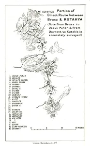
Portion of direct route between Brusa and Kutahya, c1915. (Note: from Brusa to Osauk Punar & from Devrant to Kutakia is accurately surveyed)