mail_outline sales@mediastorehouse.com
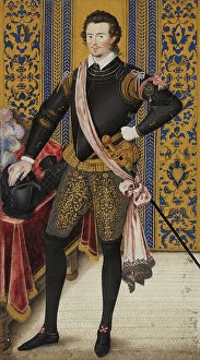
Sir Robert Dudley, Duke of Northumberland, c1600. Creator: Nicholas HilliardSir Robert Dudley, Duke of Northumberland, c1600
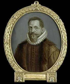
Portrait of Petrus Bertius, Professor at Leiden, 1700-1732. Creator: Arnoud van HalenPortrait of Petrus Bertius, Professor at Leiden, 1700-1732
Johan François Adriaan Cateau van Rosevelt... 1885. Creator: LoveraJohan Francois Adriaan Cateau van Rosevelt, Chief of the Construction Department and Agent General of Immigration in Suriname, 1885
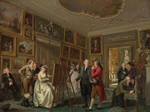
The Art Gallery of Jan Gildemeester Jansz, 1794-1795. Creator: Adriaan De LelieThe Art Gallery of Jan Gildemeester Jansz, 1794-1795. In 1792, Gildemeester, a merchant, turned two large rooms at his house on Amsterdam's Herengracht into an art gallery
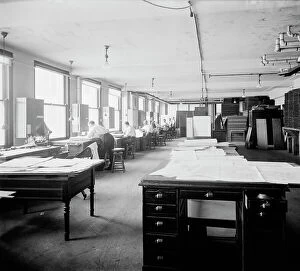
Geological Survey art room, between 1910 and 1920. Creator: Harris & EwingGeological Survey art room, [Washington, DC], between 1910 and 1920. [Map-making]
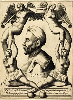
Portrait of Girolamo Ruscelli, 1566. Creator: Nicolo NelliPortrait of Girolamo Ruscelli, 1566
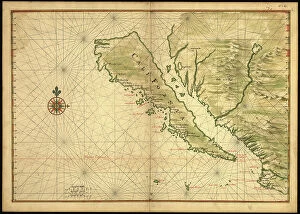
Map of California shown as an island, c 1650. Creator: Johannes VingboonsMap of California shown as an island, c 1650. This map from around 1650 shows California as an island. A half-century would pass before Spanish explorers determined with certainty that California was
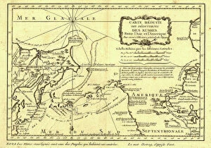
Carte re´duite des de´couvertes des Russes, entre l'Asie et l'Amerique, (1747?). This French map of Alaska, Siberia, and the North Pacific, published in 1747
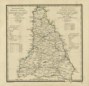
General Map of Ekaterinoslav Province: Showing Postal and Major Roads, Stations and the... 1821General Map of Ekaterinoslav Province: Showing Postal and Major Roads, Stations and the Distance in Versts between Them, 1821
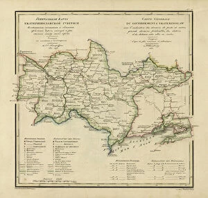
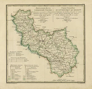
General Map of Kharkiv Province: Showing Postal and Major Roads, Stations and the... 1821General Map of Kharkiv Province: Showing Postal and Major Roads, Stations and the Distance in Versts between Them, 1821. This 1821 map of Kharkiv Provinceis from a larger work
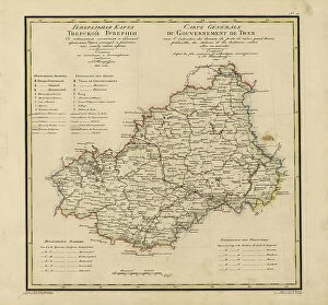
General Map of Tver Province: Showing Postal and Major Roads, Stations and the... 1821General Map of Tver Province: Showing Postal and Major Roads, Stations and the Distance in Versts between Them, 1821. This 1821 map of Tver Provinceis from a larger work
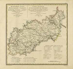
General Map of Novgorod Province: Showing Postal and Major Roads, Stations and the... 1821General Map of Novgorod Province: Showing Postal and Major Roads, Stations and the Distance in Versts between Them, 1821. This 1821 map of Novgorod Provinceis from a larger work
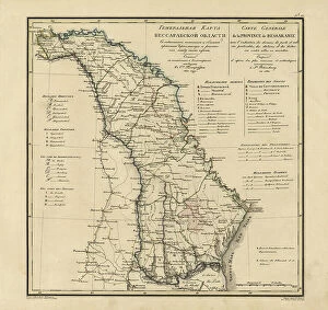
General Map of Bessarabia: Showing Postal and Major Roads, Stations and the... 1821General Map of Bessarabia: Showing Postal and Major Roads, Stations and the Distance in Versts between Them, 1821. This 1821 map of Bessarabia is from a larger work
General Map of Minsk Province: Showing Postal and Major Roads, Stations and the... 1821General Map of Minsk Province: Showing Postal and Major Roads, Stations and the Distance in Versts between Them, 1821. This 1821 map of Minsk Province is from a larger work
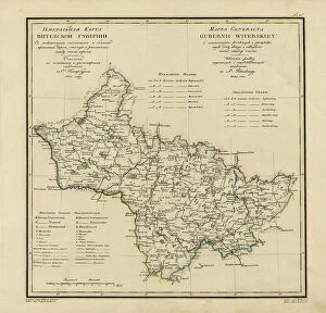
General Map of Vitebsk Province: Showing Postal and Major Roads, Stations and the... 1820General Map of Vitebsk Province: Showing Postal and Major Roads, Stations and the Distance in Versts between Them, 1820. This 1820 map of Vitebsk Provinceis from a larger work
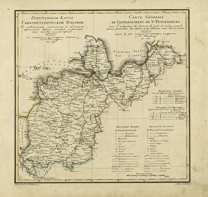
General Map of Saint Petersburg Province: Showing Postal and Major Roads, Stations and the... 1820General Map of Saint Petersburg Province: Showing Postal and Major Roads, Stations and the Distance in Versts between Them, 1820
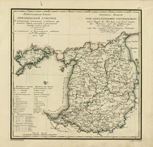
General Map of Livland Province: Showing Postal and Major Roads, Stations and the... 1820General Map of Livland Province: Showing Postal and Major Roads, Stations and the Distance in Versts between Them, 1820. This 1820 map of Livland Provinceis from a larger work
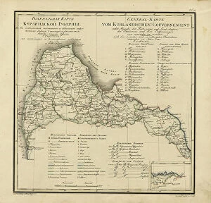
General Map of Courland Province: Showing Postal and Major Roads, Stations and the... 1820General Map of Courland Province: Showing Postal and Major Roads, Stations and the Distance in Versts between Them, 1820. This 1820 map of Courland Province is from a larger work
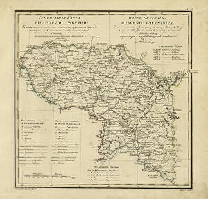
General Map of Vilnius Province: Showing Postal and Major Roads, Stations and the... 1820General Map of Vilnius Province: Showing Postal and Major Roads, Stations and the Distance in Versts between Them, 1820. This 1820 map of Vilnius Provinceis from a larger work
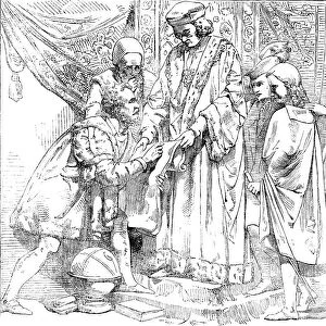
The New Houses of Parliament - Sebastian Cabot before Henry VII, 1854. Creator: UnknownThe New Houses of Parliament - Sebastian Cabot before Henry VII, 1854. Sculpture by William Theed in the Palace of Westminster
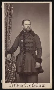
Portrait of Arthur Carl Victor Schott (1814-1875), Before 1875. Creator: UnknownPortrait of Arthur Carl Victor Schott (1814-1875), Before 1875
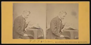
Portrait of Increase Allen Lapham (1811-1875) - Examining the Wisconsin Meteorite, Circa 1868
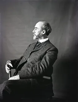
Portrait of William Henry Holmes, 1890s. Creator: United States National MuseumPortrait of William Henry Holmes, 1890s
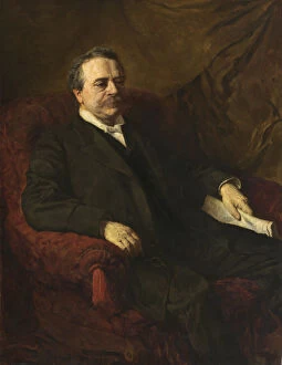
Julius Bien, 1886. Creator: George Da Maduro PeixottoJulius Bien, 1886
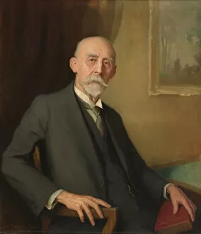
Dr. William H. Holmes, 1931. Creator: Edmund Hodgson SmartDr. William H. Holmes, 1931
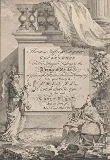
Trade Card for Thomas Jefferys, Engraver, Geographer, and Printseller, 18th century
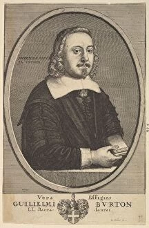
Vera Effigies Guilielmi Burton / L. L. Baccalaurei, 1657-58. Creator: Wenceslaus HollarVera Effigies Guilielmi Burton / L.L. Baccalaurei, 1657-58
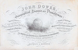
Trade card for John Dower, geographical engraver and draughtsman, 19th century
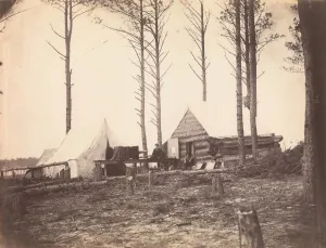
Copying Maps, Photographic Headquarters, Petersburg, Virginia, March 1865