mail_outline sales@mediastorehouse.com
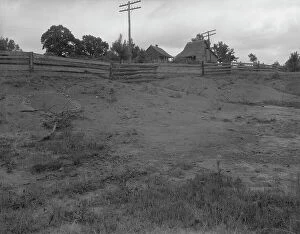
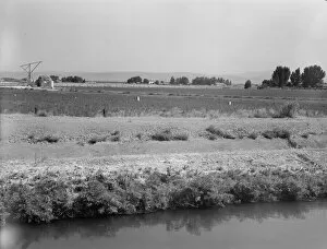
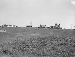
Migrants winter quarters, Farmersville, Tulare County, 1939. Creator: Dorothea LangeFarmersville, Tulare County. Migrants winter quarters
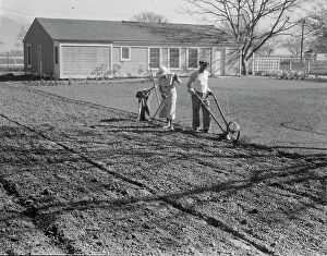
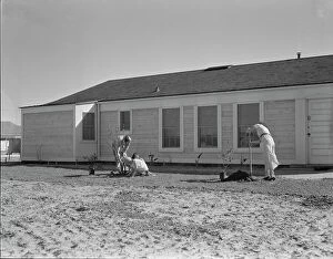
El Monte federal subsistence housing, California, 1936. Creator: Dorothea LangeEl Monte federal subsistence housing. Three-room house. Seventeen dollars and seventy cents rent applied on purchase. Father: carpenter. California
El Monte federal subsistence housing - 100 homes all occupied, California, 1936. Creator: Dorothea LangeEl Monte federal subsistence homesteads. One hundred homes. All occupied, each with nearly an acre of ground. Average yearly income eight hundred dollars. California
El Monte federal subsistence housing - 100 homes all occupied, California, 1936. Creator: Dorothea LangeEl Monte federal subsistence homesteads. 100 homes. All occupied, each with nearly an acre. Average yearly income eight hundred dollars. California
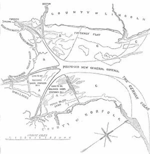
Plan of the Wash, between the Coasts of Norfolk and Lincolnshire, 1850. Creator: UnknownPlan of the Wash, between the Coasts of Norfolk and Lincolnshire, 1850. Map showing the proposed new general outfall and land to be reclaimed in the...Norfolk Estuary
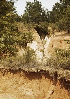
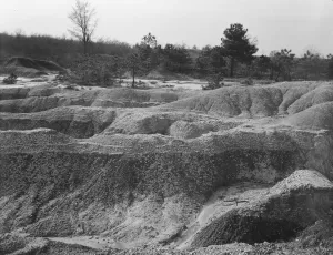
Erosion, Greene County, Georgia, 1937. Creator: Dorothea LangeErosion. Greene County, Georgia
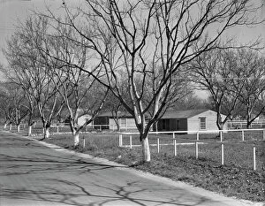
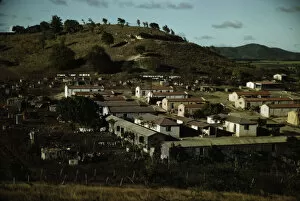
San Fernando federal subsistence homesteads, California, 1936. Creator: Dorothea LangeSan Fernando federal subsistence homesteads. Forty homes, all occupied, each with nearly an acre of ground. Average income eight hundred dollars yearly. California
Glen Tilt, near the Marble Lodge, 1850. Creator: UnknownGlen Tilt, near the Marble Lodge, [in Scotland], 1850. There was a road through the Glen before the Duke [George Murray, 6th Duke of Atholl] was born...and though he may have - which we very much
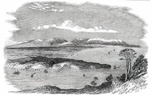
Site of the Canterbury Settlement, New Zealand, 1850. Creator: UnknownSite of the Canterbury Settlement, New Zealand, 1850....the promoters believe that their scheme will prove attractive to a class whom the tone of society prevalent in other colonies has hitherto
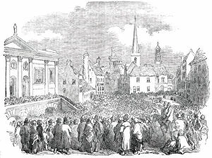
Great Tenant-Right Meeting at Kilkenny, 1850. Creator: UnknownGreat Tenant-Right Meeting at Kilkenny, [Ireland], 1850. It is peculiarly the curse of Ireland, though it is also the curse of other countries
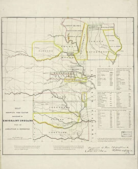
Map showing the lands assigned to emigrant Indians west of Arkansas and Missouri, 1836. Creator: Topographical BureauMap showing the lands assigned to emigrant Indians west of Arkansas and Missouri, 1836. Following passage of the Indian Removal Act in 1830
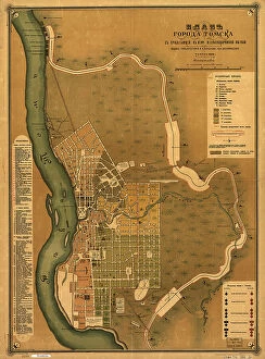
Plan goroda Tomskas prilegai?u?shchei? k nemu zheli?e?znodorozhnoi? vi?e?tv'i?u?, 1898. Creators: M. NPlan goroda Tomskas prilegai?u?shchei? k nemu zheli?e?znodorozhnoi? vi?e?tv'i?u?, 1898. Scale 1:16, 800; Relief shown by land form drawings. Russian. Shows wards and fire districts
Autumn, 1905. Creator: Anton Hans KarlinskyAutumn, 1905
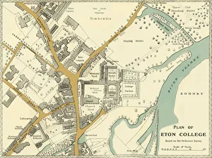
Plan of Eton College, 1911. Creator: UnknownPlan of Eton College, 1911. Generations of British and foreign aristocracy have been educated at Eton independent boarding school, founded in 1440 by King Henry VI
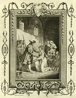
Lady Elizabeth Grey petitioning Edward IV To restore her lands, (1461), 1783. Creator: UnknownLady Elizabeth Grey petitioning Edward IV to restore her lands, (1461), 1783. Elizabeth Woodville, later to be wife of King Edward IV petitioned the king to return her lands in 1461
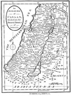
Map of Canaan divided into the twelve tribes of Israel, c1830Map of Canaan divided into the twelve tribes of Israel, 1830. Map of Canaan divided into the territories of the Twelve Tribes of Israel as described in the Bible, Numbers 23:54. Engraving c1830
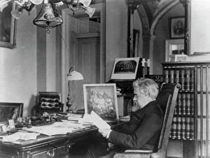
John Willock Noble, 1831-1912, between c1890 and c1910. Creator: Frances Benjamin JohnstonJohn Willock Noble, 1831-1912, between c1890 and c1910. Three-quarter length portrait, seated at desk, left profile. [Politician, lawyer, brigadier general in the Civil War
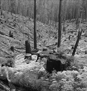
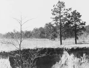
Eroded land, between 1941 and 1942. Creator: UnknownEroded land
A land and utility municipal housing project, Ponce, Puerto Rico, 1941. Creator: Jack DelanoA land and utility municipal housing project, Ponce, Puerto Rico
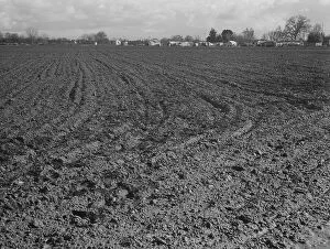
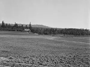
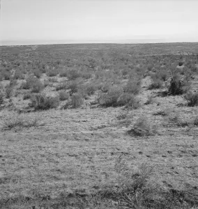
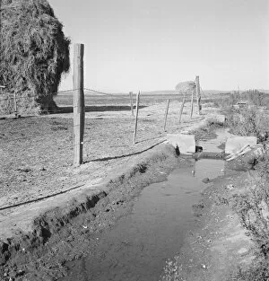
Landscape showing raw land, Nyssa Heights, Malheur County, Oregon, 1939. Creator: Dorothea LangeLandscape showing raw land. Nyssa Heights, Malheur County, Oregon
The Nieman farm showing cleared land on... near Vader, Lewis County, Western Washington, 1939. Creator: Dorothea LangeThe Nieman farm showing cleared land on which the bulldozer is clearing more land. Western Washington, Lewis County, near Vader
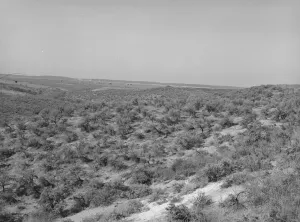
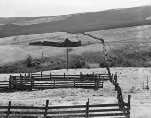
Desert stock farm, south central Washington, in region where much land has been overgrazed, 1939Desert stock farm, south central Washington, in region where much land has been overgrazed. Washington, Klickitat County
Possibly: Desert stock farm, south central Washington, in region... land has been overgrazed, 1939[Untitled, possibly related to: Desert stock farm, south central Washington, in region where much land has been overgrazed. Washington, Klickitat County]
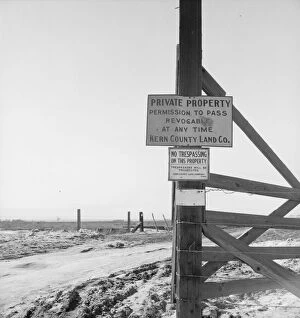
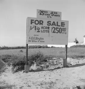
Kern County, California is largely in the hands of big landowners, 1939. Creator: Dorothea LangeKern County, California is largely in the hands of big landowners. Also it is a mecca for migrants from the Southwest. [Signs
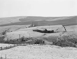
Washington, Yakima Valley, near Wapato, 1939. Creator: Dorothea LangeWashington, Yakima Valley, near Wapato. Name of Borrower, Edgar Hardt. On Tenant Purchase farm. Forty acres, price six thousand fifty dollars, all stock and machinery included
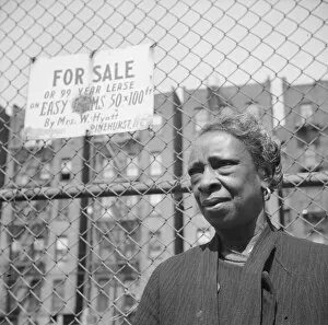
A Harlem resident, New York, 1943. Creator: Gordon ParksNew York, New York. A Harlem resident
Logged over land along U. S. 99. Southern Oregon, 1939. Creator: Dorothea LangeLogged over land along U.S. 99. Southern Oregon
View from the Smiths place across the road, showing uncleared land, Dead Ox Flat, Oregon, 1939. Creator: Dorothea LangeView from the Smiths place across the road, showing uncleared land. Dead Ox Flat. Malheur County, Oregon
Settlement of small plots held mostly by lettuce shed workers, outskirts of Salinas, CA, 1939. Creator: Dorothea LangeSettlement of small plots held mostly by lettuce shed workers, many from Oklahoma. Outskirts of Salinas, California
Emmett Smiths yard, back of the house, Dead Ox Flat, Malheur County, Oregon, 1939. Creator: Dorothea LangeEmmett Smiths yard, back of the house. Dead Ox Flat, Malheur County, Oregon
Housing for rapidly growing fringe of lettuce workers on edge of town, Salinas, California, 1939Housing for rapidly growing fringe of lettuce workers on edge of town. There houses are built by the occupants, most of them recent migrants from the Southwest
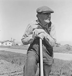
Farmer who has small plot... on outskirts of Salinas, CA, 1939. Creator: Dorothea LangeFarmer who has small plot in rapidly growing settlement of lettuce workers on outskirts of Salinas, California
New outskirts of town, showing Negro houses and soil erosion, Tupelo, Mississippi, 1936. Creator: Walker EvansNew outskirts of town, showing Negro houses and soil erosion. Tupelo, Mississippi
Erosion near Jackson, Mississippi, 1936. Creator: Walker EvansErosion near Jackson, Mississippi
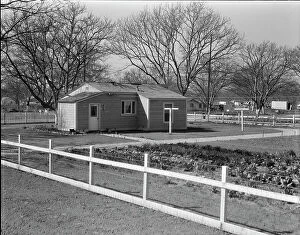
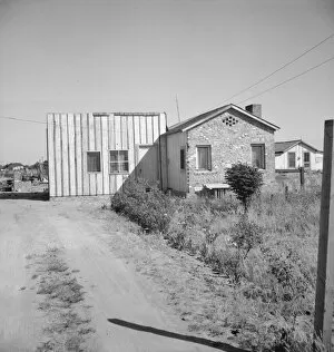
House with about an acre at Highway City, California, 1939. Creator: Dorothea LangeThere are approximately one hundred such homes, each with about an acre at Highway City, California, which show various degrees of ability in self resettlement
Erosion near Oxford, Mississippi, 1936. Creator: Walker EvansErosion near Oxford, Mississippi
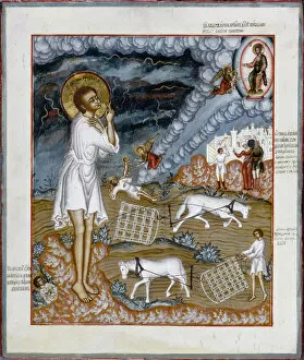
Saint Artemius of Verkola, 1774. Creator: Russian iconSaint Artemius of Verkola, 1774. Found in the Collection of the Petit Palais, Musee des Beaux-Arts de la Ville de Paris
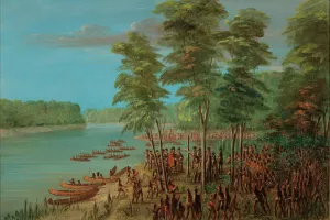
La Salle Taking Possession of the Land at the Mouth of the Arkansas. March 10, 1682, 1847/1848
Young Woman with Six Goats, 1815. Creator: Johann Christian ErhardYoung Woman with Six Goats, 1815
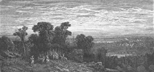
Hamstead Heath in the Olden Time, 1872. Creator: Gustave DoréHamstead Heath in the Olden Time, 1872. From, " LONDON. A Pilgrimage" by Gustave Dore and Blanchard Jerrold. [Grant and Co. 72-78, Turnmill Street, E.C. 1872]
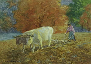
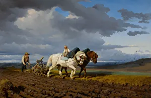
The Ploughing, 1844. Creator: Bonheur, Rosalie (Rosa) (1822-1899)The Ploughing, 1844. Private Collection
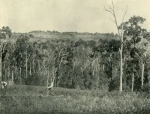
A Victorian Mountain Farm, 1901. Creator: UnknownA Victorian Mountain Farm, 1901. From " Federated Australia". [The Werner Company, London, 1901]
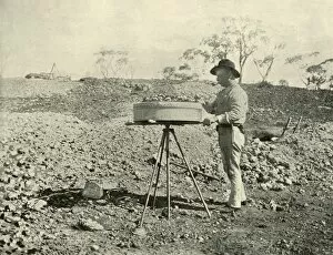
Prospecting a Lease, 1901. Creator: UnknownProspecting a Lease, 1901. From " Federated Australia". [The Werner Company, London, 1901]
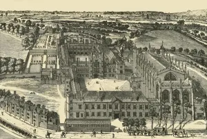
General View of Eton College, 1911. Creator: UnknownGeneral View of Eton College, 1911. Generations of British and foreign aristocracy have been educated at Eton independent boarding school, founded in 1440 by King Henry VI
Hampstead Heath in 1840, (c1876). Creator: UnknownHampstead Heath in 1840, (c1876). Ancient London heath, during Henry IIs reign privately owned by Alexander de Barentyn, the Kings butler, from early 19th century, common land
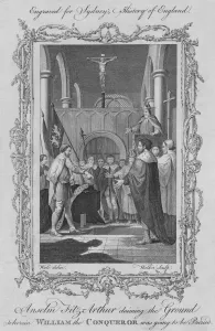
Anselm Fitz Arthur claiming the Ground where William the Conqueror was to be buried, 1773Anselm Fitz Arthur claiming the Ground wherein William the Conqueror was going to be buried, 1773. Negotiations on the price of land forcibly acquired at the Abbaye aux Hommes
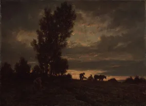
Landscape with a Plowman, 1860s. Artist: Rousseau, Theodore (1812-1867)Landscape with a Plowman, 1860s. Found in the collection of the State Hermitage, St. Petersburg
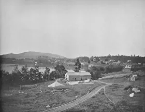
Lake Placid, Adirondacks, New York, c1897. Creator: UnknownLake Placid, Adirondacks, New York, c1897. Founded in early 19th century to develop iron ore mining operations. In 1845, Gerrit Smith bought land and granted tracts to former slaves