mail_outline sales@mediastorehouse.com
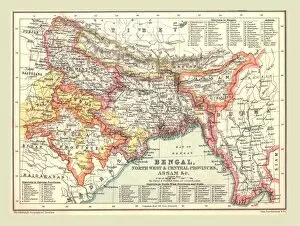
Map of Bengal, the North West and Central Provinces, and Assam, 1902. Creator: UnknownMap of Bengal, the North West and Central Provinces, and Assam, 1902. From The Century Atlas of the World. [John Walker & Co, Ltd. London, 1902]
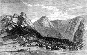
Barren Island, in the Bay of Bengal, 1858. Creator: UnknownBarren Island, in the Bay of Bengal, 1858. This island...north-east of the Andaman Islands...was visited by the Hon. East India Company's steam-frigate Semiramis...and the British ensign was
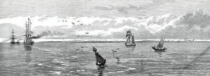
Saugor Lighthouse, off the mouth of the Hooghly, 1876. Creator: UnknownSaugor Lighthouse, off the mouth of the Hooghly, [India], 1876. The island of Saugor, upon which stands the iron lighthouse to guide ships approaching Calcutta as they enter the Hooghly river
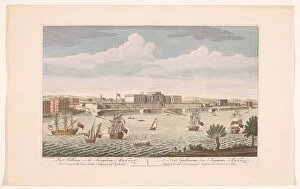
View of Fort William at Calcutta, 1754. Creator: AnonView of Fort William at Calcutta, 1754. Fort William in the Kingdom of Bengal. Belonging to the East India Company of England
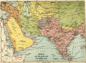
India and the Campaigns of the Middle East, First World War, 1914-1918, (c1920). Map showing British India coloured pink as part of the British Empire, Afghanistan, Persia, Asia Minor, Arabia
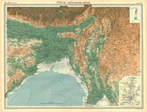
Geographical map of the north-eastern section of India, early 20th century. Pre-partition map showing the Bay of Bengal and the Ganges Delta, and what are now Bangladesh and Myanmar
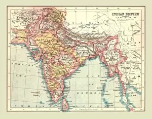
Map of the Indian Empire, 1902. Creator: UnknownMap of the Indian Empire, 1902. Showing the Indian subcontinent during the period of the British Raj (rule by the British Crown). From The Century Atlas of the World. [John Walker & Co, Ltd
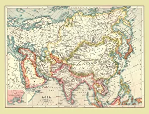
Map of Asia, 1902. Creator: UnknownMap of Asia, 1902. Showing Arabia, Persia, the Indian Subcontinent, Indochina and the Chinese Empire. From The Century Atlas of the World. [John Walker & Co, Ltd. London, 1902]
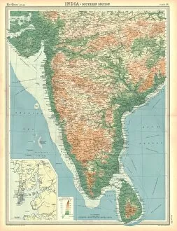
Map of India - Southern Section. Map of the south of India and what is now Sri Lanka. Plate 58 from The Times Atlas
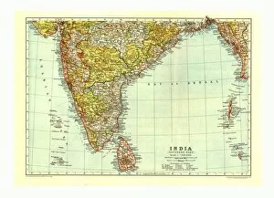
Map of India Southern part, c1910. Artist: Johann Georg Justus PerthesMap of India South, c1910. [Encyclopaedia Britannica Co]
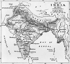
Map of India in 1857, c1912. From The Romance of India, edited by Herbert Strang. [Hodder & Stoughton, London, c1912]
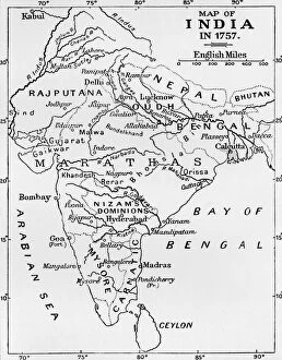
Map of India in 1757, (c1912). From The Romance of India, edited by Herbert Strang. [Hodder & Stoughton, London, c1912]
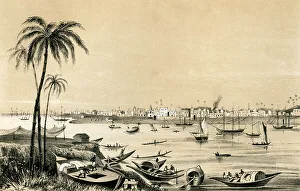
Calcutta, India, 1847. Illustration from The History of China and India, by Miss Corner, (Dean and Co, London, 1847)
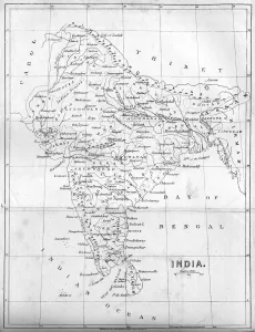
Map of India, 1847. Illustration from The History of China and India, by Miss Corner, (Dean and Co, London, 1847)
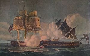
Gallant Defence of the Centurion, c1805. Artist: John Francis SartoriusGallant Defence of the Centurion, c1805. The British warship HMS Centurion defending two East Indiamen from French attack on 15 September 1804 at the Battle of Vizagapatam in the Bay of Bengal
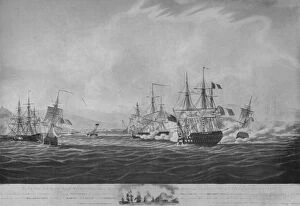
Capture of the Forte, c1800. Artist: Thomas WhitcombeCapture of the Forte, c1800. The capture of the French frigate Forte by the British warship HMS Sybille in the Bay of Bengal on 28 February 1799. The captains of both ships were killed in the battle