mail_outline sales@mediastorehouse.com
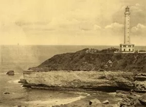
Biarritz - Le Phare, (The Lighthouse), c1930. Creator: UnknownBiarritz - Le Phare, (The Lighthouse), c1930. From " Souvenir de Biarritz". [Labouche Freres, Toulouse]
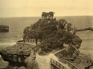
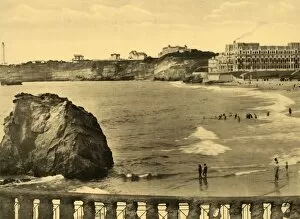
Biarritz - Le Rocher du Basta, c1930. Creator: UnknownBiarritz - Le Rocher du Basta, c1930. From " Souvenir de Biarritz". [Labouche Freres, Toulouse]
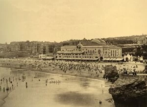
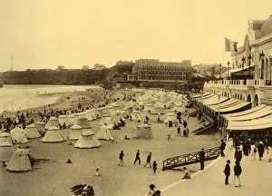
Biarritz - Le Casino Municipal et la Grande Plage, c1930. Creator: UnknownBiarritz - Le Casino Municipal et la Grande Plage, c1930. From " Souvenir de Biarritz". [Labouche Freres, Toulouse]
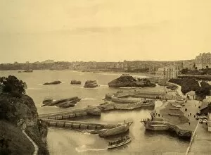
Biarritz - Le Port des Pecheurs, c1930. Creator: UnknownBiarritz - Le Port des Pecheurs, c1930. From " Souvenir de Biarritz". [Labouche Freres, Toulouse]
Biarritz - La Plage et le Casino Municipal, c1930. Creator: UnknownBiarritz - La Plage et le Casino Municipal, c1930. From " Souvenir de Biarritz". [Labouche Freres, Toulouse]
Biarritz - Hotel du Palais et la Baie, c1930. Creator: UnknownBiarritz - Hotel du Palais et la Baie, c1930. From " Souvenir de Biarritz". [Labouche Freres, Toulouse]
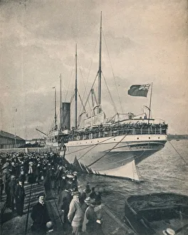
The Braemar Castle off to the Cape, with Troops, c1900. Creator: UnknownThe " Braemar Castle" off to the Cape, with Troops, c1900. Union Castle Line ship Braemar castle was built in 1898
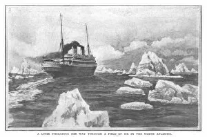
A Liner Threading Her Way Through a Field of Ice in the North Atlantic, April 20, 1912. The White Star Line ship RMS Titanic struck an iceberg in thick fog off Newfoundland on 14 April 1912
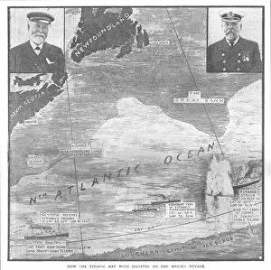
How the Titanic met with Disaster on her Maiden Voyage, April 20, 1912. Creator: UnknownHow the Titanic met with Disaster on her Maiden Voyage, April 20, 1912. Map of the North Atlantic Ocean, with portraits of William Pirrie
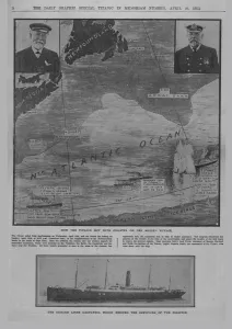
How the Titanic met with disaster... and The Cunard liner Carpathia... April 20, 1912How the Titanic met with Disaster on her Maiden Voyage, April 20, 1912. Map of the North Atlantic Ocean, with portraits of William Pirrie
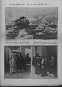
Liner in a field of ice, and people waiting for news of the Titanic disaster, April 20, 1912. A Liner Threading Her Way Through a Field of Ice in the North Atlantic
Rocket booster recovery, second Space Shuttle flight, November 1981. Creator: NASARocket booster recovery, second Space Shuttle flight, November 1981. The rocket booster is recovered from the sea. The space shuttles solid rocket boosters were reusable
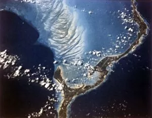
Earth from space - Eleuthera Island, Bahamas, c1980s. Creator: NASAEarth from space - Eleuthera Island, Bahamas, c1980s
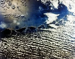
Earth from space - east coast of the USA, c1980s. Creator: NASAEarth from space - east coast of the USA, c1980s. Cloud cover and Atlantic coastline
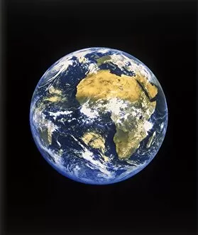
Earth from space - Africa and the Atlantic Ocean, c1980s. Creator: NASAEarth from space - Africa and the Atlantic Ocean, c1980s. Planet Earth showing the Sahara Desert, with Europe at the top
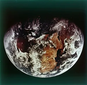
Earth from space - Africa, c1980s. Creator: NASAEarth from space - Africa, c1980s. Planet Earth showing Africa and part of the Middle East, with Europe at the top
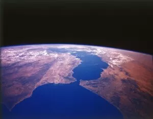
Earth from space - the Straits of Gibraltar, c1980s. Creator: NASAEarth from space - the Straits of Gibraltar, c1980s. The point where Europe and Africa meet: Gibraltar on the southern tip of Spain almost touches the coast of Morocco
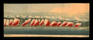
Crimson Cliffs, 1819. Creator: Daniel HavellCrimson Cliffs, 1819. A View of the Coloured Snow in Lat. 76. 25N. & Long. 65. W. Unusually coloured landscape in the North Atlantic
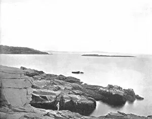
Along the Coast, Bar Harbor, Maine, USA, c1900. Creator: UnknownAlong the Coast, Bar Harbor, Maine, USA, c1900. View of the Atlantic Ocean. From Scenic Marvels of the New World edited by Prof. Geo.R. Cromwell. [C.N.Greig & Co. c1900]
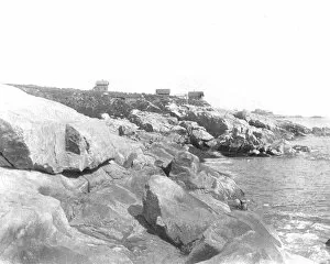
Shore Front, Marblehead, Massachusetts, USA, c1900. Creator: UnknownShore Front, Marblehead, Massachusetts, USA, c1900. English settlers established a fishing village here in the 1620s. Marblehead became a major shipyard
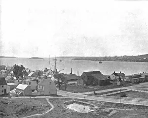
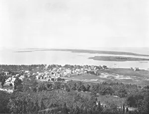
Halifax Harbour, Nova Scotia, from Dartmouth, Canada, c1900. Creator: UnknownHalifax Harbour, Nova Scotia, from Dartmouth, Canada, c1900. From Scenic Marvels of the New World edited by Prof. Geo.R. Cromwell. [C.N.Greig & Co. c1900]
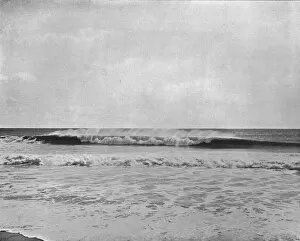
The Combing Wave, New Jersey Coast, USA, c1900. Creator: UnknownThe Combing Wave, New Jersey Coast, USA, c1900. From Scenic Marvels of the New World edited by Prof. Geo.R. Cromwell. [C.N.Greig & Co. c1900]
Sandy Hook, from Highland Light, New Jersey, USA, c1900. Creator: UnknownSandy Hook, from Highland Light, New Jersey, USA, c1900. Town located on a barrier spit of land 9.7 km long at the north end of the Jersey Shore
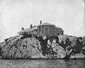
Brentons Grove, Newport, Rhode Island, USA, c1900. Creator: UnknownBrentons Grove, Newport, Rhode Island, USA, c1900. House built on a rocky outcrop overlooking the sea at Narragansett Bay. From Scenic Marvels of the New World edited by Prof. Geo.R. Cromwell
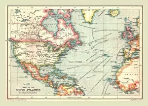
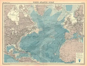
Chart of the North Atlantic, 1902. Creator: UnknownChart of the North Atlantic, 1902. Showing North and Central America, West Africa and Western Europe, and transatlantic shipping routes. From The Century Atlas of the World. [John Walker & Co, Ltd
The Beach at Atlantic City, New Jersey, USA, c1900. Creator: UnknownThe Beach at Atlantic City, New Jersey, USA, c1900. Crowded beach with people paddling, and using parasols against the sun. From Scenic Marvels of the New World edited by Prof. Geo.R. Cromwell
Map of the North Atlantic Ocean. Map showing western Europen and Iceland, Greenland, eastern Canada and the United States, Central American and the Caribbean, and West Africa
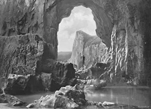
Lydstep Natural Arch, Tenby, c1896. Artist: Harvey BartonLydstep Natural Arch, Tenby, c1896. From Pictorial England and Wales. [Cassell and Company, Limited, London, Paris & Melbourne, c1896]
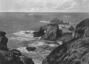
The Lands End, c1896. Artist: Frith & CoThe Lands End, c1896. From Pictorial England and Wales. [Cassell and Company, Limited, London, Paris & Melbourne, c1896]
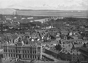
Swansea, c1896. Artist: Valentine & SonsSwansea, c1896. From Pictorial England and Wales. [Cassell and Company, Limited, London, Paris & Melbourne, c1896]
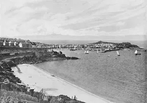
St. Ives, Cornwall, c1896. Artist: Frith & CoSt. Ives, Cornwall, c1896. From Pictorial England and Wales. [Cassell and Company, Limited, London, Paris & Melbourne, c1896]
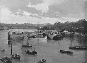
Newquay Harbour, c1896. Artist: Frith & CoNewquay Harbour, c1896. From Pictorial England and Wales. [Cassell and Company, Limited, London, Paris & Melbourne, c1896]
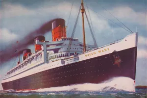
The Mighty Atlantic Record Breaker, the Queen Mary, 1937The Mighty Atlantic Record Breaker. Within a little more than three months of maiden voyage in May 1936, the Queen Mary had broken six Atlantic speed records, and had won the Blue Riband, 1937
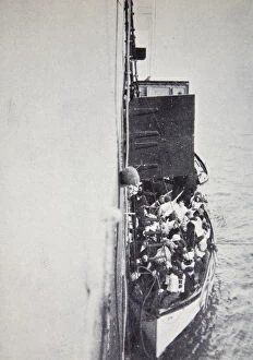
View from the Carpathia of a lifeboat from the Titanic brought alongside, 15 April, 1912. Operated by the White Star Line, RMS Titanic was the largest and most luxurious ocean liner of her time
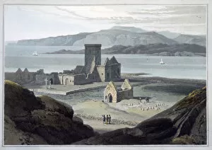
The Cathedral at Iona, Argyll and Bute, Scotland, 1817. Artist: William DaniellThe Cathedral at Iona, Argyll and Bute, Scotland, 1817. Iona is considered to be the place from which Christianity spread to Scotland after St Columba founded a monastery on the island in 563
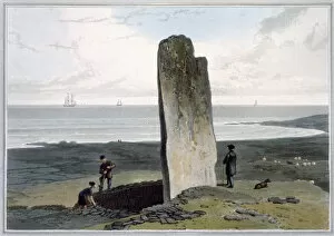
Druidical Stone at Strather near Barvas, Isle of Lewis, Hebrides, Scotland, 1820. From A Voyage Around Great Britain Undertaken between the Years 1814 and 1825 by William Daniell
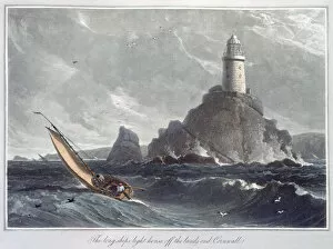
The Longships Lighthouse off the Lands End, Cornwall, 1814. Artist: William DaniellThe Longships Lighthouse off the Lands End, Cornwall, 1814. View of the original Longships Lighthouse, built in 1795. The light was obscured in high seas
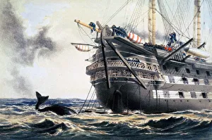
HMS Agamemnon laying the original Atlantic telegraph cable, 1857 (1866). ArtistHMS Agamemnon laying the original Atlantic telegraph cable, 1857 (1866). HMS Agamemnon was the first warship to be built with screw propulsion
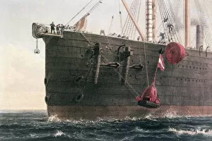
The laying of the transatlantic telegraph cable, August 8th, 1866. Artist: Robert DudleyThe laying of the transatlantic telegraph cable, August 8th, 1866. The launching of the buoy marking the spot where the cable had been grappled
Map of the British Isles, 1910. From The British Isles in Pictures, by H. Clive Barnard, M.A. D.Lit. [A. & C. Black, Limited, London, 1910]
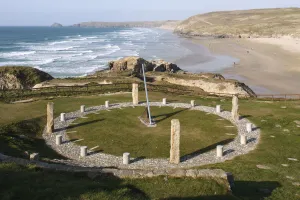
Millennium Sundial, Perranporth, Cornwall, 2009
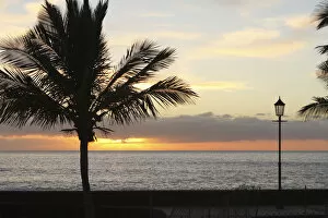
Sunset over the sea, Tazacorte, La Palma, Canary Islands, Spain, 2009
Santa Cruz de la Palma from Los Cancajos, La Palma, Canary Islands, Spain, 2009
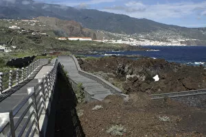
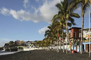
Puerto Naos, La Palma, Canary Islands, Spain, 2009
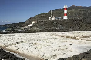
Faro de Fuencaliente lighthouses, La Palma, Canary Islands, Spain, 2009
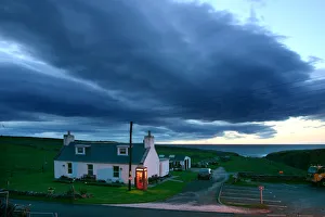
Durness, after a storm, Highland, Scotland. Durness is on the far northern coast of Scotland
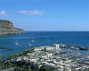
Puerto de Mogan, Gran Canaria, Canary Islands
Breakwater, Puerto de Mogan, Gran Canaria, Canary Islands