mail_outline sales@mediastorehouse.com
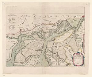
Map of the surroundings of Zandvliet, 1642. Creator: Willem BlaeuMap of the surroundings of Zandvliet, 1642. The north on the left, the borders coloured, cities, buildings and flags indicated. At the top left Explanation of the symbols on the map
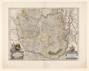
Map of Brabant, 1631. Creator: Willem BlaeuMap of Brabant, 1631. Map of the Duchy of Brabant. At the bottom right the scale in German miles. Bottom left the title between sphinxes, above it the coat of arms and woman with staff
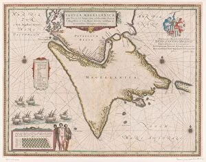
Map of the Strait of Magellan, 1635-1664. Creator: Willem BlaeuMap of the Strait of Magellan, 1635-1664. At the top right a coat of arms
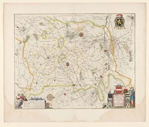
Map of Brabant, 1635. Creator: Michael van LangrenMap of Brabant, 1635. Prima pars Brabantiae cuius caput Lovanivm'. Top right: a coat of arms; bottom right: title in a cartouche with King David playing the harp
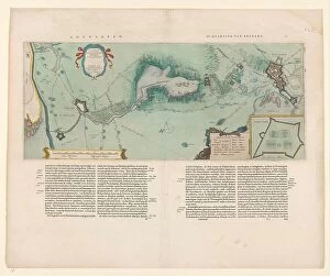
Map of the area between Bergen op Zoom and Steenbergen, 1630. Creator: Franciscus van SchootenMap of the area between Bergen op Zoom and Steenbergen, 1630. Tabula Bergarum ad Zomam Stenbergae'. Showing fortresses, trees, hills, harbours, areas susceptible to flooding
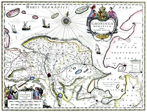
Map of Groningen, Netherlands, 17th century. A map of the Dutch province of Groningen, published by Willem Blaeu after the original design by Barthold Wicheringe
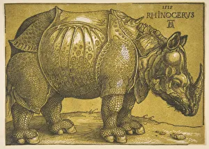
The Rhinoceros, after 1620. Creator: Albrecht DurerThe Rhinoceros, after 1620
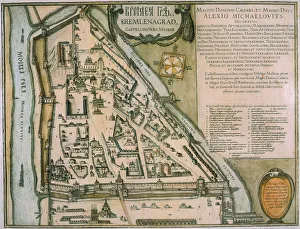
Map of the Moscow Kremlin (Castellum Urbis Moskvae), Russia, 1597. Artist: Willem BlaeuMap of the Moscow Kremlin (Castellum Urbis Moskvae), Russia, 1597. Found in the collection the State Museum of History, Moscow