mail_outline sales@mediastorehouse.com
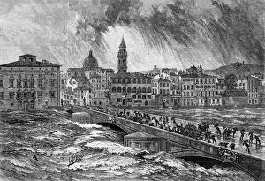
The late flood of the Arno at Florence – from a sketch by E. W. Cooke, R.A., 1864. Creator: Mason JacksonThe late flood of the Arno at Florence - from a sketch by E. W. Cooke, R.A., 1864. View of '...the flood which visited that city from the sudden rise of the river Arno
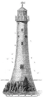
New Lighthouse on Bishop Rock, Scilly Islands, 1858. Creator: UnknownNew Lighthouse on Bishop Rock, Scilly Islands, 1858. It is built upon the Bishop, one of the clusters of rocks on the west of the Scilly Islands...The rock is so narrow that it was necessary in one
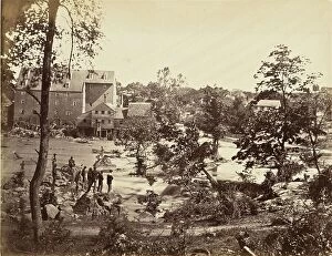
Johnson's Mill, Petersburg, VA. 1865. Creator: Tim O'SullivanJohnson's Mill, Petersburg, VA. 1865
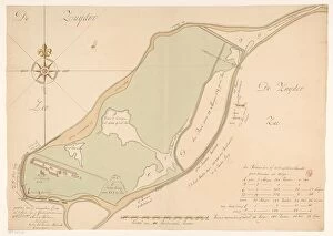
Map of the island of Urk, 1720. Creator: Maurits WalravenMap of the island of Urk, 1720. Map hand-drawn in 1720 by surveyor Maurits Walraven based on two anonymous maps. Bottom centre: scale of 160 Rhineland rods
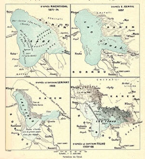
'Variations du Tchad; L'Ouest Africain, 1914. Creator: Unknown'Variations du Tchad; L'Ouest Africain, 1914. From "Grande Geographie Bong Illustree", 1914
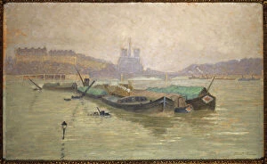
Ile Saint-Louis and Notre-Dame, seen from the Austerlitz bridge, c1910. Creator: Georges-Emile CaretteIle Saint-Louis and Notre-Dame, seen from the Austerlitz bridge, c1910
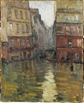
Rue Maitre-Albert (1910 floods), 1910. Creator: Germain Eugene BonnetonRue Maitre-Albert (1910 floods), 1910
Rue du Haut-Pavé towards the Quai de Montebello (floods of 1910), 1910. Creator: Germain Eugene BonnetonRue du Haut-Pave towards the Quai de Montebello (floods of 1910), 1910
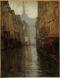
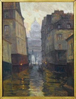
Rue du Haut-Pavé towards Place Maubert (floods from 1910), 1910. Creator: Germain Eugene BonnetonRue du Haut-Pave towards Place Maubert (floods from 1910), 1910
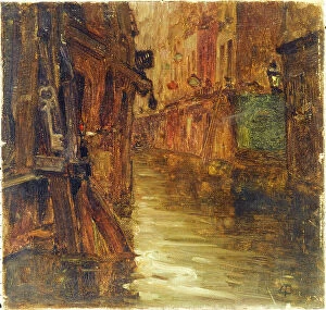
Rue de Bièvre, view of boulevard Saint-Germain (1910 floods), 1910. Creator: Germain Eugene BonnetonRue de Bievre, view of boulevard Saint-Germain (1910 floods), 1910
"The Barrage of the Nile", 1854. Creator: Unknown. "The Barrage of the Nile", 1854"The Barrage of the Nile", 1854. Dam across the River Nile in Egypt. A large passage is kept close to the Eastern shore, for the steamers
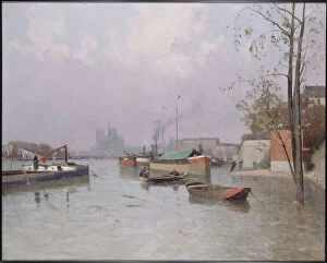
Flood of the Seine, near the Saint-Martin canal, in November 1896. Creator: Gustan Le Senechal de KerdreoretFlood of the Seine, near the Saint-Martin canal, in November 1896
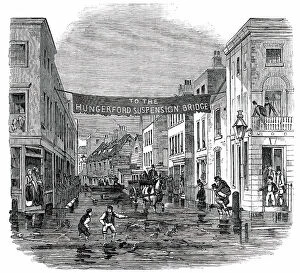
Overflow of the Thames on Tuesday - Lambeth-Stairs, 1850. Creator: UnknownOverflow of the Thames on Tuesday - Lambeth-Stairs, [London], 1850....the tide rose so extraordinarily high, as to overflow the banks of the river
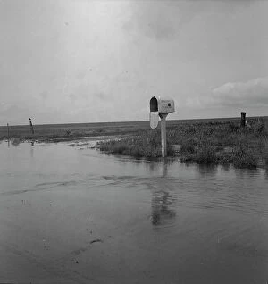
This year (1937) there are floods and heavy rains in the Dust Bowl, Texas, 1937. Creator: Dorothea LangeThis year (1937) there are floods and heavy rains in the Dust Bowl. Texas
The High Tide - Overflow of the Thames on Tuesday - Vine-Street, York-Road, Lambeth, 1850. Creator: UnknownThe High Tide - Overflow of the Thames on Tuesday - Vine-Street, York-Road, Lambeth, [London], 1850....the tide rose so extraordinarily high
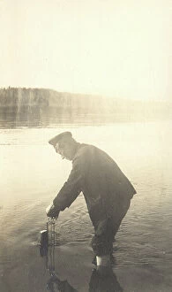
The moment of measuring the water level at the Inorogda hydrometric station, 1909. Creator: Vladimir Ivanovich FedorovThe moment of measuring the water level at the Inorogda hydrometric station, 1909. Amur Oblast Museum of Regional History and Folklife
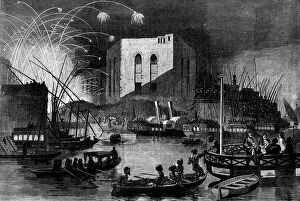
A night scene on the Nile near the mouth of the Cairo canal, during the festival of Gebr... 1862. Creator: UnknownA night scene on the Nile near the mouth of the Cairo canal, during the festival of Gebr-el-Haleeg, or breaking the canal, 1862
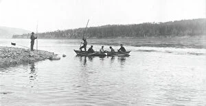
The moment of taking measurements of the river depth from a boat, 1909. Creator: Vladimir Ivanovich FedorovThe moment of taking measurements of the river depth from a boat, 1909. Amur Oblast Museum of Regional History and Folklife
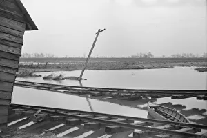
Tennessee farmhouse near Ridgeley after flood had subsided, 1937. Creator: Walker EvansTennessee farmhouse near Ridgeley after flood had subsided
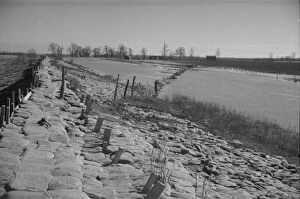
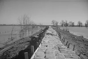
The Bessie Levee, along a subsidiary... Mississippi River, near Tiptonville, Tennessee, 1937. Creator: Walker EvansThe Bessie Levee, along a subsidiary of the Mississippi River, near Tiptonville, Tennessee. The levee has been augmented with sand bags during the 1937 flood
The Bessis Levee, along a subsidiary of the Mississippi River, near Tiptonville, Tennessee, 1937. Creator: Walker EvansThe Bessie Levee, along a subsidiary of the Mississippi River, near Tiptonville, Tennessee. The levee has been augmented with sand bags during the 1937 flood
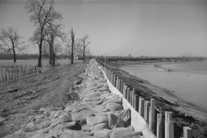
The Bessie Levee augmented with sand bags during the 1937 flood, Near Tiptonville, Tennessee, 1937The Bessie Levee augmented with sand bags during the 1937 flood. Near Tiptonville, Tennessee
The Bessie Levee augmented with sand bags during the 1937 flood near Tiptonville, Tennessee, 1937The Bessie Levee augmented with sand bags during the 1937 flood near Tiptonville, Tennessee
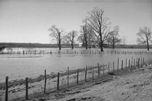
Farmyard covered with flood waters near Ridgeley, Tennessee, 1937. Creator: Walker EvansFarmyard covered with flood waters near Ridgeley, Tennessee
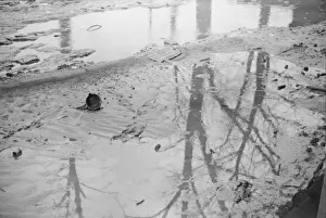
Possibly: Farmyard covered with flood waters near Ridgeley, Tennessee, 1937. Creator: Walker Evans[Untitled photo, possibly related to: Farmyard covered with flood waters near Ridgeley, Tennessee]
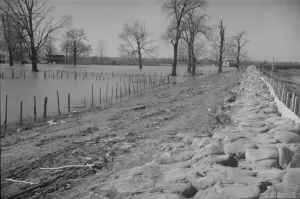
The Bessie Levee, along a subsid... Mississippi River, near Tiptonville, Tennessee, 1937. Creator: Walker EvansThe Bessie Levee, along a subsidiary of the Mississippi River, near Tiptonville, Tennessee. The levee has been augmented with sand bags during the 1937 flood
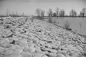
The Bessie Levee augmented with sand bags, near Tiptonville, Tennessee, 1937. Creator: Walker EvansThe Bessie Levee augmented with sand bags during the 1937 flood near Tiptonville, Tennessee
Carp, from the Fish from American Waters series (N8) for Allen &Carp, from the Fish from American Waters series (N8) for Allen & Ginter Cigarettes Brands, 1889
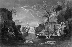
The same day were all the fountains of the great deep broken up... mid 19th centuryThe same day were all the fountains of the great deep broken up, and the windows of heaven were opened, mid 19th century. Biblical scene