mail_outline sales@mediastorehouse.com
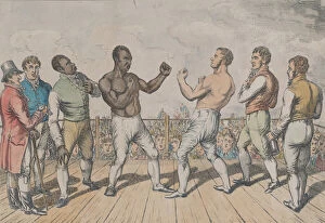
The Battle Between Cribb and Molineaux, September 28, 1811, October 3, 1811. Cribbs second was John Gully and his bottle-holder Joe Ward
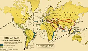
The World in the Elizabethan Era, 1926. Creators: Unknown, Emery Walker LtdThe World in the Elizabethan Era, 1926. Map of the world during the reign of Queen Elizabeth I (1558-1603). The key shows: Mediaeval Trade routes, (the shipping in Asiatic seas was oriental)
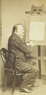
George Cruikshank, 1860 / 69. Creator: W. Walker & SonsGeorge Cruikshank, 1860/69. [Portrait of the British caricaturist and illustrator]. Albumen print (carte-de-visite)
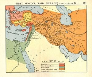
First Mongol Raid (Hulagu), circa 1400 A. D. c1915. Creator: Emery Walker LtdFirst Mongol Raid (Hulagu), circa 1400 A.D. c1915. Map of civilisations in the Middle East during the early 15th century: Byzantine, other Christian states, Bahri Mamluks
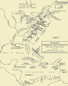
English American Settlements - latter part of 17th Century, 1926. Creators: UnknownEnglish American Settlements - latter part of 17th Century, 1926. Map of the eastern coast of North America, the Caribbean and the north coast of South America, showing areas settled by Europeans
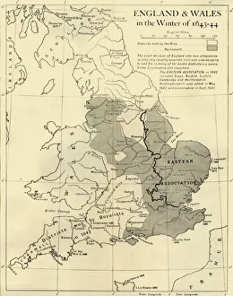
England & Wales in the Winter of 1643-44, 1926. Creators: Unknown, Emery Walker LtdEngland & Wales in the Winter of 1643-44, 1926. Map showing England and Wales during the Civil War period. The key shows districts held by the king (Charles I), and by parliament
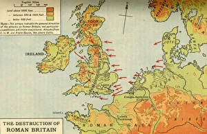
The Destruction of Roman Britain, 1926. Creators: Unknown, Emery Walker LtdThe Destruction of Roman Britain, 1926. Map of Britain showing invasions towards the end of the Roman period (43 to 410 AD)
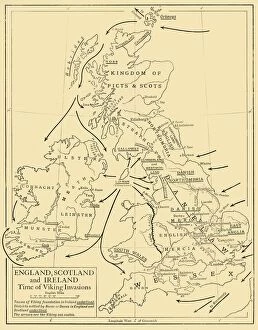
England, Scotland and Ireland - Time of Viking Invasions, 1926. Creators: UnknownEngland, Scotland and Ireland - Time of Viking Invasions, 1926. Map of Britain during the 9th-11th century. Towns of Viking foundation in Ireland underlined
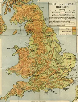
Celtic and Roman Britain, 1926. Creator: Emery Walker LtdCeltic and Roman Britain, 1926. Map of Britain during the Roman (43 to 410 AD) and Celtic periods. All the forts and towns here marked had roads to them, even in the Welsh mountains