mail_outline sales@mediastorehouse.com
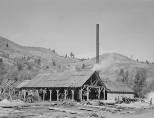
Possibly: The sawmill, Ola self-help sawmill co-op, Gem County, Idaho, 1939. Creator: Dorothea Lange[Untitled, possibly related to: The sawmill. Ola self-help sawmill co-op. Gem County, Idaho]
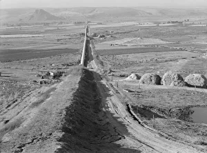
The longest siphon in the world crosses the Malheur Valley, Malheur County, Oregon, 1939. Creator: Dorothea LangeThe longest siphon in the world crosses the Malheur Valley. It carries water to the bench land beyond a division of the project called Dead Ox Flat. Malheur County, Oregon-67
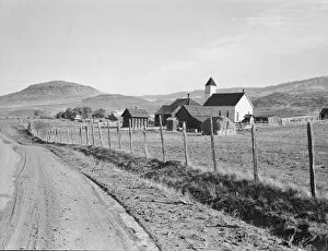
The Carlock farmstead, Gem County, Idaho, 1939. Creator: Dorothea LangeThe Carlock farmstead. Mr. Carlock is a member of Ola self-help sawmill co-op. Gem County, Idaho
Possibly: Upper end of Squaw Creek Valley... Ola self-help sawmill co-op, Gem County, Idaho, 1939[Untitled, possibly related to: Upper end of Squaw Creek Valley near the mill, showing part of the timber resources. Ola self-help sawmill co-op. Gem County, Idaho]
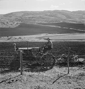
Possibly: Young Idaho farmer plowing in the fall of the year... Gem County, Idaho, 1939. Creator: Dorothea Lange[Untitled, possible realted to: Young Idaho farmer plowing in the fall of the year while the other members of the Ola self-help sawmill co-op are working in the sawmill
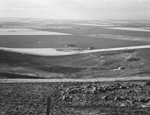
Looking across the Malheur Valley from Lincoln Bench, Malheur County, Oregon, 1939. Creator: Dorothea LangeLooking across the Malheur Valley from Lincoln Bench. Malheur County, Oregon
Siphon - the worlds longest - which carries water 5 miles to Dead Ox Flat, Oregon, 1939. Creator: Dorothea Lange[Untitled, possibly related to: Siphon--the worlds longest--which carries water five miles to Dead Ox Flat. It is eight feet in diameter. Malheur County, Oregon]
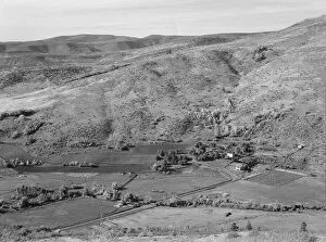
View of the valley from Dazey farm, Homedale district, Malheur County, Oregon, 1939. Creator: Dorothea LangeView of the valley from Dazey farm. Homedale district, Malheur County, Oregon
Looking down the newly plowed wheat fields of the Umatilla Valley, Oregon, 1939. Creator: Dorothea LangeLooking down the newly plowed wheat fields of the Umatilla Valley, Oregon. Thirteen miles south of Pendleton, Umatilla County, Oregon
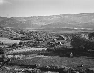
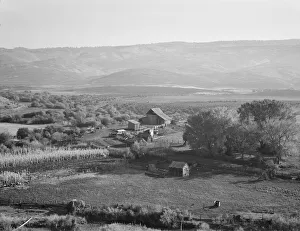
Squaw Valley farm, Gem County, Idaho, 1939. Creator: Dorothea LangeSquaw Valley farm. 640 acres, with sixty in tillable land, raises mainly livestock, Established about fifty years ago. Note shackes on small building in foreground
A new house for descendant of old Idaho... Ola self-help sawmill co-op, Gem County, Idaho, 1939A new house for descendant of old Idaho family, now a member of Ola self-help sawmill co-op. Gem County, Idaho. Lumber was supplied by the mill
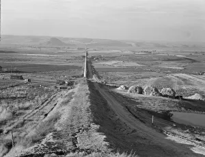
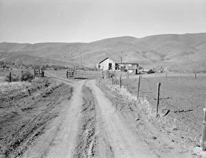
Voting farmers in Squaw Creek Valley, entering Ola, Gem County, Idaho, 1939. Creator: Dorothea LangeEntering Ola, Gem County, Idaho. Voting farmers in Squaw Creek Valley number 185, town population about 30. Ola self-help co-op. See general capttion 48
Squaw Valley farm, 640 acres, with sixty in tillable land... Gem County, Idaho, 1939. Creator: Dorothea LangeSquaw Valley farm. 640 acres, with sixty in tillable land, raises mainly livestock, Established about fifty years ago. Note shackes on small building in foreground
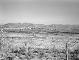
View of small valley, dry farming, Gem County, Idaho, 1939. Creator: Dorothea LangeView of small valley, dry farming. Gem County, Idaho
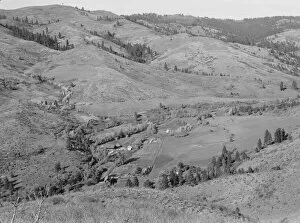
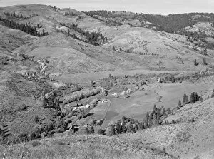
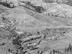
Upper end of Squaw Creek Valley... Ola self-help sawmill co-op, Gem County, Idaho, 1939. Creator: Dorothea LangeUpper end of Squaw Creek Valley near the mill, showing part of the timber resources. Ola self-help sawmill co-op. Gem County, Idaho
Possibly: Looking down on Ola self-help co-op mill showing the upper end[Untitled, possibly related to: Looking down on Ola self-help co-op mill showing the upper end of Squaw Creek Valley, the creek lined with trees, the new dry shed near the mill
Looking down on Ola self-help co-op mill showing the upper end of Squaw... Gem County, Idaho, 1939Looking down on Ola self-help co-op mill showing the upper end of Squaw Creek Valley, the creek lined with trees, the new dry shed near the mill
Umatilla Valley wheat farms, Umatilla County, Oregon, 1939. Creator: Dorothea LangeUmatilla Valley wheat farms. Umatilla County, Oregon
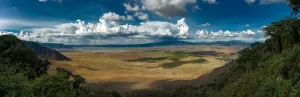
Ngorongoro Crater. Creator: Viet ChuNgorongoro Crater
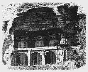
View of the Cavern of Tirthankars, near Gwalior, c1891. Creator: James GrantView of the Cavern of Tirthankars, near Gwalior, c1891. From " Cassells Illustrated History of India Vol. I.", by James Grant. [Cassell Petter & Galpin, London, Paris and New York]
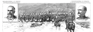
Notes in the Black Mountains and Sikkim Campaign s, Northern India; Northumberland Fusiliers fordi Creator: UnknownNotes in the Black Mountains and Sikkim Campaign s, Northern India; Northumberland Fusiliers fording the River Sirun, 1888. From, The Graphic. An Illustrated Weekly Newspaper Volume 38
Into the Valley. Creator: Robert MannoInto the Valley
Well, Hello. Creator: Joshua JohnstonWell, Hello
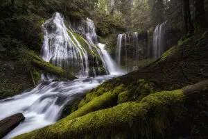
Panther Creek Falls. Creator: Joshua JohnstonPanther Creek Falls
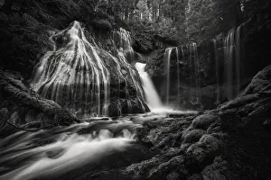
Panther Creek Falls BW. Creator: Joshua JohnstonPanther Creek Falls BW
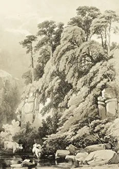
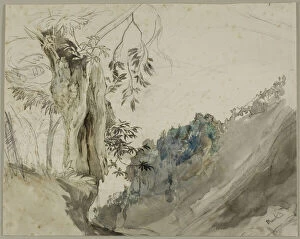
Wych Elm and Firs, from The Park and the Forest, 1841. Creator: James Duffield HardingWych Elm and Firs, from The Park and the Forest, 1841
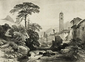
Le Casset; Vallee du Monetier, n. d. Creator: James Duffield HardingLe Casset; Vallee du Monetier, n.d
Val of Shanganagh, Killiney, August 1843. Creator: Elizabeth MurrayVal of Shanganagh, Killiney, August 1843
On the way from Val Oscuro to Nice, March 8, 1842. Creator: Elizabeth MurrayOn the way from Val Oscuro to Nice, March 8, 1842
The Lauterbrunnen, 1908. Creator: Donald Shaw MacLaughlanThe Lauterbrunnen, 1908
Study for Vignette in AbbeDinouarts "Vie du Venerable don Juan deStudy for Vignette in Abbe Dinouarts " Vie du Venerable don Juan de Palafox", p. 391, c. 1767
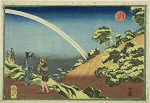
Surugadai, from the series "Famous Places in the Eastern Capital (Toto Meisho)"Surugadai, from the series " Famous Places in the Eastern Capital (Toto Meisho)", c. 1832/33
Spanish Chestnut, n. d. Creator: John RuskinSpanish Chestnut, n.d
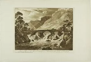
Pont y Pair Over the River Conway Above Llanrwst in the County of Denbigh, 1776
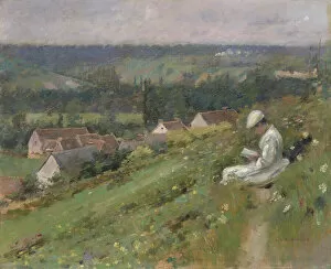
The Valley of Arconville, c. 1887. Creator: Theodore RobinsonThe Valley of Arconville, c. 1887. Landscape in Giverny, France
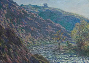
The Petite Creuse River, 1889. Creator: Claude MonetThe Petite Creuse River, 1889
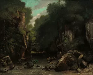
The Valley of Les Puits-Noir, 1868. Creator: Gustave CourbetThe Valley of Les Puits-Noir, 1868
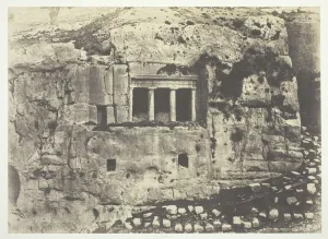
Jerusalem, Valley of Josaphat, Tomb of St. James (Jerusalem, Vallee de Josaphat, Tombeau de Saint Jacques), 1854, printed 1856. Salted paper print
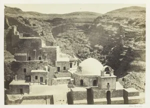
Convent of Mar-Saba, Near Jerusalem, 1857. Creator: Francis FrithConvent of Mar-Saba, Near Jerusalem, 1857. Albumen print, pl. 11 from the album " Egypt and Palestine, volume ii" (1858/60)
Summer, 1897. Creator: Slavicek, Antonin (1870-1910)Summer, 1897. Private Collection
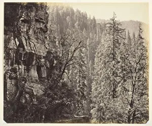
Untitled [cliffs and trees], c. 1865. Creator: Samuel BourneUntitled [cliffs and trees], c. 1865. [View in Narkunda Forest, Chini Valley, Himalayas, India]. Albumen print
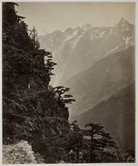
Untitled [hillside and mountains], c. 1865. Creator: Samuel BourneUntitled [hillside and mountains], c. 1865. [Sutlej Valley in the Chini region of India]. Albumen print
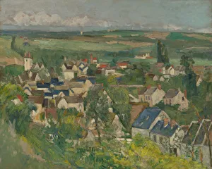
Auvers, Panoramic View, 1873 / 75. Creator: Paul CezanneAuvers, Panoramic View, 1873/75
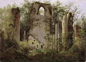
Monastery ruin Eldena near Greifswald, ca 1825. Creator: FriedrichMonastery ruin Eldena near Greifswald, ca 1825. Found in the Collection of the Staatliche Museen, Berlin
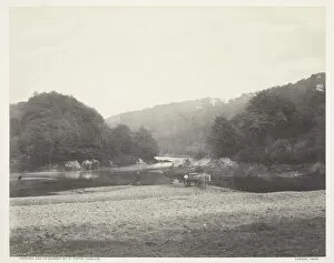
View of the Ribble, Yorkshire, c. 1860, printed c. 1870. Creator: Roger FentonView of the Ribble, Yorkshire, c. 1860, printed c. 1870. A work made of albumen print
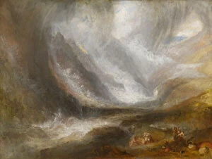
Valley of Aosta: Snowstorm, Avalanche, and Thunderstorm, 1836 / 37. Creator: JMW TurnerValley of Aosta: Snowstorm, Avalanche, and Thunderstorm, 1836/37
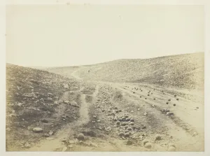
The Valley of the Shadow of Death, 1855. Creator: Roger FentonThe Valley of the Shadow of Death, 1855. A work made of salted paper print, plate 8 from the album " photographs taken in the crimea" (1856)
Pike Pool, Beresford Dale, 1880s. Creator: Peter Henry EmersonPike Pool, Beresford Dale, 1880s. A work made of photogravure, plate l from the album " the compleat angler or the contemplative mans recreation, volume ii" (1888); edition 109/250