mail_outline sales@mediastorehouse.com
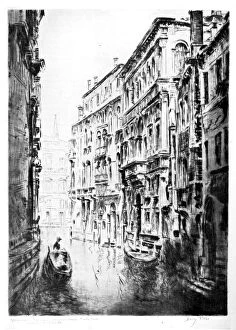
Grimari Canal, Venice, 1930. Artist: JF Barry PittarGrimari Canal, Venice, 1930. Illustration from Apollo, A Journal of the Arts, (London 1930)
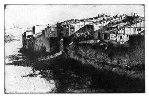
Miranda de Ebro, 1925. Artist: Ernest Stephen LumsdenMiranda de Ebro, 1925. View of a town on the river Ebro in northern Spain. Illustration from Apollo, A Journal of the Arts, (London 1925)
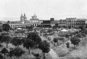
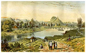
La Plata, Buenos Aires, Argentina, 1895
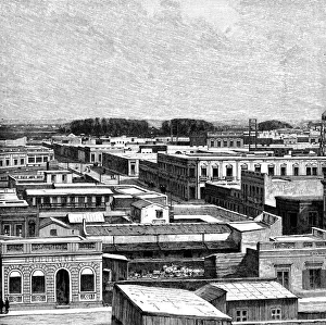
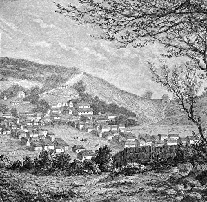
San Miguel de Tucuman, Argentina, 1895. From The Universal Geography with Illustrations and Maps, division XXXVIII, written by Elisee Reclus and published by Virtue & Co. Limited (London, 1895)
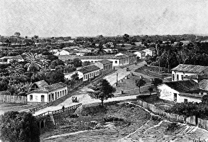
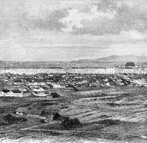
Manaos, Brazil, 1895. Artist: TaylorManaos, Brazil, 1895. As seen from the suburbs. From The Universal Geography with Illustrations and Maps, division XXXVIII, written by Elisee Reclus and published by Virtue & Co
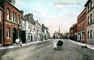
The Broadway, St Ives, Cambridgeshire, early 20th century. Artist: Valentine & SonsThe Broadway, St Ives, Cambridgeshire, early 20th century
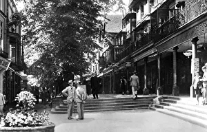
The Pantiles, Tunbridge Wells, Kent, early 20th century
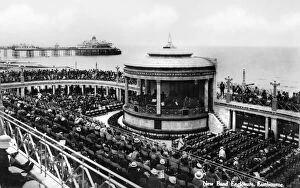
The new band enclosure, Eastbourne, East Sussex, early 20th century
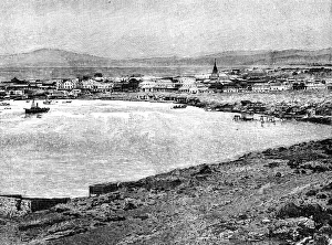
Caldera, Chile, 1895. From The Universal Geography with Illustrations and Maps, division XXXVI, written by Elisee Reclus and published by Virtue & Co. Limited (London, 1895)
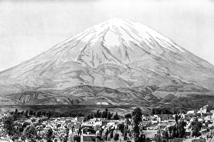
Arequipa and Mount Misti, Peru, 1895. From The Universal Geography with Illustrations and Maps, division XXXVI, written by Elisee Reclus and published by Virtue & Co. Limited (London, 1895)
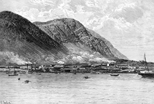
Willemsted, Curacao, Netherlands antilles, 1895. Artist: T TaylorWillemsted, Curacao, Netherlands antilles, 1895. From The Universal Geography with Illustrations and Maps, division XXXVI, written by Elisee Reclus and published by Virtue & Co. Limited (London, 1895)
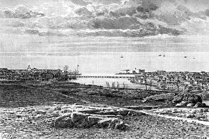
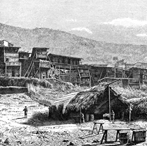
Tocopilla, c1890. Artist: T TaylorTocopilla, c1890. The Universal Geography with Illustrations and Maps, Division XXXVI, Virtue & Co Limited, London, c1890
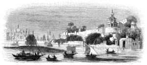
General view of Nanking, c1890. The town of Nanjing in China. Illustration from The Universal Geography with Illustrations and Maps, Division XIII, (Virtue & Co Limited, London, c1890)
Shui-Kow, on the Upper Min, Fokien, c1890. View of a town on the River Min in Fukien, China. Illustration from The Universal Geography with Illustrations and Maps, Division XIII
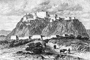
The Potala palace in Lhasa, Tibet, in the 17th century, (c1890)The Potala palace in Lhasa, Tibet, in the 17th century, Illustration from The Universal Geography with Illustrations and Maps, Division XIII, (Virtue & Co Limited, London, c1890)
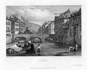
Namur, Belgium, 1830. Artist: William FindenNamur, Belgium, 1830
Algiers in 1832, (c1890). Illustration from The Universal Geography with Illustrations and Maps, Division XXI, (Virtue & Co Limited, London, c1890)
View of Ghardaia, Algeria, c1890. Artist: Armand KohlView of Ghardaia, Algeria, c1890. Illustration from The Universal Geography with Illustrations and Maps, Division XXI, (Virtue & Co Limited, London, c1890)
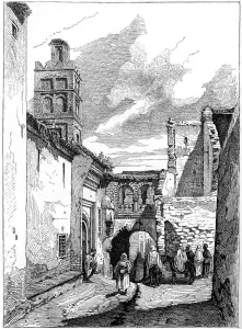
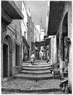
Street view in Tlemcen, Algeria, c1890. Illustration from The Universal Geography with Illustrations and Maps, Division XXI, (Virtue & Co Limited, London, c1890)
Nemours, Algeria, 1895. From The Universal Geography with Illustrations and Maps, division XXI, written by Elisee Reclus and published by Virtue & Co. Limited (London, 1895)
Old town, Algiers, c1890. Artist: Armand KohlOld town, Algiers, c1890. Illustration from The Universal Geography with Illustrations and Maps, Division XXI, (Virtue & Co Limited, London, c1890)
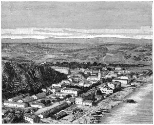
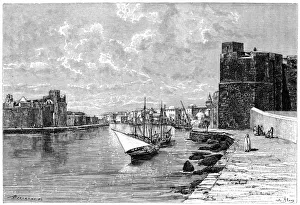
Bizerta, viewed from the Kasbah, c1890. Artist: BertrandBizerta, viewed from the Kasbah, c1890. The Tunisian port of Bizerta on the Mediterranean. Illustration from The Universal Geography with Illustrations and Maps, Division XXI, (Virtue & Co Limited)
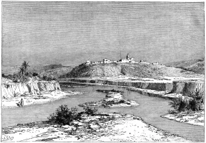
The Mejerda at Slugia, above Mejez-el-Bad, c1890. Artist: Armand KohlThe Mejerda at Slugia, above Mejez-el-Bad, c1890. The River Mejerda near Medjez-el-Bab, Tunisia. Illustration from The Universal Geography with Illustrations and Maps, Division XXI
View of Blida, Algeria, c1890. Artist: Armand KohlView of Blida, Algeria, c1890. Illustration from The Universal Geography with Illustrations and Maps, Division XXI, (Virtue & Co Limited, London, c1890)
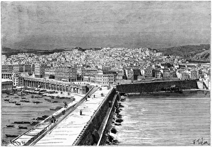
Algiers, Algeria, c1890. Artist: Armand KohlAlgiers, Algeria, c1890. View from the Kheir El-Din Pier. Illustration from The Universal Geography with Illustrations and Maps, Division XXI, (Virtue & Co Limited, London, c1890)
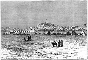
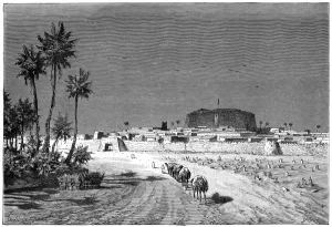
View of Murzuk, c1890. Artist: BarbantView of Murzuk, c1890. The town of Marzuq in Libya. Illustration from The Universal Geography with Illustrations and Maps, Division XXI, (Virtue & Co Limited, London, c1890)
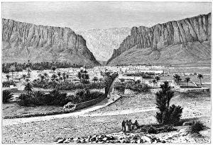
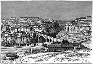
The El-Kantara Gorge, Tunisia, 1895. Artist: Armand KohlThe El-Kantara Gorge, Tunisia, 1895. From The Universal Geography with Illustrations and Maps, division XXI, written by Elisee Reclus and published by Virtue & Co. Limited (London, 1895)
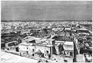
View of Kairwan, Tunisia, c1890. Artist: Armand KohlView of Kairwan, Tunisia, c1890. Illustration from The Universal Geography with Illustrations and Maps, Division XXI, (Virtue & Co Limited, London, c1890)
View of El Kef, Tunisia, c1890. Artist: HildibrandView of El Kef, Tunisia, c1890. Illustration from The Universal Geography with Illustrations and Maps, Division XXI, (Virtue & Co Limited, London, c1890)
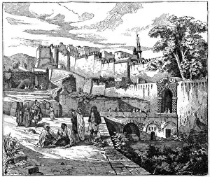
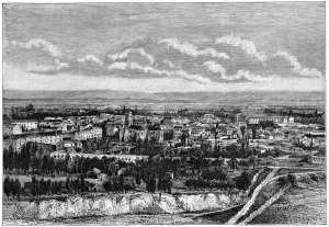
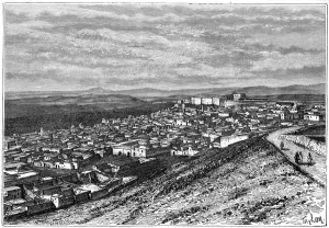
Constantine, Algeria, c1890. Artist: A KohlConstantine, Algeria, c1890. View of Constantine, taken from the Mansura route. Illustration from The Universal Geography with Illustrations and Maps, Division XXI, (Virtue & Co Limited, London)
Newport Castle and bridge, Newport, Wales, 1900. From The Life and Times of Queen Victoria by Robert Wilson (1900)
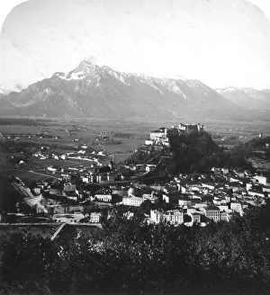
The Kapuzinerberg, Salzburg, Austria, c1900. Artist: Wurthle & SonsThe Kapuzinerberg, Salzburg, Austria, c1900. Stereoscopic card
General view of Kang-Hoa, Lower Hang-Kiang, c1890. Illustration from The Universal Geography with Illustrations and Maps, Division XIII, (Virtue & Co Limited, London, c1890)
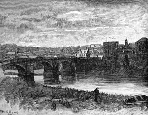
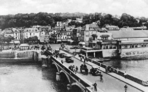
The bridge on the River Touques, Trouville, France, c1920s. The Queen of Beaches, French postcard
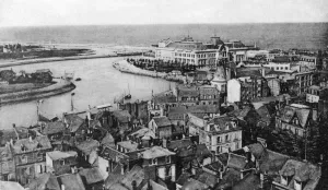
Trouville, France, c1920s. General view showing the casino and the River Touques estuary. The Queen of Beaches, French postcard
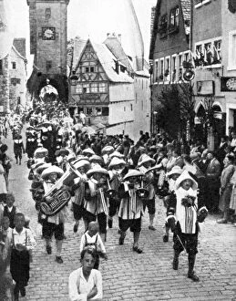
Festival in the medieval old town, Rothenburg ob der Tauber, Bavaria, Germany, 1936. From Peoples of the World in Pictures, edited by Harold Wheeler, published by Odhams Press Ltd (London, 1936)
Sandoway, Arakan, Myanmar, 19th century. Artist: C Kegan PaulSandoway, Arakan, Myanmar, 19th century
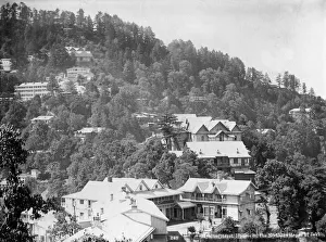
Elysium Hotel, houses on the nothern slopes of Jakko, Shimla, India, early 20th century
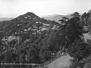
Longwood Hotel, Elysium Hill, Shimla hill range, India, early 20th century
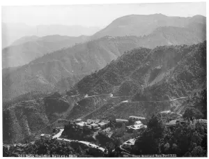
Sinauli village, with the Hindustan and the Tibet roads, Simla, India, early 20th century
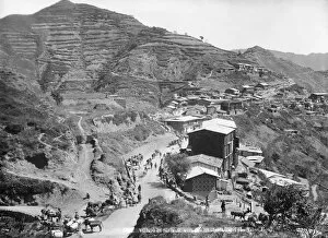
Old Tonga road from Kalka to Simla, India, early 20th century. Tonga road and Tara Devi Hill
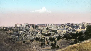
Urfa, Mesopotamia. View of Urfa, also known as Edessa, in what is now Turkey
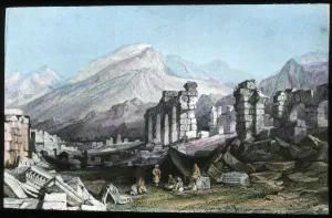
Ruins at Laodicea, Turkey
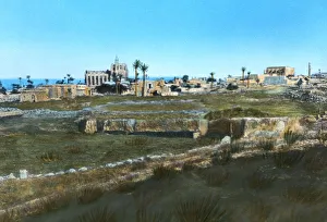
Sea road to the east, old Famagusta, Cyprus
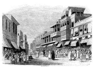
Bazaar in Bombay, India, 1847. Artist: KirchnerBazaar in Bombay, India, 1847. Market in Mumbai, with canopied balconies above. Illustration from The History of China and India, by Miss Corner, (Dean and Co, London, 1847)
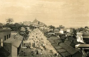
Town and fort of Agra, 1847. Artist: RobinsonTown and fort of Agra, India, 1847. Illustration from The History of China and India, by Miss Corner, (Dean and Co, London, 1847)
A street in Bombay, 1847. View of Mumbai during the British Empire period. Illustration from The History of China and India, by Miss Corner, (Dean and Co, London, 1847)
Town and fort of Trichinopoly, India, 1847. View of Tiruchirapalli, Tamil Nadu, during the British Empire period. Illustration from The History of China and India, by Miss Corner, (Dean and Co)