State Collection (page 8)
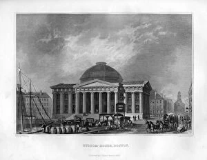
Custom House, Boston, Massachusetts, 1855. Artist: J Archer
Custom House, Boston, Massachusetts, 1855. Illustration from the History and Topography of the United States of North America, Volume II, by John Howard Hinton, published by Samuel Walker, (Boston)
All Professionally Made to Order for Quick Shipping