mail_outline sales@mediastorehouse.com
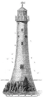
New Lighthouse on Bishop Rock, Scilly Islands, 1858. Creator: UnknownNew Lighthouse on Bishop Rock, Scilly Islands, 1858. It is built upon the Bishop, one of the clusters of rocks on the west of the Scilly Islands...The rock is so narrow that it was necessary in one
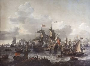
The Battle of the Zuider Zee, 1573, 1663. Creator: Jan Theunisz. BlanckerhoffThe Battle of the Zuider Zee, 1573, 1663
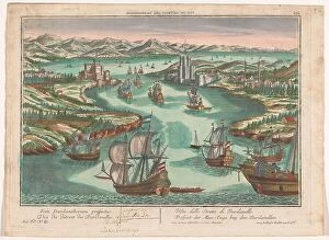
View of the Dardanelles Strait, 1742-1801. Creator: AnonView of the Dardanelles Strait, 1742-1801. On the left the European side with the castle Kilitbahir. On the right the Asian side with the Cimenlik castle
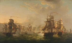
Clash of the Dutch and British Fleets during the Passage of the Dutch Flotilla to Boulogne (1804), 1806
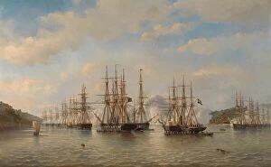
Dutch, English, French and American Squadrons in Japanese Waters during the Expedition led by the Fr CreatorDutch, English, French and American Squadrons in Japanese Waters during the Expedition led by the French Commander Constant Jaures, September 1864, 1864
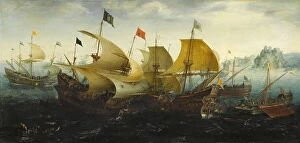
The Battle of Cadiz, 1608. Creator: Aert AnthoniszThe Battle of Cadiz, 1608. Other Title(s): The Battle of CadizIncident from the Battle of the Spanish Armada
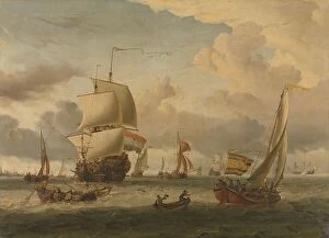
The Roads of Enkhuizen, 1654-1708. Creator: Abraham StorckThe Roads of Enkhuizen, 1654-1708
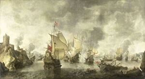
Battle of the Combined Venetian and Dutch Fleets against the Turks in the Bay of Foya, 1649, 1656
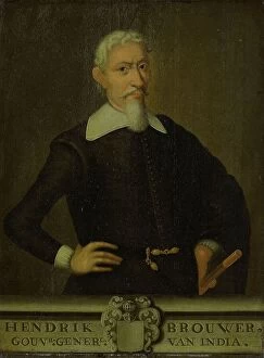
Portrait of Hendrik Brouwer, Governor-General of the Dutch East Indies, 1750-1800. Creator: UnknownPortrait of Hendrik Brouwer, Governor-General of the Dutch East Indies, 1750-1800
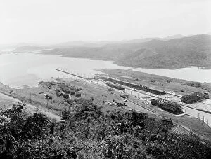
Pedro Miguel Locks, birdseye view, Panama Canal, between 1913 and 1920. Creator: UnknownPedro Miguel Locks, birdseye view, Panama Canal, between 1913 and 1920
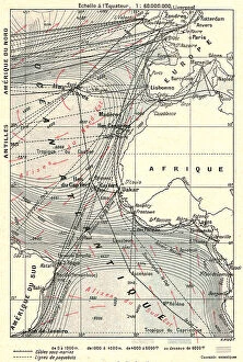
'Les routes l'Atlantique; L'Ouest Africain, 1914. Creator: Unknown'Les routes l'Atlantique; L'Ouest Africain, 1914. From "Grande Geographie Bong Illustree", 1914
"The Barrage of the Nile", 1854. Creator: Unknown. "The Barrage of the Nile", 1854"The Barrage of the Nile", 1854. Dam across the River Nile in Egypt. A large passage is kept close to the Eastern shore, for the steamers
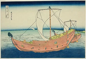
Sea Lane Off Kazusa Province (Kazusa no kairo), from the series "Thirty-six Views of... c. 1830/33Sea Lane Off Kazusa Province (Kazusa no kairo), from the series "Thirty-six Views of Mount Fuji (Fugaku sanjurokkei)", Japan, c. 1830/33
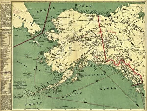
Millroy's map of Alaska and the Klondyke gold fields, 1897. Creator: J. J. MillroyMillroy's map of Alaska and the Klondyke gold fields, 1897. The Klondike Gold Rush of 1898 began in earnest within 18 months of a major gold strike on Bonanza Creek
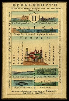
Abosko-B'erneborg Province, 1856. Creator: UnknownAbosko-B'erneborg Province, 1856. This card is one of a souvenir set of 82 illustrated cards-one for each province of the Russian Empire as it existed in 1856
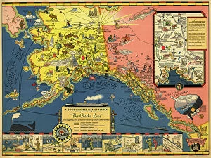
The Alaska Line, 1934. Creator: Alaska Steamship CoThe Alaska Line, 1934. This map, published in 1934 for the tourist market with colorful images and motifs, shows various shipping routes of the Alaska Line
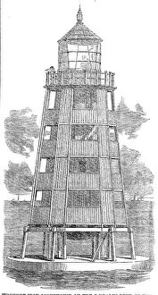
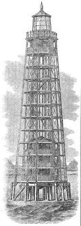
Wrought-iron lighthouse on the Daedalus Reef, in the Red Sea, 1862. Creator: UnknownWrought-iron lighthouse on the Daedalus Reef, in the Red Sea, 1862. The great intercourse which is carried on...by what is called the overland route, has made the Red Sea almost an English highway
Wrought-iron lighthouse on the Ushruffee Reef, in the Strait of Jubal, in the Red Sea, 1862. Creator: UnknownWrought-iron lighthouse on the Ushruffee Reef, in the Strait of Jubal, in the Red Sea, 1862. The great intercourse which is carried on...by what is called the overland route
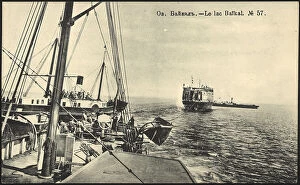
Lake Baikal, 1904-1917. Creator: UnknownLake Baikal, 1904-1917. National Library of Russia
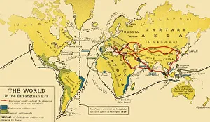
The World in the Elizabethan Era, 1926. Creators: Unknown, Emery Walker LtdThe World in the Elizabethan Era, 1926. Map of the world during the reign of Queen Elizabeth I (1558-1603). The key shows: Mediaeval Trade routes, (the shipping in Asiatic seas was oriental)
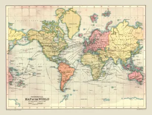
Commercial Map of the World, 1902. Creator: UnknownCommercial Map of the World, 1902. With shipping routes. From The Century Atlas of the World. [John Walker & Co, Ltd. London, 1902]
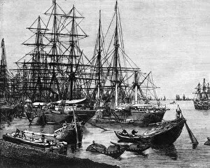
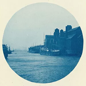
View of the Port of Calcutta, c1891. Creator: James GrantView of the Port of Calcutta, c1891. From " Cassells Illustrated History of India Vol. II.", by James Grant. [Cassell Petter & Galpin, London, Paris and New York]
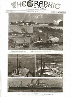
The Graphic, Front Cover Saturday July 14th. 1888, 1888. Creator: UnknownThe Graphic, Front Cover Saturday July 14th. 1888, 1888. From, The Graphic. An Illustrated Weekly Newspaper Volume38. July to December, 1888
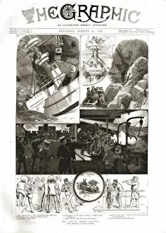
The Graphic, Front Cover Saturday August 25th. 1888, 1888. Creator: UnknownThe Graphic, Front Cover Saturday August 25th. 1888, 1888. From, The Graphic. An Illustrated Weekly Newspaper Volume 38. July to December, 1888
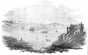
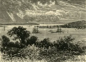
The Proposed Breakwater at Portland, 1844. Creator: UnknownThe Proposed Breakwater at Portland, 1844. Shipping off the coast near the Isle of Portland, Dorset. The Harbour of Refuge Commissioners having just completed a careful survey of Weymouth Bay
Port Scene on the Great Lakes, ca. 1895. Creator: UnknownPort Scene on the Great Lakes, ca. 1895
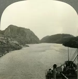
Gold Hill, Gaillard Cut, Panama Canal, c1930s. Creator: UnknownGold Hill, Gaillard Cut, Panama Canal, c1930s. Culebra, formerly Gaillard Cut, is an artificial valley forming part of the Panama Canal and was a great engineering feat of its time
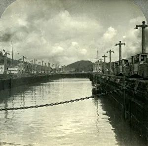
Through the Panama Canal, Pedro Miguel Locks, c1930s. Creator: UnknownThrough the Panama Canal, Pedro Miguel Locks, c1930s. Pedro Miguel Locks on the Panama Canal, one of the greatest engineering works ever undertaken when it opened in 1914
Falmouth Harbour, 1898. Creator: UnknownFalmouth Harbour, 1898. The third deepest natural harbour in the world, and the deepest in Western Europe. From " Our Own Country, Volume III"
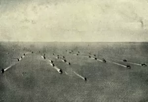
The Supremacy of the Seas, (1919). Creator: UnknownThe Supremacy of the Seas, (1919). Scene from the First World War, 1914-1919: The supremacy of the British Navy and Merchant Service finds apt illustration in the photograph of a convoy of merchant
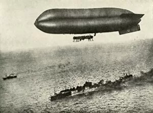
An Airship Escorting a Convoy, (1919). Creator: UnknownAn Airship Escorting a Convoy, (1919). An armed airship protects a convoy of ships, scene from the First World War, 1914-1919
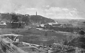
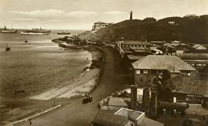
Steamer Point II. Aden, c1918-c1939. Creator: UnknownSteamer Point II. Aden, c1918-c1939. From an album of postcards
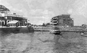
The Landing Stage. Aden, c1918-c1939. Creator: UnknownThe Landing Stage. Aden, c1918-c1939. From an album of postcards
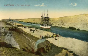
Kantara - The Suez Canal, c1918-c1939. Creator: UnknownKantara - The Suez Canal, c1918-c1939. From an album of postcards
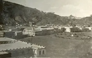
Steamer Point in Aden, c1918-c1939. Creator: UnknownSteamer Point in Aden, c1918-c1939. From an album of postcards
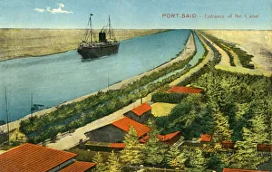
Port-Said - Entrance of the Canal, c1918-c1939. Creator: UnknownPort-Said - Entrance of the Canal, c1918-c1939. From an album of postcards
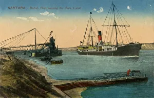
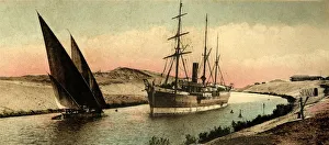
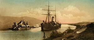
Kantara - British Ship passing the Suez Canal, c1918-c1939. Creator: UnknownKantara - British Ship passing the Suez Canal, c1918-c1939. From an album of postcards
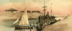
Canal of Suez - The curve of el-Guersh, c1918-c1939. Creator: UnknownCanal of Suez - The curve of el-Guersh, c1918-c1939. From an album of postcards
Post Office and Bay, Aden, c1918-c1939. Creator: UnknownPost Office and Bay, Aden, c1918-c1939. From an album of postcards
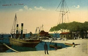
Ismailia - Lac Timsah, c1918-c1939. Creator: UnknownIsmailia - Lac Timsah, c1918-c1939. From an album of postcards
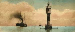
Canal of Suez. The bitter lakes - The north light-house, c1918-c1939. Creator: UnknownCanal of Suez. The bitter lakes - The north light-house, c1918-c1939. From an album of postcards
Canal of Suez - Tussun curve, c1918-c1939. Creator: UnknownCanal of Suez - Tussun curve, c1918-c1939. From an album of postcards
Canal of Suez - Chantier VI, c1918-c1939. Creator: UnknownCanal of Suez - Chantier VI, c1918-c1939. From an album of postcards
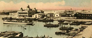
Port Said. - The entrance to the canal and Offices to the Company, c1918-c1939. From an album of postcards
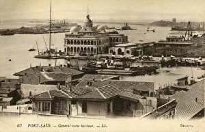
Port-Said. - General view harbour. - LL. c1918-c1939. Creator: UnknownPort-Said. - General view harbour. - LL. c1918-c1939. From an album of postcards
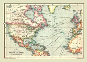
Chart of the North Atlantic, 1902. Creator: UnknownChart of the North Atlantic, 1902. Showing North and Central America, West Africa and Western Europe, and transatlantic shipping routes. From The Century Atlas of the World. [John Walker & Co, Ltd
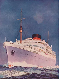
The Attractive Colouring of the Union Castle liner Stirling Castle, 1937. From Shipping Wonders of the World, Vol. II, edited by Clarence Winchester. [The Fleetway House, London]