mail_outline sales@mediastorehouse.com
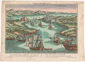
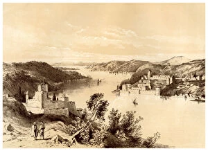
View of the Dardanelles Strait, 1742-1801. Creator: AnonView of the Dardanelles Strait, 1742-1801. On the left the European side with the castle Kilitbahir. On the right the Asian side with the Cimenlik castle
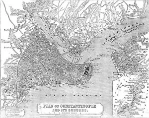
Plan of Constantinople and its Suburbs, 1856. Creator: John DowerPlan of Constantinople and its Suburbs, 1856. Map showing the city of Constantinople (modern Istanbul, Turkey), including the Golden Horn or the Port'; the Bosphorus or Channel of Constantinople
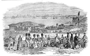
H.B.M. Foot Guards encamped at Scutari - from a daguerreotype by Mr. Robertson, of Constan... 1854. Creator: UnknownH.B.M. Foot Guards encamped at Scutari - from a daguerreotype by Mr. Robertson, of Constantinople, 1854. British troops at Scutari Barracks [in Turkey], during the Crimean War
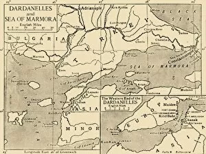
Map of the Dardanelles and Sea of Marmara, c1914, (1920). Creator: UnknownMap of the Dardanelles and Sea of Marmara, c1914, (1920). The coastline around parts of Turkey, Bulgaria, the Black Sea and the Aegean during the First World War
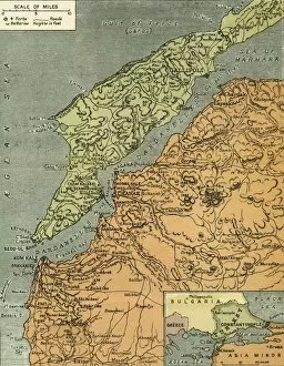
The Dardanelles with its Forts, 1919. Creator: London Geographical InstituteThe Dardanelles with its Forts, 1919. Map of the Turkish coast showing the Gallipoli peninsula which saw heavy fighting during the First World War, 1914-1919, with many casualties on both sides
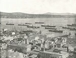
The Bosphorus looking towards Scutari, Constantinople, Ottoman Empire, 1895. CreatorThe Bosphorus looking towards Scutari, Constantinople, Ottoman Empire, 1895. Ships at anchor in what is now Istanbul, Turkey
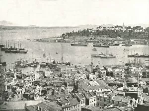
The entrance to the Golden Horn, Constantinople, Ottoman Empire, 1895. Creator: W &s LtdThe entrance to the Golden Horn, Constantinople, Ottoman Empire, 1895. Ships at anchor in what is now Istanbul, Turkey. From " Round the World in Pictures and Photographs
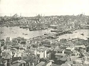
The Galata bridge across the Golden Horn, Constantinople, Ottoman Empire, 1895. CreatorThe Galata bridge across the Golden Horn, Constantinople, Ottoman Empire, 1895. Ships on the river in what is now Istanbul, Turkey
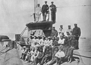
The officers and crew of the HM Submarine E14, 1915The officers and crew of HM Submarine E14, 1915. Carried out the daring raids against Turkish shipping in the Sea of Marmora. From The Manchester Guardian History of the War Vol. III - 1915
Fortresses of the Dardanelles, Turkey, 19th century. Artist: McFarlane and ErskineFortresses of the Dardanelles, Turkey, 19th century. The Dardanelles is a narrow strait in northwestern Turkey connecting the Aegean Sea to the Sea of Marmara
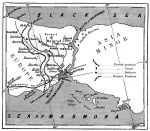
A map showing the positions of Russian and Turkish lines outside Constantinople, 1900. Illustration of one of the many Russo-Turkish wars. In the centre is Constantinople, (now Istanbul, Turkey)