mail_outline sales@mediastorehouse.com
'Populations de l'Afrique australe; Afrique Australe, 1914. Creator: Unknown'Populations de l'Afrique australe; Afrique Australe, 1914. From "Grande Geographie Bong Illustree", 1914
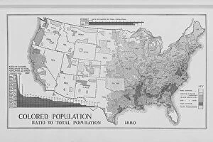
Colored population ratio to total population 1880, 1897. Creator: UnknownColored population ratio to total population 1880, 1897
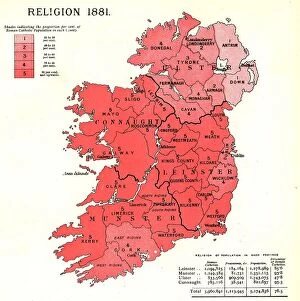
The Graphic Statistical Maps of Ireland; Religion 1881, 1886. Creator: UnknownThe Graphic Statistical Maps of Ireland; Religion 1881, 1886. From "The Graphic. An Illustrated Weekly Newspaper Volume 33. January to June, 1886"
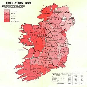
The Graphic Statistical Maps of Ireland; Education 1881, 1886. Creator: UnknownThe Graphic Statistical Maps of Ireland; Education 1881, 1886. From "The Graphic. An Illustrated Weekly Newspaper Volume 33. January to June, 1886"
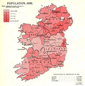
The Graphic Statistical Maps of Ireland; Population 1881, 1886. Creator: UnknownThe Graphic Statistical Maps of Ireland; Population 1881, 1886. From "The Graphic. An Illustrated Weekly Newspaper Volume 33. January to June, 1886"
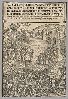
Flemish Rebellion, plate 7 from Historical Scenes from the Life of Emperor...printed c. 1520. Creator: Wolf TrautFlemish Rebellion, plate 7 from Historical Scenes from the Life of Emperor Maximilian I from the Triumphal Arch, 1515-17, printed c. 1520
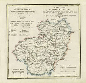
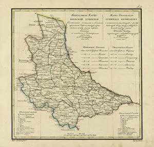
General Map of Kaluga Province: Showing Postal and Major Roads, Stations and... 1822General Map of Kaluga Province: Showing Postal and Major Roads, Stations and the Distance in Versts between Them, 1822. This 1822 map of Kaluga Province is from a larger work
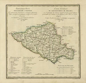
General Map of Poltava Province: Showing Postal and Major Roads, Stations and... 1821General Map of Poltava Province: Showing Postal and Major Roads, Stations and the Distance in Versts between Them, 1821. This 1821 map of Poltava Provinceis from a larger work
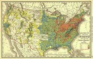
Rand, McNally & Co.'s map of the United States showing, in six degrees the density of pop... 1890Rand, McNally & Co.'s map of the United States showing, in six degrees the density of population, 1890, (1892). This map, published in 1892 by the Chicago-based Rand McNally and Company
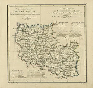
General Map of Pskov Province: Showing Postal and Major Roads, Stations and the Distance... 1820General Map of Pskov Province: Showing Postal and Major Roads, Stations and the Distance in Versts between Them, 1820. This 1820 map of Pskov Provinceis from a larger work
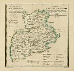
General Map of Chernigov Province: Showing Postal and Major Roads, Stations and... 1821General Map of Chernigov Province: Showing Postal and Major Roads, Stations and the Distance in Versts between Them, 1821
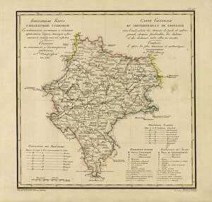
General Map of Moscow Province: Showing Postal and Major Roads, Stations and the.. 1821General Map of Moscow Province: Showing Postal and Major Roads, Stations and the Distance in Versts between Them, 1821. This 1821 map of Smolensk Provinceis from a larger work
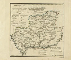
General Map of Kherson Province: Showing Postal and Major Roads, Stations and... 1821General Map of Kherson Province: Showing Postal and Major Roads, Stations and the Distance in Versts between Them, 1821. This 1821 map of Kherson Provinceis from a larger work
General Map of Kiev Province: Showing Postal and Major Roads, Stations and.. 1821General Map of Kiev Province: Showing Postal and Major Roads, Stations and the Distance in Versts between Them, 1821. This 1821 map of Kiev Province is from a larger work
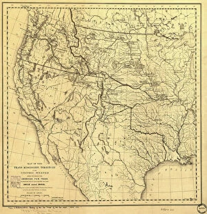
Map of the Trans-Mississippi of the United States during the period of the American fur... 1902Map of the Trans-Mississippi of the United States during the period of the American fur trade as conducted from St. Louis between the years 1807 and 1843, 1902. This map, published in 1902 in H.M
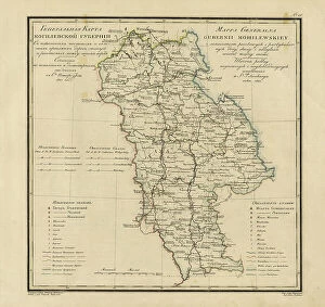
General Map of Mogilev Province: Showing Postal and Major Roads, Stations and... 1821General Map of Mogilev Province: Showing Postal and Major Roads, Stations and the Distance in Versts between Them, 1821. This 1821 map of Mogilev Provinceis from a larger work
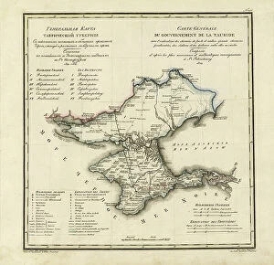
General Map of Taurida Province: Showing Postal and Major Roads, Stations and.. 1822General Map of Taurida Province: Showing Postal and Major Roads, Stations and the Distance in Versts between Them, 1822. This 1822 map ofTaurida Provinceis from a larger work
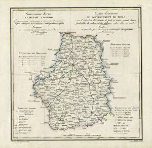
General Map of Tula Province: Showing Postal and Major Roads, Stations and... 1822General Map of Tula Province: Showing Postal and Major Roads, Stations and the Distance in Versts between Them, 1822. This 1822 map of Tula Provinceis from a larger work
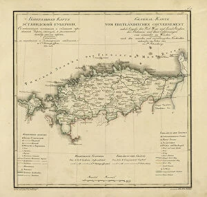
General Map of Estland Province: Showing Postal and Major Roads, Stations and... 1820General Map of Estland Province: Showing Postal and Major Roads, Stations and the Distance in Versts between Them, 1820. This 1820 map of Estland Province is from a larger work
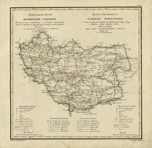
General Map of Volhynia Province: Showing Postal and Major Roads, Stations... 1820General Map of Volhynia Province: Showing Postal and Major Roads, Stations and the Distance in Versts between Them, 1820. This 1820 map of Volhynia Provinceis from a larger work
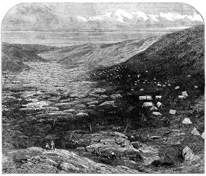
The Tuapeka Goldfields, Otago, New Zealand, 1862. Creator: W ThomasThe Tuapeka Goldfields, Otago, New Zealand, 1862. The province received a great impetus in June, last year, by the discovery of goldfields situated on a stream called the Tuapeka...The immediate
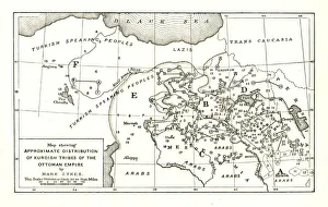
Map showing Approximate Distribution of Kurdish Tribes of the Ottoman Empire, c1915. Diagram by British writer, soldier and diplomatic advisor Mark Sykes (1879-1919)
Taking the Census, 1854. Creator: Francis William EdmondsTaking the Census, 1854
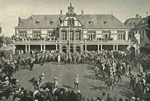
Hauling Down the Transvaal Flag at Johannesburg, 1901. Creator: Lionel JamesHauling Down the Transvaal Flag at Johannesburg, 1901. From " South Africa and the Transvaal War, Vol. V", by Louis Creswicke. [T. C. & E. C. Jack, Edinburgh, 1901]
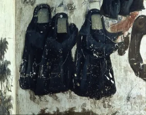
Women with veil, a custom that was used in the Shiite population of Persia in the Safavid age, 17th century murals
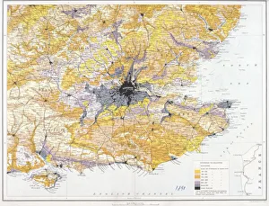
Map of London and south-east England, 1891. Artist: John BartholomewMap of London and south-east England, 1891. Map showing the population density of London and the surrounding counties
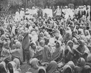
In the Far East - In famine-stricken Indi. 1900. Artist: AF MaconochieIn the Far East - In famine-stricken India. 1900. In the Far East - In famine-stricken India. Sixteen hundred poor women of the Salii and Koshti castes being served out with clothing at Sholapu
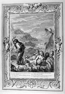
Deucalion and Pyrrha repeople the world by throwing stones behind them, 1733. Artist: Bernard PicartDeucalion and Pyrrha repeople the world by throwing stones behind them, 1733. A plate from Le Temple des Muses, Amsterdam, 1733. Found in the collection of Jean Claude Carriere
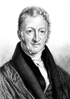
Thomas Robert Malthus, English economist and clergyman. Malthus (1766-1834) believed that population growth would outstrip food supplies, with disastrous results
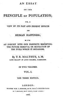
Title page of Essay on the Principle of Population by Thomas Malthus, 1806. Artist: Thomas MalthusTitle page of Essay on the Principle of Population by Thomas Malthus, 1806. Thomas Robert Malthus (1766-1834), English cleric and economist