mail_outline sales@mediastorehouse.com
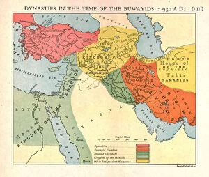
Dynasties in the time of the Buwayids, circa 932 A. D. c1915. Creator: Emery Walker LtdDynasties in the time of the Buwayids, circa 932 A.D. c1915. Map of civilisations in the Middle East during the 10th century: Byzantine, Buwayid Kingdom, Abbasid Caliphate, Kingdom of the Ikhshids
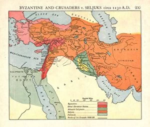
Byzantine and Crusaders v. Seljuks, circa 1130 A. D. c1915. Creator: Emery Walker LtdByzantine and Crusaders v. Seljuks, circa 1130 A.D. c1915. Map of civilisations in the Middle East during the 12th century: Byzantine, other Christian states, Abbasid Caliphate, Seljuks, Fatimids
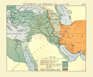
Ottoman and Persian, after 1450 A. D. c1915. Creator: Emery Walker LtdOttoman and Persian, after 1450 A.D. c1915. Map of empires in the Middle East during the 15th-17th centuries: Ottoman Empire at the accession of Mohammed II, 1451 AD, Additions 1481-1683
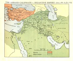
The Abbasid Caliphate v. Byzantine Empire, circa 786 A. D. c1915. Creator: Emery Walker LtdThe Abbasid Caliphate v. Byzantine Empire, circa 786 A.D. c1915. Map of civilisations in the Middle East during the 8th century, and also showing the eastern Mediterranean, Red Sea, Caspian Sea
Bagdad and the Persian Campaign, First World War, end of April 1916, (c1920). Creator: UnknownBagdad and the Persian Campaign, First World War, end of April 1916, (c1920)....map showing approximately the lines of the British advance from the Persian Gulf
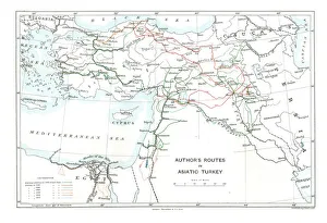
Authors Routes in Asiatic Turkey, c1915. Creator: Stanfords Geographical EstablishmentAuthors Routes in Asiatic Turkey, c1915. Map showing the journeys of British writer, soldier and diplomatic advisor Mark Sykes (1879-1919) who travelled through Palestine, Iraq, Syria
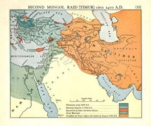
Second Mongol Raid (Timur), circa 1450 A. D. c1915. Creator: Emery Walker LtdSecond Mongol Raid (Timur), circa 1450 A.D. c1915. Map of civilisations in the Middle East during the 14th and 15th centuries: Ottomans c1350 AD, Ottoman Empire in 1400 AD
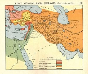
First Mongol Raid (Hulagu), circa 1400 A. D. c1915. Creator: Emery Walker LtdFirst Mongol Raid (Hulagu), circa 1400 A.D. c1915. Map of civilisations in the Middle East during the early 15th century: Byzantine, other Christian states, Bahri Mamluks
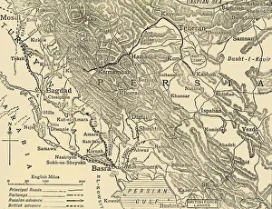
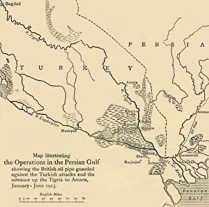
Map illustrating the Operations in the Persian Gulf, First World War, 1915, (c1920)....showing the British oil pipe guarded against the Turkish attacks and the advance up the Tigris to Amara
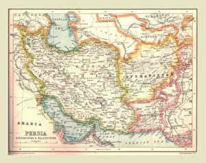
Map of Persia, 1902. Creator: UnknownMap of Persia, 1902. Showing Persia, Afghanistan and Baluchistan, and the Persian Gulf. From The Century Atlas of the World. [John Walker & Co, Ltd. London, 1902]
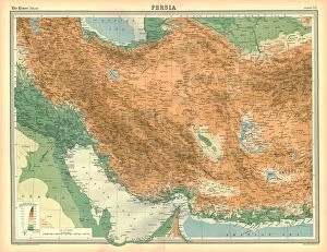
Map of Persia. Map of what is now known as Iran, showing the Persian Gulf. Plate 53 from The Times Atlas
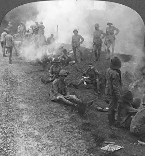
Early morning camp fires and breakfast in the Persian Gulf, World War I, c1914-c1918. From a box set of stereoscopic cards titled The Great War
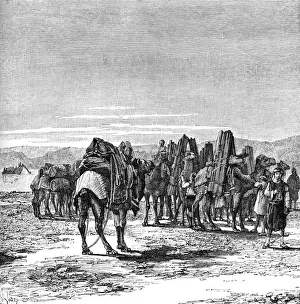
A caravan on the banks of the Euphrates, 1895. From The Universal Geography with Illustrations and Maps, division XVII, written by Elisee Reclus and published by Virtue & Co. Limited (London, 1895)
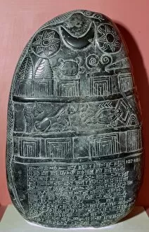
Babylonian boundary-stone recording a gift of landA Babylonian boundary stone (kudurru), Kassite dynasty, about 1125-1100 BC, probably from southern Iraq. The cuneiform inscription records the gift of land near Edina in South Babylonia to Gula-eresh