mail_outline sales@mediastorehouse.com
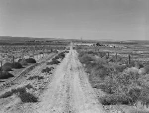
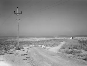
Section of lone road approaching the Schroeder place, Dead Ox Flat, Malheur County, Oregon, 1939Section of lone road approaching the Schroeder place. Dead Ox Flat, Malheur County, Oregon
View of newly reclaimed bench land, Dead Ox Flat, Malheur County, Oregon, 1939. Creator: Dorothea LangeView of newly reclaimed bench land. Emmett Smith (farm in background), " took his place out of the bush 3 years ago." Dead Ox Flat, Malheur County, Oregon
Texans earning their way westward, bound for a new start in Oregon, US 99, California, 1935. Creator: Dorothea LangeTexans earning their way westward, bound for a new start in Oregon. United States No. 99, California
Western wheat country in a region which yields... Umatilla County, Oregon, 1939. Creator: Dorothea LangeWestern wheat country in a region which yields over twenty five bushels to the acre. Banks, mortgage companies and insurance companies own many farms in this area. Umatilla County, Oregon
Western wheat country in a region which yields over twenty five... Umatilla County, Oregon, 1939Western wheat country in a region which yields over twenty five bushels to the acre. Banks, mortgage companies and insurance companies own many farms in this area. Umatilla County, Oregon
On bench land of the Owyhee project, Nyssa Heights, Malheur County, Oregon, 1939. Creator: Dorothea LangeOn bench land of the Owyhee project. Sage brush, irrigated fields, homestead. Nyssa Heights, Malheur County, Oregon
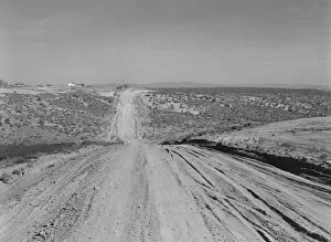
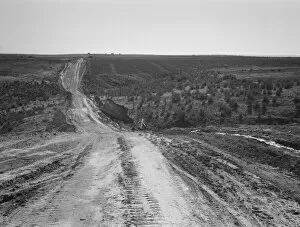
Landscape on top of bench, showing new lands, and farms... Dead Ox Flat, Oregon, 1939. Creator: Dorothea LangeLandscape on top of bench, showing new lands, and farms beyond. Road was built by the CCC (Civilian Conservation Corps). Dead Ox Flat, Malheur County, Oregon
Owyhee project landscape, East Bench, west of Vale, Malheur County, Oregon, 1939. Creator: Dorothea LangeOwyhee project landscape. East Bench, west of Vale, Malheur County, Oregon
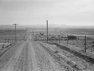
Road leading to small farm in northern Oregon, Irrigon, Morrow County, Oregon, 1939. Creator: Dorothea LangeRoad leading to small farm in northern Oregon. Irrigon, Morrow County, Oregon
Empty road; the East Ardley section of the M1, prior to opening, Wakefield, West Yorkshire, 1967. A lone van patrols the East Ardley section of the M1 near Wakefield prior to its opening