mail_outline sales@mediastorehouse.com
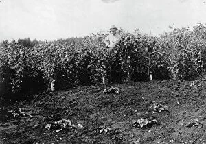
Strawberry plants on government farm, 1916. Creator: Curtis & Miller. Strawberry plants on government farm, 1916Strawberry plants on government farm, 1916
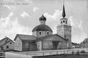
Russian church, between c1900 and c1930. Creator: UnknownRussian church, between c1900 and c1930
Pea crop near Sitka, between c1900 and c1930. Creator: UnknownPea crop near Sitka, between c1900 and c1930
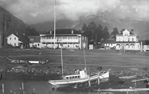
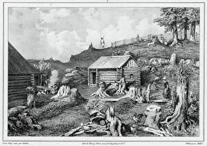
Pioneer house, between c1900 and c1930. Creator: UnknownPioneer house, between c1900 and c1930
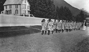
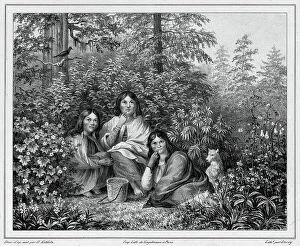
Indian children from the Sheldon Jackson School, between c1900 and c1930. Creator: UnknownIndian children from the Sheldon Jackson School, between c1900 and c1930
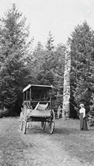
Totem pole, between c1900 and c1930. Creator: UnknownTotem pole, between c1900 and c1930
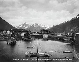
Three Sisters Mts. (background), between c1900 and c1930. Creator: UnknownThree Sisters Mts. (background), between c1900 and c1930
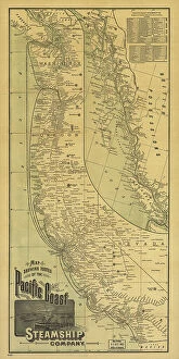
Map showing routes of the Pacific coast Steamship Company, 1891. Creator: Rand McNallyMap showing routes of the Pacific coast Steamship Company, 1891. This foldable tourist brochure, published by Rand McNally and Company in 1891
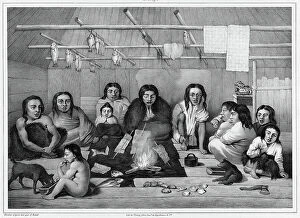
Interior of a clochan hut (Sitka island, north coast of America), 19th century. One of 65 lithographs that were included in the volume of maps published after the round-the-world voyage of
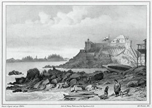
The caloches inhabitants of Sitka Island (northwest coast of America), 19th century. One of 65 lithographs that were included in the volume of maps published after the round-the-world voyage of
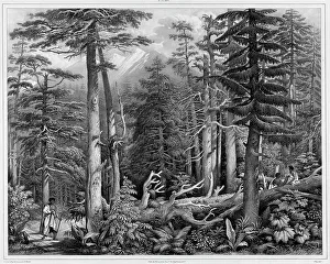
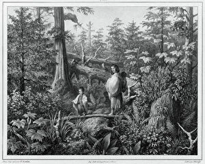
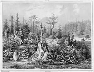
Forest of Sitka Island (northwest coast of America), 19th century. Creators: Alexander Postels, Godefroy EngelmannForest of Sitka Island (northwest coast of America), 19th century. One of 65 lithographs that were included in the volume of maps published after the round-the-world voyage of the corvette Seniavin
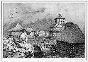
View taken in the Russian colony of Novo-Arkhangelsk (Sitkha island) (northwest... 19th century)View taken in the Russian colony of Novo-Arkhangelsk (Sitkha island) (northwest coast of America), 19th century. One of 65 lithographs that were included in the volume of maps published after
View taken in the Russian colony of Novo-Arkhangelsk (Sitkha island) (northwes... 19th century)View taken in the Russian colony of Novo-Arkhangelsk (Sitkha island) (northwest coast of America), 19th century. One of 65 lithographs that were included in the volume of maps published after
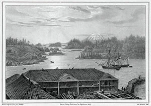
View of Sitka Bay (taken from Governor's House) (northwest coast of America), 19th century. One of 65 lithographs that were included in the volume of maps published after the round-the-world
Settlement of Novo-Arkhangel'sk (Sitka Island), Northwest Coast of America, 19th century. One of 65 lithographs that were included in the volume of maps published after the round-the-world voyage
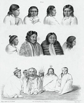
Inhabitants of the island of Sitka (northwest coast of America), 19th century. One of 65 lithographs that were included in the volume of maps published after the round-the-world voyage of
Inhabitants of the island of Sitkha (northwest coast of America), 19th century. One of 65 lithographs that were included in the volume of maps published after the round-the-world voyage of
Vegetation around the settlement of Novo-Arkhangelsk (northwest coast of America), 19th century. One of 65 lithographs that were included in the volume of maps published after the round-the-world