mail_outline sales@mediastorehouse.com
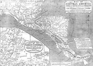
Map of Central America shewing the Proposed Routes of Communication between the Atlantic & Pacific O CreatorMap of Central America shewing the Proposed Routes of Communication between the Atlantic & Pacific Oceans, 1856....and the Disputed Territories of British Honduras (Belize)
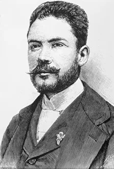
Pedro Rafael Cuadra of Nicaragua, 1915. Creator: Harris & Ewing. Pedro Rafael Cuadra of Nicaragua, 1915Pedro Rafael Cuadra of Nicaragua, 1915
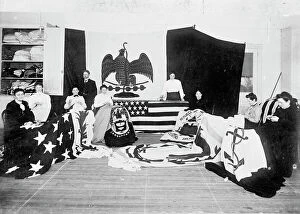
Flag Factory, 1913. Creator: Harris & Ewing. Flag Factory, 1913. Creator: Harris & EwingFlag Factory, 1913. Women making flags - Estados Unidos de Colombia - Republica de Nicaragua - Centro America'. The United States of Colombia was composed of nine sovereign states'
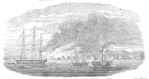
The Burning of Greytown, 1854. Creator: UnknownThe Burning of Greytown, 1854. Post-office and Mosquito flag-staff; Hanseatic Consulate; Lyons Hotel; American Consulate; British Consulate; house containing the powder'
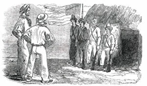
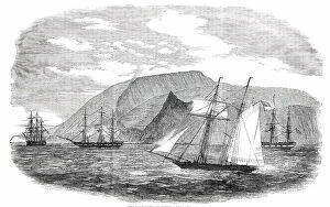
Tigre Island - the United States Garrison, 1850. Creator: UnknownTigre Island - the United States Garrison, 1850. Sketch by "a Traveller in Central America"...by no means a caricature picture of the United States garrison upon the Island
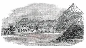
Tigre Island, 1850. Creator: UnknownTigre Island, [now in Honduras], 1850. From "Illustrated London News", 1850. Sketch by "a Traveller in Central America"...of...the interior of the island
The Northernmost Chincha (Guano) Island, 1850. Creator: UnknownThe Northernmost Chincha (Guano) Island, [Peru], 1850. Sketch by "a Traveller in Central America". In 1840 attention was first drawn to guano for the purposes of agriculture in Europe
Ruben Dario. (Felix Ruben Garcia Sarmiento). (1867 - 1916), Nicaraguan poet and writer
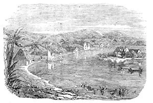
Greytown - from a recent sketch, 1857. Creator: UnknownGreytown - from a recent sketch, 1857. The place is interesting as the head-quarters of Captain Erskine's squadron. In the Sketch you look to the west: the anchorage and harbour are out of sight
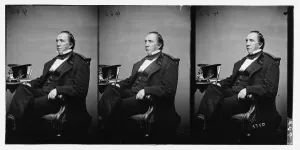
Clay, Thos. Hart, ca. 1860-1865. Creator: UnknownClay, Thos. Hart, ca. 1860-1865
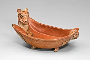
Open Bowl in the Form of a Jaguar, A. D. 600 / 900. Creator: UnknownOpen Bowl in the Form of a Jaguar, A.D. 600/900. Ometepe Island, Lake Nicaragua (Cocibolca), Nicaragua
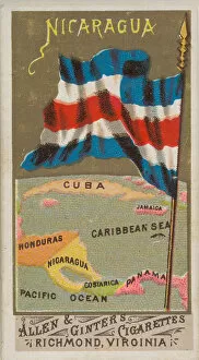
Nicaragua, from Flags of All Nations, Series 1 (N9) for Allen &Nicaragua, from Flags of All Nations, Series 1 (N9) for Allen & Ginter Cigarettes Brands, 1887
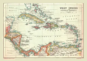
Map of the West Indies and Central America, 1902. Creator: UnknownMap of the West Indies and Central America, 1902. Showing the various Caribbean islands, and the north coast of South America. From The Century Atlas of the World. [John Walker & Co, Ltd
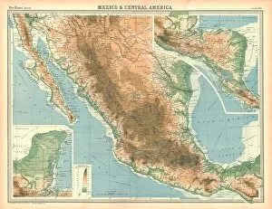
Map of Mexico and Central America. Map showing Baja California, Mexico and the Yucatan peninsula, Plate 95 from The Times Atlas
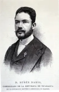
Ruben Dario (1867-1916, Nicaraguan poet, engraving in 1892
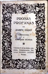
Cover of the play Prosas Profanas
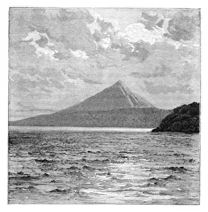
Mombacho Volcano and the shores of Lake Nicaragua, c1890. From Universal Geography, Maps & Illustrations, Vol XXXIV, Virtue & Co Limited, (London, c1890)
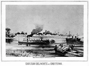
San Juan del Norte (Greytown), California, 19th century (1937). Artist: Nagel & SchwartzSan Juan del Norte or Greytown, 1937. A print from Old California, In Pictures and Story, by Stewart Edward White, Doubleday, Doran and Company, New York, 1937
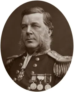
Captain Bedford Clapperton Trevelyan Pim, British naval officer, 1883. Artist: Lock & WhitfieldCaptain Bedford Clapperton Trevelyan Pim, British naval officer, 1883. Pims naval career saw him involved in Arctic exploration as well as active service in the Crimean War and in China
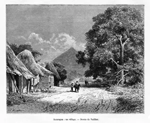
A village, Nicaragua, 19th century. Artist: VuillierA village, Nicaragua, 19th century
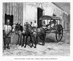
Stagecoach, Nicaragua, 19th century. Artist: E RonjatStagecoach, Nicaragua, 19th century