mail_outline sales@mediastorehouse.com
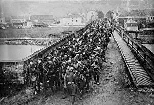
U.S. Army enters Germany, Dec 1918. Creator: Bain News ServiceU.S. Army enters Germany, Dec 1918. The American 18th Infantry crossing the Moselle River into Germany after World War I. The town in the background is Gravenmacher, in the Grand Dutchy of Luxemburg.
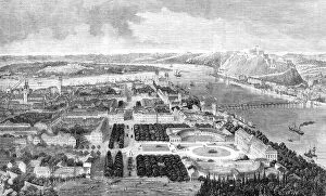
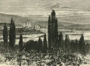
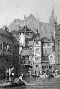
The city of Coblentz, 1860. Creator: UnknownThe city of Coblentz, 1860. Coblentz is a fortified city of Rhenish Prussia, on the left bank of the Rhine, at the influx of the Moselle
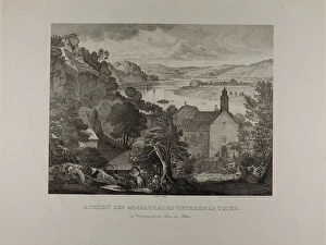
View of the Mosel Valley below Trier with the Rocks of Pallien in the Foreground, 1824/27
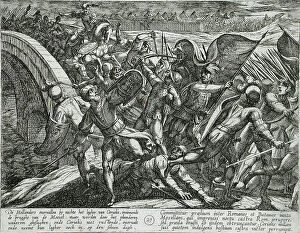
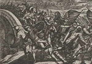
The Dutch During a Surprise Attack of the Roman Camp on the Moselle, Publshed 1612. Creator: Antonio TempestaThe Dutch During a Surprise Attack of the Roman Camp on the Moselle, Publshed 1612. From The War of the Romans Against the Batavians, pl. 27
Map of Thionville, c.1710. Creator: AnonMap of Thionville, c.1710. Map of the Fortress of Thionville (here spelled Theonville) on the Moselle. A scale at the bottom left
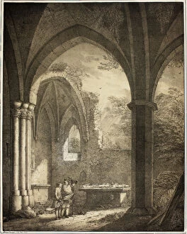
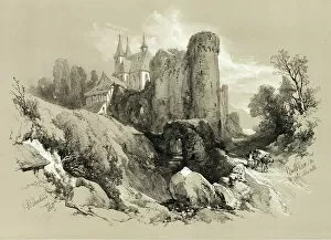
Ruin of the Church of Our Lady with the Tombstones of Genevieve and the Count... 1821. Creator: Domenico Quaglio IIRuin of the Church of Our Lady with the Tombstones of Genevieve and the Count Palatine Siegfried in the Mosel Valley near Andernach, from Collection of Memorable Medieval Buildings in Germany, 1821
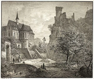
Church at Kobern on the Mosel, 1823. Creator: Domenico Quaglio IIChurch at Kobern on the Mosel, 1823
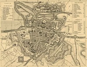
Plan of Metz and its Fortifications, c1872. Creator: R. WalkerPlan of Metz and its Fortifications, c1872. Map of the town of Metz (in France), showing military buildings, public buildings, churches etc
Map of the Battle of Gravelotte, 18 August 1870, (c1872). Creator: R. WalkerMap of the Battle of Gravelotte, 18 August 1870, (c1872). Map: Drawn under the Superintendance of Captain Hozier, showing the enemy positions
Panoramic Landscape near the River Moselle, c. 1830. Creator: Theodore RousseauPanoramic Landscape near the River Moselle, c. 1830
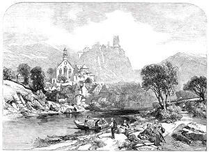
Beilstein on the Moselle - by J. D. Harding - from the new water colour exhibition, 1845Beilstein on the Moselle - by J.D. Harding - from the new water colour exhibition, 1845. This charming picture - a small one - has been purchased for thirty guineas...It is, certainly
Plate 27: The Dutch During a Surprise Attack of the Roman Camp on the Moselle, from The War of the Romans Against the Batavians (Romanorvm et Batavorvm societas), 1611
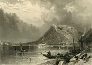
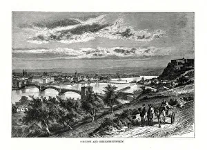
Ehrenbreitstein, c1872. Creator: E I RobertsEhrenbreitstein, c1872. View of the fortress at Ehrenbreitstein in Germany, at the junction of the Mosel and Rhine rivers
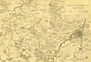
Map of the Battle of Vionville, 16 August 1870, (c1872). Creator: R. WalkerMap of the Battle of Vionville, 16 August 1870, (c1872). Map: Drawn under the Superintendance of Captain Hozier, showing the enemy positions
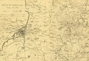
Map of the Battle of Courcelles, 14 August 1870, (c1872). Creator: R. WalkerMap of the Battle of Courcelles, 14 August 1870, (c1872). Map: Drawn under the Superintendance of Captain Hozier, showing the enemy positions
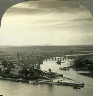
Where the Moselle Enters the Rhine, Coblenz, Germany, c1930s. Creator: UnknownWhere the Moselle Enters the Rhine, Coblenz, Germany, c1930s. From " Tour of the World". [Keystone View Company, Meadville, Pa. New York, Chicago, London]
Treves, 1890. Creator: UnknownTreves, 1890. Trier formerly known in English as Treves is a city in Germany on the banks of the river Moselle, founded by the Celts in late-4th century BC
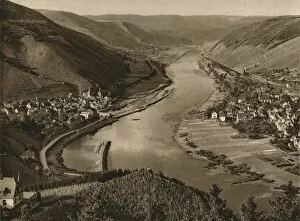
Mosel. Alf-Bullay, 1931. Artist: Kurt HielscherMosel. Alf-Bullay, 1931. From Deutschland by Kurt Hielscher. [F. A. Brockhaus, Leipzig, 1931]
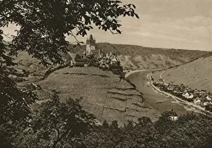
Cochem (Mosel), 1931. Artist: Kurt HielscherCochem (Mosel), 1931. From Deutschland by Kurt Hielscher. [F. A. Brockhaus, Leipzig, 1931]
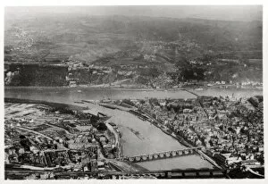
Aerial view of Koblenz, Rhine-Palantinate, Germany, from a Zeppelin, c1931 (1933). A photograph from Zeppelin-Weltfahrten, Vom ersten Luftschiff 1899 bis zu den Fahrten des LZ127 Graf Zeppelin 1932
Koblenz on the Rhine, Germany, 1893. Artist: John L StoddardKoblenz on the Rhine, Germany, 1893. Illustration from Portfolio of Photographs of Famous Cities, Scenes and Paintings, (The Werner Company, Chicago, c1893)
View in Metz, northern France, 19th century. Artist: Thomas BarberView in Metz, northern France, 19th century
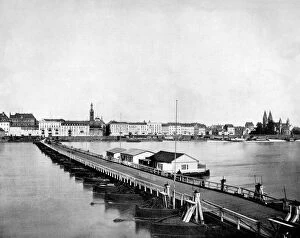
Koblenz and Festung Ehrenbreitstein, Germany, 1879. View of the city which lies at the junction of the Mosel and Rhine rivers
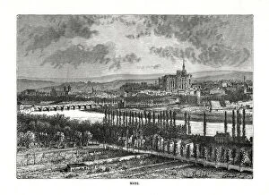
Metz, France, 19th century. Artist: Charles BarbantMetz, France, 19th century. The city lies on the Mosel and Seille rivers
Beilstein on the Moselle, from Picturesque Selections, 1860