mail_outline sales@mediastorehouse.com
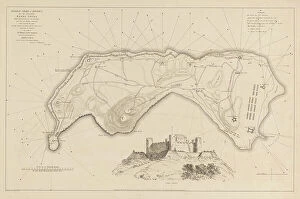
Conquest of Banda by the English on August 9, 1810, (1811). Creator: M. GrahamConquest of Banda by the English on August 9, 1810, (1811). lllustrative account of Captain Cole's splendid achievement in the capture of the island of Banda
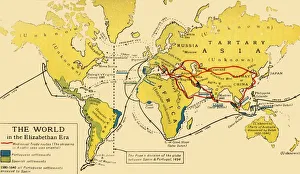
The World in the Elizabethan Era, 1926. Creators: Unknown, Emery Walker LtdThe World in the Elizabethan Era, 1926. Map of the world during the reign of Queen Elizabeth I (1558-1603). The key shows: Mediaeval Trade routes, (the shipping in Asiatic seas was oriental)
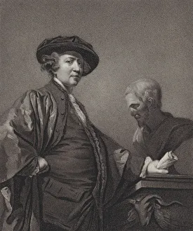
Sir Joshua Reynolds, Knight, 1811. Creator: William BondSir Joshua Reynolds, Knight, 1811
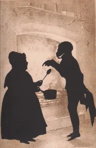
A Treatise on Silhouette Likenesses, 1835. Creator: Auguste Amant Constant Fidele EdouartA Treatise on Silhouette Likenesses, 1835. [Johns Funny Story to Mary the Cook]
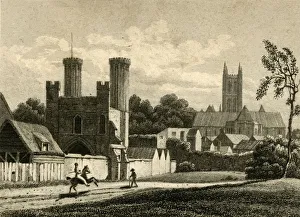
Canterbury, Kent, 1822. Creator: J GreigCanterbury, Kent, 1822. View of the cathedral and city gate. [Longman & Co, London, 1822]
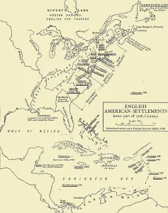
English American Settlements - latter part of 17th Century, 1926. Creators: UnknownEnglish American Settlements - latter part of 17th Century, 1926. Map of the eastern coast of North America, the Caribbean and the north coast of South America, showing areas settled by Europeans
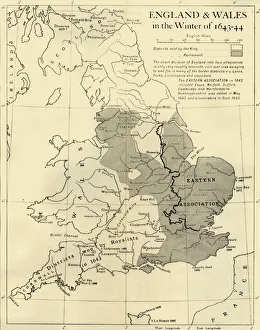
England & Wales in the Winter of 1643-44, 1926. Creators: Unknown, Emery Walker LtdEngland & Wales in the Winter of 1643-44, 1926. Map showing England and Wales during the Civil War period. The key shows districts held by the king (Charles I), and by parliament
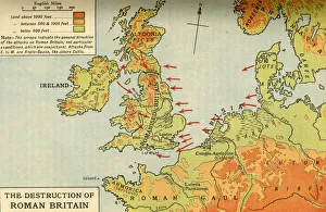
The Destruction of Roman Britain, 1926. Creators: Unknown, Emery Walker LtdThe Destruction of Roman Britain, 1926. Map of Britain showing invasions towards the end of the Roman period (43 to 410 AD)
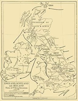
England, Scotland and Ireland - Time of Viking Invasions, 1926. Creators: UnknownEngland, Scotland and Ireland - Time of Viking Invasions, 1926. Map of Britain during the 9th-11th century. Towns of Viking foundation in Ireland underlined
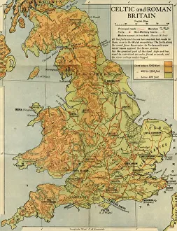
Celtic and Roman Britain, 1926. Creator: Emery Walker LtdCeltic and Roman Britain, 1926. Map of Britain during the Roman (43 to 410 AD) and Celtic periods. All the forts and towns here marked had roads to them, even in the Welsh mountains
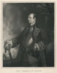
John, Marquis of Granby, c1758-1760, (1810). Creator: William BondJohn, Marquis of Granby, c1758-1760, (1810). Portrait of British soldier Lieutenant-General John Manners, Marquess of Granby (1721-1770), Commander-in-Chief of the Army. Engraving after a painting
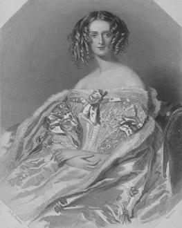
The Marchioness of Aylesbury, 1840. Creator: WH EgletonThe Marchioness of Aylesbury, 1840. Portrait of Maria Elizabeth Brudenell-Bruce (nee Tollemache, 18091-1893) who became the first Marchioness of Ailesbury in 1833 on her marriage to Charles