mail_outline sales@mediastorehouse.com
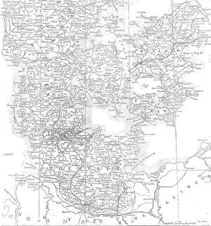
The seat of war in Denmark, 1864. Creator: John DowerThe seat of war in Denmark, 1864. The Second Schleswig War was the second military conflict over the Schleswig-Holstein Question of the nineteenth century
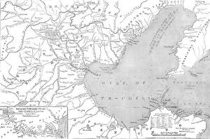
Map of North-east China, showing the Gulf of Pechili, the Tien-Tsin (Peiho) River... 1860. Creator: John DowerMap of North-east China, showing the Gulf of Pechili, the Tien-Tsin (Peiho) River, and the approaches to Pekin, 1860. By the latest intelligence from China we learn that the French
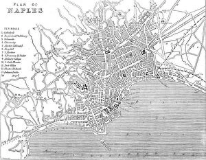
Plan of Naples, 1860. Creator: John DowerPlan of Naples, 1860. Naples is built at the base and on the slopes of a range of hills which have the general form of an amphitheatre
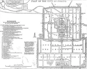
Plan of the city of Peking, 1860. Creator: John DowerPlan of the city of Peking, 1860. Peking or Pekin (Chinese Pihking, "the northern capital"), the capital of the province of Chili
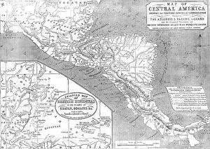
Map of Central America shewing the Proposed Routes of Communication between the Atlantic & Pacific O CreatorMap of Central America shewing the Proposed Routes of Communication between the Atlantic & Pacific Oceans, 1856....and the Disputed Territories of British Honduras (Belize)
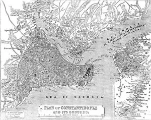
Plan of Constantinople and its Suburbs, 1856. Creator: John DowerPlan of Constantinople and its Suburbs, 1856. Map showing the city of Constantinople (modern Istanbul, Turkey), including the Golden Horn or the Port'; the Bosphorus or Channel of Constantinople
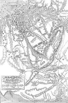
Sebastopol and Balaclava shewing the position of the Allied Forces, 1854. Creator: John DowerSebastopol and Balaclava shewing the position of the Allied Forces, 1854. Crimean War. The severe and costly battles of Balaclava and Inkerman
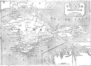
Map of the Crimea and plan of Sebastopol, 1854. Creator: John DowerMap of the Crimea and plan of Sebastopol, 1854. Crimean War. In the expectation of great sacrifices and severe contests that must attend the attack upon Sebastopol
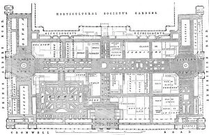
Ground plan of the International Exhibition Building, 1862. Creator: John DowerGround plan of the International Exhibition Building, [South Kensington, London], 1862. Block Plan of the Building, representing the area as arranged with courts, trophies, fountains, &c
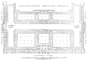
Plan of the galleries of the International Exhibition Building, 1862. Creator: John DowerPlan of the galleries of the International Exhibition Building, [South Kensington, London], 1862. Block Plan of the Building, representing the area as arranged with courts, trophies, fountains, &c
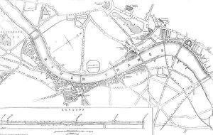
Plan of the Thames Embankment, 1862. Creator: John DowerPlan of the Thames Embankment, 1862. The commissioners...recommend that an embanked roadway of about two miles should be formed between Westminster-bridge and Battersea Park
Trade card for John Dower, geographical engraver and draughtsman, 19th century