mail_outline sales@mediastorehouse.com
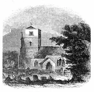
Beddington Church, 1844. Creator: UnknownBeddington Church, 1844. View of the 14th-century flint parish church of St Marys in Beddington, Surrey, (now in the London Borough of Sutton). It was extensively restored in the 19th century
Military map of a thirty six mile area around London, c1804
General Map of London, 1847. Artist: Benjamin Rees DaviesMap of London and surrounding areas, 1847
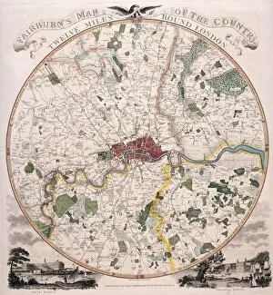
Map of London, 1798. Artist: E BourneMap of twelve mile area around London, 1798. Bottom left view shows Chelsea Hospital and bottom right view shows Greenwich Hospital
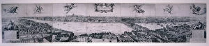
Panoramic view of London, c1730. Artist: Marc Abraham RuprechtView of the City of London across the River Thames from Southwark with a key to buildings and points on the river, c1730. In the foreground two equestrian gentlemen proceed from the right
View of London from the south, 1832. Artist: Robert MartinView of London from the south, 1832. Section of a panoramic view of Westminster and the City of London from Whitehall to St Katherines by the Tower and beyond
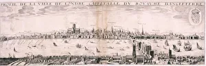
View of London from the south, 1643. Artist: Hugue PicartView of London from the south, 1643. View towards Westminster and the City of London across the River Thames from Southwark
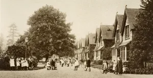
Dr Barnardos Institute for Destitute Children, Barkingside, London, 19th century. In 1866 Thomas John Barnardo (1845-1905), a medical missionary
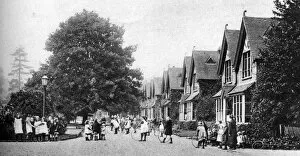
A Dr Barnardos home, Barkingside, London, 1926-1927. From Wonderful London, volume II, edited by Arthur St John Adcock, published by Amalgamated Press (London, 1926-1927)
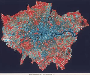
Composite Landsat false colour image of Greater London, 1979. This image was processed by the Space Department at the Royal Aircraft Establishment, Farnborough