mail_outline sales@mediastorehouse.com
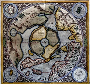
Atlas of Gerardus Mercator, 1595, map of the Arctic to the North Pole and surrounding lands within and outside the Arctic Circle
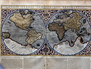
Atlas of Gerardus Mercator, 1595. World Map
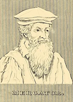
Mercator, (1512-1594), 1830. Creator: UnknownMercator, (1512-1594), 1830. Gerardus Mercator (1512-1594) Belgian geographer, cosmographer and cartographer known for his 1569 world map of sailing courses with rhumb lines
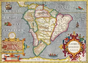
South America (America Meridionalis): from the Atlas of Gerardus Mercator, 1633, (1936). Artist: Gerardus MercatorSouth America (America Meridionalis): from the Atlas of Gerardus Mercator, 1633, (1936). Published at Antwerp by Hondius From The Connoisseur, Vol. 98, edited by H. Granville Fell
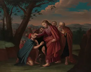
Christ Healing the Blindman, ca. 1725-30. Creator: Gerardus DuyckinckChrist Healing the Blindman, ca. 1725-30
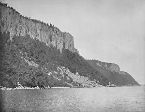
Northern End of Palisades, Hudson River, c1897. Creator: UnknownNorthern End of Palisades, Hudson River, c1897. The Palisades, are a line of steep basalt cliffs along the west side of the lower Hudson River, they appear on the first European map of the New World
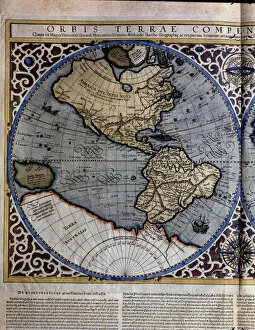
Atlas of Gerardus Mercator, 1595, map of the Americas and part of Antarctica
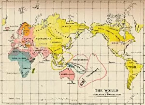
Map of the World on Mercators Projection, 1902Map - The World on Mercators Projection, 1902. From The Living Races of Mankind, Vol. I. [Hutchinson & Co, London, 1902]